Category:Maps of the history of Sardinia
Jump to navigation
Jump to search
- Regions of Italy: Abruzzo · Apulia · Basilicata · Campania · Emilia-Romagna · Friuli-Venezia Giulia · Lazio · Liguria · Lombardy · Piedmont · Sardinia · Sicily · Trentino-South Tyrol · Tuscany · Veneto
Use the appropriate category for maps showing all or a large part of Sardinia. See subcategories for smaller areas:
| If the map shows | Category to use |
|---|---|
| Sardinia on a recently created map | Category:Maps of Sardinia or its subcategories |
| Sardinia on a map created more than 70 years ago | Category:Old maps of Sardinia or its subcategories |
| the history of Sardinia on a recently created map | Category:Maps of the history of Sardinia or its subcategories |
| the history of Sardinia on a map created more than 70 years ago | Category:Old maps of the history of Sardinia or its subcategories |
Subcategories
This category has the following 4 subcategories, out of 4 total.
A
M
- Maps of judicatures of Sardinia (21 F)
Media in category "Maps of the history of Sardinia"
The following 92 files are in this category, out of 92 total.
-
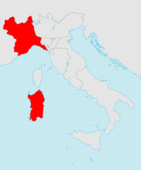
REmpire Corsica-Sardinia.svg 2,180 × 1,600; 517 KB
-
Vandales.png 1,575 × 1,104; 8 KB
-
Italy 1000 AD alt1.svg 564 × 810; 187 KB
-
Italy 1000 AD-ar.svg 565 × 811; 326 KB
-
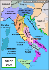
Italy 1000 AD-de.svg 572 × 819; 334 KB
-
Italy 1000 AD-el.png 418 × 600; 67 KB
-
Italy 1000 AD-es.svg 565 × 811; 710 KB
-
Italy 1000 AD-fr.svg 564 × 810; 186 KB
-
Italy 1000 AD-he.svg 565 × 811; 481 KB
-
Italy 1000 AD-hu.svg 565 × 811; 361 KB
-
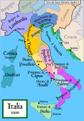
Italy 1000 AD-it.svg 565 × 811; 400 KB
-
Italy 1000 AD-ru.svg 565 × 811; 334 KB
-
Italy 1000 AD-zh.png 565 × 811; 193 KB
-
Italy 1000 AD.svg 565 × 811; 861 KB
-
Italya MS 1000.png 566 × 812; 254 KB
-
Italya MS 1000.svg 565 × 811; 835 KB
-
Aragonese Empire.PNG 386 × 255; 7 KB
-
Sardinia 1324.png 1,193 × 1,753; 775 KB
-
La couronne d'Aragon en Sardaigne.svg 945 × 1,687; 122 KB
-
Italy 1494 AD hu.svg 688 × 930; 417 KB
-
Italy 1494 AD-ar.png 419 × 600; 92 KB
-
Italy 1494 AD-fr.svg 576 × 812; 417 KB
-
Italy 1494 AD-hu.svg 688 × 930; 416 KB
-
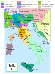
Italy 1494 AD-it.svg 688 × 930; 418 KB
-
Italy 1494 el.png 419 × 600; 98 KB
-
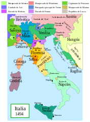
Italia 1494b-es.svg 688 × 930; 418 KB
-
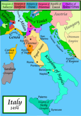
Italy 1494 AD.png 1,261 × 1,805; 144 KB
-
Kingdom of Sardinia & Royal cities - 16th century.png 1,193 × 1,753; 641 KB
-
Dominions House Habsburg abdication Charles V.jpg 1,654 × 1,029; 554 KB
-
Habsburg Map 1547.jpg 1,654 × 1,029; 534 KB
-
Spain1580.gif 397 × 312; 6 KB
-
Italia 1796 - HE.svg 767 × 1,093; 256 KB
-
Italia 1796.svg 767 × 1,093; 70 KB
-
Italy 1796 AD-ar.png 419 × 600; 90 KB
-
Italy 1796 AD-el.png 419 × 600; 91 KB
-
Italy 1796 AD-it.png 767 × 1,093; 231 KB
-
Italy 1796 AD-ko.png 1,007 × 1,442; 202 KB
-
Italy 1796 AD-sv.png 1,007 × 1,442; 213 KB
-
Italy 1796 heb.jpg 1,251 × 1,814; 970 KB
-
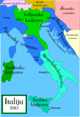
Italia 1810.jpg 413 × 599; 125 KB
-
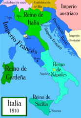
Italia 1810.svg 1,759 × 2,167; 2.46 MB
-
Italija 1810 Slovenscina.png 628 × 911; 171 KB
-
Italy 1810 heb.jpg 1,251 × 1,814; 888 KB
-
Italy c 1810-es.png 1,249 × 1,805; 320 KB
-
Italy c 1810.png 1,251 × 1,814; 90 KB
-
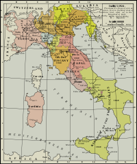
Italy unification 1815 1870.jpg 1,073 × 1,164; 480 KB
-
Koenigreich Neapel Sizilien.jpg 1,482 × 1,899; 221 KB
-
LocationReinodeCerdeña.PNG 250 × 115; 9 KB
-
Nord Italia1815.jpg 990 × 649; 183 KB
-
Unification of Italy 1815-1870.jpg 813 × 894; 181 KB
-
Unification of Italy 1815-1924.svg 267 × 321; 1.1 MB
-
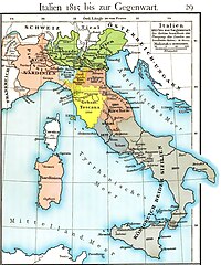
Völkerkarte von Mittel- und Südosteuropa. Italien 1815 bis zur Gegenwart (1905)-es.svg 2,722 × 2,998; 1.03 MB
-
Völkerkarte von Mittel- und Südosteuropa. Italien 1815 bis zur Gegenwart (1905).jpg 1,574 × 1,886; 600 KB
-
-
Italy1816cs.png 1,541 × 1,729; 804 KB
-
Italia1859-HE.png 1,124 × 1,330; 209 KB
-
Italia1859.png 387 × 387; 7 KB
-
إيطاليا - فخر الدين.PNG 507 × 600; 73 KB
-
Butler Italiæ Pars Media (Part Sardinia).jpg 576 × 688; 408 KB
-
Aragona vs Pisa.png 573 × 310; 19 KB
-
Barbaria.jpg 500 × 700; 94 KB
-
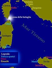
Battle of Alalia map.jpg 514 × 673; 155 KB
-
"Insu un konigreich Sardinien". Augsburg, Gabriel Bodenehr, 1704.png 1,897 × 1,052; 5.14 MB
-
Carta marchesato di Oristano.jpg 1,056 × 1,008; 540 KB
-
Différents peuplements antiques de la Sardaigne-es.svg 945 × 1,687; 84 KB
-
Différents peuplements antiques de la Sardaigne.svg 945 × 1,687; 84 KB
-
Espansione di Pisa.png 1,500 × 669; 200 KB
-
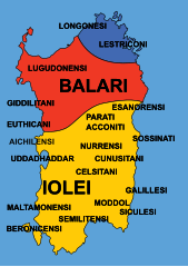
Etnie Nuragiche-2.svg 595 × 842; 153 KB
-
Etnie Nuragiche.jpg 297 × 616; 153 KB
-
I popoli della Sardegna Romana.png 1,826 × 2,706; 944 KB
-
ILIENSI.png 762 × 1,170; 1.22 MB
-
Ita-sardinia.png 2,048 × 2,458; 278 KB
-
Italia 1494b-ca.svg 688 × 930; 416 KB
-
Italia 1810 ca.svg 1,759 × 2,167; 2.07 MB
-
Italy 1000 AD alt1 ru.svg 564 × 810; 185 KB
-
Italy 1000 AD alt1-es.svg 564 × 810; 182 KB
-
Italy 1000 AD-pt.svg 565 × 811; 140 KB
-
Italy 1000 AD-zh.svg 706 × 1,014; 353 KB
-
Italy c 1810 ar.jpg 413 × 599; 42 KB
-
Italy c 1810-ko.png 576 × 835; 201 KB
-
Itàlia any 1000.svg 564 × 810; 189 KB
-
Mappa marchesato di Oristano.jpg 642 × 996; 364 KB
-
Reiaume de Sardenha 1859.svg 637 × 1,267; 268 KB
-
Royaume de Sardaigne 16e siecle.png 1,193 × 1,752; 581 KB
-
Sardegna - Torri costiere.GIF 972 × 1,287; 36 KB
-
Sardegna fenicia e punica.png 1,232 × 2,294; 403 KB
-
Sardegna pisana.png 1,236 × 1,612; 403 KB
-
Sardegna romana.svg 601 × 1,078; 431 KB
-
Sardegna, inizio 14 secolo.png 309 × 488; 44 KB
-
Sardinia - Carales 215 aC - Ampsicora rivolta.png 334 × 599; 315 KB
-
Sardinia - Decimomannu 215 aC - Ampsicora rivolta.png 334 × 599; 314 KB
-
Sardinia 215 aC - Ampsicora rivolta.png 601 × 1,078; 809 KB