Moffat Beach, Queensland
| Moffat Beach Caloundra, Queensland | |||||||||||||||
|---|---|---|---|---|---|---|---|---|---|---|---|---|---|---|---|
 Views from Moffat Head, 2018 | |||||||||||||||
 | |||||||||||||||
 Moffat Beach | |||||||||||||||
| Coordinates | 26°47′36″S 153°08′19″E / 26.7933°S 153.1386°E | ||||||||||||||
| Population | 2,691 (2021 census)[1] | ||||||||||||||
| • Density | 1,920/km2 (4,980/sq mi) | ||||||||||||||
| Postcode(s) | 4551 | ||||||||||||||
| Area | 1.4 km2 (0.5 sq mi) | ||||||||||||||
| Time zone | AEST (UTC+10:00) | ||||||||||||||
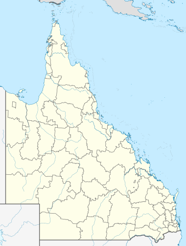
| Location | |||||||||||||||
| LGA(s) | Sunshine Coast Region | ||||||||||||||
| County | Canning | ||||||||||||||
| Parish | Bribie | ||||||||||||||
| State electorate(s) | Caloundra | ||||||||||||||
| Federal division(s) | Fisher | ||||||||||||||
| |||||||||||||||
Moffat Beach is a coastal suburb in the Sunshine Coast Region, Queensland, Australia.[2] In the 2021 census, Moffat Beach had a population of 2,691 people.[1]
Geography
[edit]Moffat Beach is within the Caloundra urban centre, located directly north-east of Caloundra CBD.
History
[edit]The suburb and beach were named after James Campbell Moffat, a chemist from Brisbane, who acquired 20 acres (8.1 ha) of coastal land at Caloundra on 18 August 1882. A year later, he built a holiday house c. 500 metres south-east of Moffat Beach on the headland which now also bears his name.[2][3][4][5]
The Queen of the Colonies pandanus tree stood on the headland above the site where 13 passengers from the Queen of the Colonies shipwreck were cast ashore in a small boat during stormy weather in April 1863 while returning from Moreton Island. In 1963, a concrete memorial was erected on the site.[6][7]
In 1888, Caloundra's first guesthouse "Sea Glint" opened on a ridge overlooking present-day Moffat Beach. During this time Sir Thomas McIllwraith, Premier of Queensland, was a regular visitor to Sea Glint on the shore of Tooway Lake or Wilson's Lake as it was then known [7]
Demographics
[edit]In the 2016 census, Moffat Beach had a population of 2,553 people, made up of 1245 (48.8%) male and 1307 (51.2%) female. The median age of the Moffat Beach population was 44 years, above both the Queensland median of 37 and the Australian median of 38. 77.4% of people were born in Australia. The next most common countries of birth were England (5.1%) and New Zealand (4.5%). 92% of people only spoke English at home. Religious affiliations in Moffat Beach were predominantly No Religion (33.5%), Catholic (23.1%) and Anglican (15.4%).[8]
In the 2021 census, Moffat Beach had a population of 2,691 people.[1]
Education
[edit]There are no schools in Moffat Beach. The nearest primary school is Caloundra State School in neighbouring Caloundra. The nearest secondary school is Caloundra State High School also in Caloundra.[9]
Shopping and eating
[edit]A bakery, convenience store, doctors' surgery and post office are located at Buccleugh Street.[citation needed]
Cafes, restaurants and takeaways as well as gift shops, an art gallery and craft brewery are located in Seaview Terrace and around the corner into Roderick Street.[citation needed]
Parks and recreation
[edit]Eleanor Shipley Park stretches from Tooway Lake through to the cafes of Seaview Terrace. Barbecue facilities and picnic shelters are provided, as well as a children's play area and easy access to Moffat beach.[citation needed]
Roslin Park in Roslin Street provides a children's play area and is dog-friendly.[citation needed]
On Moffat Beach, dogs are allowed off-leash before 8am and after 4pm. The beach itself is unpatrolled.[citation needed]
The Des Dywer walking track is an oceanway that runs from Moffat Beach to Bulcock beach, following the coastline on cliffs and boardwalks.[citation needed]
Surfing
[edit]Moffat Beach is protected from southerly winds by Moffat Headland which provides a sought-after surf break.[citation needed]
One of Australia's longest-running surf competitions, the Pa and Ma Bendall Surfing Classic is held every Easter in honour of local surfing legends Charles "Pa" and Marjorie "Ma" Bendall.[10]
References
[edit]- ^ a b c Australian Bureau of Statistics (28 June 2022). "Moffat Beach (SAL)". 2021 Census QuickStats. Retrieved 28 February 2023.
- ^ a b "Moffat Beach – suburb in Sunshine Coast Region (entry 48764)". Queensland Place Names. Queensland Government. Retrieved 27 January 2020.
- ^ "Caloundra, Qld". Aussie Towns. Archived from the original on 16 May 2022. Retrieved 3 June 2022.
- ^ "Heritage". Sunshine Coast Regional Council. Archived from the original on 16 November 2021. Retrieved 29 July 2024.
- ^ "Caloundra". The Sydney Morning Herald. 8 February 2004. Archived from the original on 27 February 2007. Retrieved 8 February 2004.
- ^ "Queen of the Colonies". Monument Australia. Archived from the original on 17 March 2021. Retrieved 29 January 2022.
- ^ a b "1850-1899 | Heritage". Sunshine Coast Council. Archived from the original on 16 November 2021. Retrieved 16 November 2021.
- ^ Australian Bureau of Statistics (27 June 2017). "Moffat Beach (SSC)". 2016 Census QuickStats. Retrieved 20 October 2018.
- ^ "Queensland Globe". State of Queensland. Retrieved 4 April 2020.
- ^ "Pa and Ma Bendell Heritage Story". Heritage. Sunshine Coast Regional Council. Archived from the original on 12 March 2024. Retrieved 29 July 2024.
External links
[edit]Media related to Moffat Beach, Queensland at Wikimedia Commons
- "Moffat Beach". Queensland Places. Centre for the Government of Queensland, University of Queensland.
| Authority control databases: National |
|---|