Íomhá:Luton Town Hall - geograph.org.uk - 944904.jpg
Size of this preview: 450 × 600 picteilín. Other resolutions: 180 × 240 picteilín | 480 × 640 picteilín.
Taispeáin leagan ardtaifigh den íomhá (480 × 640 picteilín, méid comhaid: 97 KB, cineál MIME: image/jpeg)
| Seo comhad as An Cómhaoin Viciméid. Tá an tuairisc as an leathanach tuairisc Cómhaoin a leanas thíos.
|
Achoimriú
| Tuairisc |
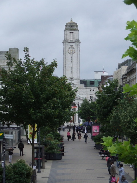
English: Luton Town Hall Looking along George Street to the Town Hall. |
| Dáta | |
| Foinse | From geograph.org.uk |
| Údar | Thomas Nugent |
| Creidiúint (required by the license) | Thomas Nugent / Luton Town Hall / |
| Camera location | | View this and other nearby images on: OpenStreetMap |
|---|
| Object location | | View this and other nearby images on: OpenStreetMap |
|---|
Ceadúnú

|
This image was taken from the Geograph project collection. See this photograph's page on the Geograph website for the photographer's contact details. The copyright on this image is owned by Thomas Nugent and is licensed for reuse under the Creative Commons Attribution-ShareAlike 2.0 license.
|
This file is licensed under the Creative Commons Attribution-Share Alike 2.0 Generic license.
Creidiúint: Thomas Nugent
- Is féidir:
- an saothar seo a roinnt – an saothar seo a chóipeáil, a dháil amach, agus a tharchur
- an saothar seo a athmheascadh – an saothar seo a oiriúnú
- Ach amháin má leantar na coinníollacha seo a leanas:
- sannadh – Ní mor creidiúint a thabhairt leis an saothar, faoi mar a shonraigh an údar nó tabharthóir an ceadúnais (ach ná húsáid modh a thugann le fios go thacaíonn sé/sí tú féin nó an úsáid a bhaineann tú as an saothar).
- comhroinn araon – Má athraíonn tú nó síneann tú amach an saothar seo, ní féidir é a dháileadh ach amhaín faoin gceadúnas céanna nó ceann cosúil leis an gceann seo.
Stair chomhaid
Cliceáil ar dáta/am chun an comhad a radharc mar a bhí sé ag an am sin.
| Dáta/Am | Mionsamhail | Toisí | Úsáideoir | Nóta tráchta | |
|---|---|---|---|---|---|
| faoi láthair | 10:23, 22 Feabhra 2011 | 480 × 640 (97 KB) | GeographBot | == {{int:filedesc}} == {{Information |description={{en|1=Luton Town Hall Looking along George Street to the Town Hall.}} |date=2008-08-18 |source=From [http://www.geograph.org.uk/photo/944904 geograph.org.uk] |author=[http://www.geograph.org.uk/profile/48 |
Úsáid comhaid
Tá nasc chuig an gcomhad seo ar na leathanaigh seo a leanas:
Global file usage
The following other wikis use this file:
- Úsáid ar ar.wikipedia.org
- Úsáid ar arz.wikipedia.org
- Úsáid ar ast.wikipedia.org
- Úsáid ar azb.wikipedia.org
- Úsáid ar az.wikipedia.org
- Úsáid ar ba.wikipedia.org
- Úsáid ar be.wikipedia.org
- Úsáid ar ca.wikipedia.org
- Úsáid ar ceb.wikipedia.org
- Úsáid ar cs.wikipedia.org
- Úsáid ar cy.wikipedia.org
- Úsáid ar da.wikipedia.org
- Úsáid ar de.wikivoyage.org
- Úsáid ar el.wikipedia.org
- Úsáid ar en.wikivoyage.org
- Úsáid ar eo.wikipedia.org
- Úsáid ar eu.wikipedia.org
- Úsáid ar fr.wikipedia.org
- Úsáid ar he.wikipedia.org
- Úsáid ar hu.wikipedia.org
- Úsáid ar is.wikipedia.org
- Úsáid ar it.wikivoyage.org
- Úsáid ar lld.wikipedia.org
- Úsáid ar ms.wikipedia.org
- Úsáid ar os.wikipedia.org
- Úsáid ar pl.wikivoyage.org
- Úsáid ar pt.wikipedia.org
- Úsáid ar ru.wikipedia.org
- Úsáid ar sr.wikipedia.org
- Úsáid ar sv.wikipedia.org
- Úsáid ar tt.wikipedia.org
- Úsáid ar ur.wikipedia.org
- Úsáid ar vo.wikipedia.org
- Úsáid ar www.wikidata.org
- Úsáid ar yi.wikipedia.org