Ficheiro:Balearic Sea map.png
Tamaño desta vista previa: 800 × 511 píxeles. Outras resolucións: 320 × 204 píxeles | 640 × 409 píxeles | 1.000 × 639 píxeles.
Ficheiro orixinal (1.000 × 639 píxeles; tamaño do ficheiro: 77 kB; tipo MIME: image/png)
| Este ficheiro procede de Wikimedia Commons. A continuación móstrase a información da súa páxina de descrición. Commons é un repositorio libre de ficheiros multimedia. Pode contribuír alí cargando as súas imaxes. |
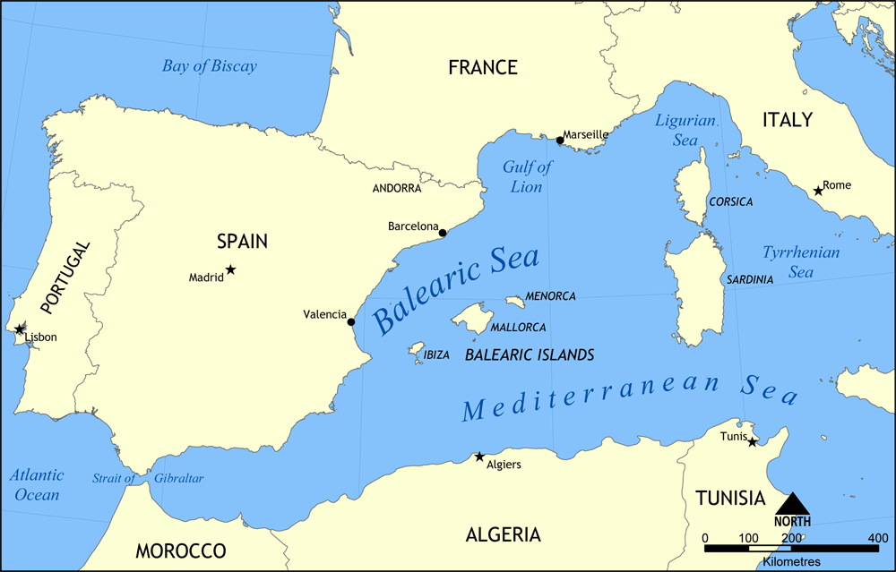
Map showing the location of the Balearic Sea, part of the Mediterranean Sea.
Created by NormanEinstein, May 26, 2006.
Eu, como posuidor dos dereitos de autor desta obra, pola presente publícoa baixo a seguinte licenza:

|
Autorízase a copia, distribución e/ou modificación deste documento baixo os termos da licenza de documentación libre GNU, versión 1.2 ou calquera outra que posteriormente publique a Free Software Foundation; sen seccións invariables, textos de portada, nin textos de contraportada. Inclúese unha copia da devandita licenza na sección titulada GNU Free Documentation License. |
| Este ficheiro está licenciado baixo a licenza Creative Commons recoñecemento compartir igual 3.0 sen adaptar. | ||
| ||
| A etiqueta desta licenza engadiuse a este ficheiro como parte da actualización da licenza GFDL. |
Historial do ficheiro
Prema nunha data/hora para ver o ficheiro tal e como estaba nese momento.
| Data/Hora | Miniatura | Dimensións | Usuario | Comentario | |
|---|---|---|---|---|---|
| actual | 26 de maio de 2006 ás 15:31 | 1.000 × 639 (77 kB) | NormanEinstein | Map showing the location of the Balearic Sea, part of the Mediterranean Sea. Created by NormanEinstein, May 26, 2006. {{GFDL-self}} Category:Maps of seas |
Uso do ficheiro
As seguintes 2 páxinas usan este ficheiro:
Uso global do ficheiro
Os seguintes wikis empregan esta imaxe:
- Uso en af.wikipedia.org
- Uso en an.wikipedia.org
- Uso en avk.wikipedia.org
- Uso en az.wikipedia.org
- Uso en az.wiktionary.org
- Uso en be.wikipedia.org
- Uso en bg.wikipedia.org
- Uso en bn.wikipedia.org
- Uso en bs.wikipedia.org
- Uso en ca.wikipedia.org
- Uso en ce.wikipedia.org
- Uso en ckb.wikipedia.org
- Uso en cv.wikipedia.org
- Uso en da.wikipedia.org
- Uso en en.wikipedia.org
- HMS Nelson (28)
- French battleship Bouvet
- Balearic Sea
- Malta convoys
- User:NormanEinstein/gallery
- French ironclad Dévastation
- French battleship Mirabeau
- French battleship Justice
- French battleship Vérité
- French battleship République
- French battleship Patrie
- French ironclad Magenta (1890)
- French battleship Charles Martel
- French battleship Brennus
- French ironclad Marceau
- French ironclad Neptune
- French cruiser Lavoisier
- French cruiser Troude
- Action of 19 February 1801
- User talk:Keith-264/sandbox5
- French cruiser Milan
- French cruiser Tage
- French cruiser Sfax
- French cruiser Forbin
- French cruiser Lalande
- French cruiser Cosmao
- French cruiser Cassard
- French cruiser Du Chayla
- French cruiser D'Iberville
- French cruiser Casabianca
- Uso en es.wikipedia.org
Ollar o uso global deste ficheiro.