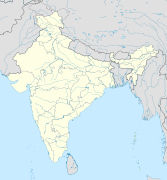
ଫାଇଲ:India relief location map.jpg
Appearance

ଏହି ଦେଖଣାର ଆକାର: ୫୫୭ × ୬୦୦ ପିକ୍ସେଲ । ବାକି ରେଜୋଲୁସନ: ୨୨୩ × ୨୪୦ ପିକ୍ସେଲ | ୪୪୬ × ୪୮୦ ପିକ୍ସେଲ | ୭୧୩ × ୭୬୮ ପିକ୍ସେଲ | ୯୫୧ × ୧,୦୨୪ ପିକ୍ସେଲ | ୧,୫୦୦ × ୧,୬୧୫ ପିକ୍ସେଲ.
ମୂଳ ଫାଇଲ (୧,୫୦୦ × ୧,୬୧୫ ପିକସେଲ, ଫାଇଲ ଆକାର: ୧.୯୧ MB, ଏମ.ଆଇ.ଏମ.ଇର ପ୍ରକାର: image/jpeg)
ଫାଇଲ ଇତିହାସ
ଏହା ଫାଇଲଟି ସେତେବେଳେ ଯେମିତି ଦିଶୁଥିଲା ତାହା ଦେଖିବା ପାଇଁ ତାରିଖ/ବେଳା ଉପରେ କ୍ଲିକ କରନ୍ତୁ
| ତାରିଖ/ବେଳ | ନଖ ଦେଖଣା | ଆକାର | ବ୍ୟବହାରକାରୀ | ମତାମତ | |
|---|---|---|---|---|---|
| ଏବେକାର | ୧୯:୨୬, ୧୪ ଅକ୍ଟୋବର ୨୦୨୦ | ୧,୫୦୦ × ୧,୬୧୫ (୧.୯୧ MB) | NordNordWest | upd Telangana/Andhra Pradesh | |
| ୨୧:୧୮, ୧୭ ଜୁଲାଇ ୨୦୨୦ | ୧,୫୦୦ × ୧,୬୧୫ (୧.୯୧ MB) | NordNordWest | + Ladakh | ||
| ୨୧:୨୧, ୩୧ ଜୁଲାଇ ୨୦୧୬ | ୧,୫୦୦ × ୧,୬୧୫ (୧.୯୩ MB) | Julieta39 | According with User:NordNordWest: Thick grey line = de facto & de jure recognised borders; slim grey line = de facto contested borders; broken grey line = claimed borders. | ||
| ୧୮:୦୦, ୩୧ ଜୁଲାଇ ୨୦୧୬ | ୧,୫୦୦ × ୧,୬୧୫ (୧.୯ MB) | NordNordWest | Reverted to version as of 20:09, 5 June 2014 (UTC); no text in location maps, has to work in all languages | ||
| ୨୨:୨୦, ୩୦ ଜୁଲାଇ ୨୦୧୬ | ୧,୫୦୦ × ୧,୬୧୫ (୧.୯୪ MB) | Julieta39 | More clarely : Thick grey line = de facto & de jure recognised borders ; Slim grey line = de facto contested borders ; Broken grey line = claimed borders (cbI = by India, cbP = by Pakistan, cbC = by China). | ||
| ୦୧:୩୯, ୬ ଜୁନ ୨୦୧୪ | ୧,୫୦୦ × ୧,୬୧୫ (୧.୯ MB) | NordNordWest | + Telangana | ||
| ୧୯:୫୧, ୭ ଜୁନ ୨୦୧୧ | ୧,୫୦୦ × ୧,୬୧୫ (୧.୯୫ MB) | NordNordWest | + missing Nagaland | ||
| ୨୧:୦୧, ୨୩ ଅପ୍ରେଲ ୨୦୧୦ | ୧,୫୦୦ × ୧,୬୧୫ (୨ MB) | Uwe Dedering | {{Information |Description={{en|1=Location map of India. Equirectangular projection. Strechted by 106.0%. Geographic limits of the map: * N: 37.5° N * S: 5.0° N * W: 67.0° E * E: 99.0° E Made with Natural Earth. Free vector and raster map data @ natur |
ଫାଇଲ ବ୍ୟବହାର
ଏହି 32 ପୃଷ୍ଠାସବୁ ଏହି ଫାଇଲ ସହ ଜଡ଼ିତ:
- କାଜିରଙ୍ଗା ଜାତୀୟ ଉଦ୍ୟାନ
- କାହ୍ନା ଜାତୀୟ ଉଦ୍ୟାନ
- କୁଲଡିହା ବନ୍ୟଜନ୍ତୁ ସଂରକ୍ଷଣାଳୟ
- ଗହୀରମଥା ସାମୁଦ୍ରିକ ଅଭୟାରଣ୍ୟ
- ଗୋପ ମନ୍ଦିର
- ଗୋରୁମାରା ଜାତୀୟ ଉଦ୍ୟାନ
- ଜଳଦାପଡ଼ା ଜାତୀୟ ଉଦ୍ୟାନ
- ଜିମ୍ କର୍ବେଟ୍ ଜାତୀୟ ଉଦ୍ୟାନ
- ତାଡୋବା ଜାତୀୟ ଉଦ୍ୟାନ
- ଦୁଧ୍ୱା ଜାତୀୟ ଉଦ୍ୟାନ
- ନାଗାରହୋଳେ ଜାତୀୟ ଉଦ୍ୟାନ
- ପକ୍ ପ୍ରଣାଳୀ
- ପନ୍ନା ଜାତୀୟ ଉଦ୍ୟାନ
- ପେଞ୍ଚ୍ ଜାତୀୟ ଉଦ୍ୟାନ
- ପେରିୟାର୍ ଜାତୀୟ ଉଦ୍ୟାନ
- ବାନ୍ଦିପୁର ଜାତୀୟ ଉଦ୍ୟାନ
- ବାନ୍ଧବଗଡ଼ ଜାତୀୟ ଉଦ୍ୟାନ
- ମୁଦୁମଲାଇ ଜାତୀୟ ଉଦ୍ୟାନ
- ମୋରଣୀ
- ରନ୍ଥାମ୍ବୋର୍ ଜାତୀୟ ଉଦ୍ୟାନ
- ରାଜାଜୀ ଜାତୀୟ ଉଦ୍ୟାନ
- ଶ୍ରୀ ଭେଙ୍କଟେଶ୍ୱର ଜାତୀୟ ଉଦ୍ୟାନ
- ସତପୁଡ଼ା ଜାତୀୟ ଉଦ୍ୟାନ
- ସରିସ୍କା ଜାତୀୟ ଉଦ୍ୟାନ
- ସୁନ୍ଦରବନ ଜାତୀୟ ଉଦ୍ୟାନ
- ସେଣ୍ଟିନେଲି ଜନଜାତି
- ହେମିସ୍ ଜାତୀୟ ଉଦ୍ୟାନ
- ଛାଞ୍ଚ:Location map India
- ଛାଞ୍ଚ:Location map India/doc
- ଛାଞ୍ଚ:Location map India airport
- ମଡ୍ୟୁଲ:Location map/data/India
- ମଡ୍ୟୁଲ:Location map/data/India/doc
ଜଗତ ଫାଇଲ ବ୍ୟବହାର
ତଳଲିଖିତ ଉଇକିସବୁ ଏହି ଫାଇଲଟିକୁ ବ୍ୟବହାର କରିଥାନ୍ତି:
- ace.wikipedia.orgରେ ବ୍ୟବହାର
- af.wikipedia.orgରେ ବ୍ୟବହାର
- als.wikipedia.orgରେ ବ୍ୟବହାର
- am.wikipedia.orgରେ ବ୍ୟବହାର
- anp.wikipedia.orgରେ ବ୍ୟବହାର
- ar.wikipedia.orgରେ ବ୍ୟବହାର
- ast.wikipedia.orgରେ ବ୍ୟବହାର
- as.wikipedia.orgରେ ବ୍ୟବହାର
- azb.wikipedia.orgରେ ବ୍ୟବହାର
- az.wikipedia.orgରେ ବ୍ୟବହାର
- Şablon:Yer xəritəsi Hindistan
- Benqal körfəzi
- Andaman dənizi
- Bandipur Milli Parkı
- Lakkadiv dənizi
- Səkkizinci Dərəcə boğazı
- Doqquzuncu Dərəcə boğazı
- Onuncu Dərəcə boğazı
- Dunkan boğazı
- Polk boğazı
- Caldapara Milli Parkı
- Cafna yarımadası
- Kathiyavar yarımadası
- Hindustan
- Tar (səhra)
- Andaman adaları
- Nikobar adaları
- Mahatma Qandi Dəniz Milli Parkı
- Şrixarikota
ଏହି ଫାଇଲଟିର ଅଧିକ ବିଶ୍ୱବ୍ୟାପୀ ବ୍ୟବହାର ଦେଖନ୍ତୁ ।


