ଫାଇଲ:North Rhine-Westphalia location map 05.svg

Size of this PNG preview of this SVG file: ୫୨୭ × ୫୨୪ ପିକ୍ସେଲ. ବାକି ରେଜୋଲୁସନ: ୨୪୧ × ୨୪୦ ପିକ୍ସେଲ | ୪୮୩ × ୪୮୦ ପିକ୍ସେଲ | ୭୭୨ × ୭୬୮ ପିକ୍ସେଲ | ୧,୦୩୦ × ୧,୦୨୪ ପିକ୍ସେଲ | ୨,୦୬୦ × ୨,୦୪୮ ପିକ୍ସେଲ.
ମୂଳ ଫାଇଲ (SVG ଫାଇଲ, ସାଧାରଣ ମାପ ୫୨୭ × ୫୨୪ ପିକ୍ସେଲ, ଫାଇଲ ଆକାର: ୪.୪୨ MB)
This is a file from the Wikimedia Commons. Information from its description page there is shown below. |
ସାରକଥା
| ବିବରଣୀ |
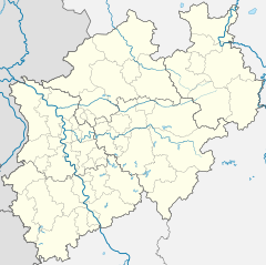
Deutsch: Positionskarte Nordrhein-Westfalen, Germany. Geographische Begrenzung der Karte:
English: Location map North Rhine-Westphalia, Germany. Geographic limits of the map:
Français : Carte du land Rhénanie-du-Nord-Westphalie (Allemagne) destinée à géolocalisation. Les limites géographiques sont:
|
|||||||||||||
| ତାରିଖ | ||||||||||||||
| ମୂଳାଧାର |
ଆପଣା କାମ, based on (not all layers may be visible or included):
Only to compare some issues: |
|||||||||||||
| ଲେଖକ |
TUBS |
|||||||||||||
| ଅନ୍ୟ ସଂସ୍କରଣ |
[]
|
|||||||||||||
| SVG genesis |


ସତ୍ଵ

|
ମାଗଣା ସଫ୍ଟବେର ଫାଉଣ୍ଡେସନ ଦେଇ ପ୍ରକାଶିତ କୌଣସି ବଦଳାଇ ନହେବା ଭଳି ଧାରା, ଆଗ ବା ପଛ ପଟ ମଲାଟ ବିନା GNU ଖୋଲା ଦଲିଲକାରଣ ଲାଇସେନ୍ସ ୧.୨ ତମ ସଙ୍କଳନ ବା ଆଉ କୌଣସି ସର୍ତ୍ତାବଳି ଅନୁସାରେ ଏହି ଦଲିଲର ନକଲ, ବଣ୍ଟନ ତଥା/କିମ୍ବା ବଦଳାଇବା ନିମନ୍ତେ ଅନୁମତି ଦିଆଗଲା । GNU ମାଗଣା ଦଲିଲକରଣ ଲାଇସେନ୍ସ ନାମକ ବିଭାଗରେ ଲାଇସେନ୍ସର ନକଲ ଦିଆଯାଇଅଛି । |
ଏହି ଫାଇଲଟି କ୍ରିଏଟିଭ କମନ୍ସ ଆଟ୍ରିବୁସନ ୩.୦ ଅଣପୋର୍ଟେଡ଼, ୨.୫ ଜେନେରିକ, 2.0 ଜେନେରିକ ତଥା ୧.୦ ଜେନେରିକ ଲାଇସେନ୍ସଭୁକ୍ତ ।
ଶ୍ରେୟ: TUBS

- ଆପଣ ଆରାମରେ:
- ବାଣ୍ଟିପାରିବେ – କାମଟିକୁ ନକଲ କରିପାରିବେ, ବାଣ୍ଟିପାରିବେ ଓ ପ୍ରସାରଣ କରିପାରିବେ
- ମିଶାଇପାରିବେ – କାମଟି ଅଭିଯୋଜନ କରିପାରିବେ
- ତଳଲିଖିତ ସର୍ତ୍ତାବଳୀ ଅଧୀନରେ:
- ଶ୍ରେୟ – ଆପଣ ମନେ କରି ଏହି କାମର ଆବଶ୍ୟକୀୟ ଶ୍ରେୟ ମୂଳ ଗଢ଼ାଳି ବା ସ୍ୱତ୍ୱାଧୀକାରୀଙ୍କୁ ଦେବେ ଏବଂ ଦେଲାବେଳେ ଲାଇସେନ୍ସର ଲିଙ୍କ ଦେଇ କି କି ବଦଳ କଲେ ଉଲ୍ଲେଖ କରିବେ । ଏହା ଉପଯୁକ୍ତ ଢଙ୍ଗରେ କରିବେ କିନ୍ତୁ ଲାଇସେନ୍ସ ଦେଉଥିବା ବ୍ୟକ୍ତି ଆପଣଙ୍କ ପ୍ରଚାର କଲା ଭଳି କିଛି ଲେଖିବେ ନାହିଁ ।
ଏହି ଫାଇଲଟି କ୍ରିଏଟିଭ କମନ୍ସ ଆଟ୍ରିବୁସନ ୩.୦ ଅଣପୋର୍ଟେଡ଼, ୨.୫ ଜେନେରିକ, ୨.୦ ଜେନେରିକ ତଥା ୧.୦ ଜେନେରିକ ଲାଇସେନ୍ସଭୁକ୍ତ ।
ଶ୍ରେୟ: TUBS
- ଆପଣ ଆରାମରେ:
- ବାଣ୍ଟିପାରିବେ – କାମଟିକୁ ନକଲ କରିପାରିବେ, ବାଣ୍ଟିପାରିବେ ଓ ପ୍ରସାରଣ କରିପାରିବେ
- ମିଶାଇପାରିବେ – କାମଟି ଅଭିଯୋଜନ କରିପାରିବେ
- ତଳଲିଖିତ ସର୍ତ୍ତାବଳୀ ଅଧୀନରେ:
- ଶ୍ରେୟ – ଆପଣ ମନେ କରି ଏହି କାମର ଆବଶ୍ୟକୀୟ ଶ୍ରେୟ ମୂଳ ଗଢ଼ାଳି ବା ସ୍ୱତ୍ୱାଧୀକାରୀଙ୍କୁ ଦେବେ ଏବଂ ଦେଲାବେଳେ ଲାଇସେନ୍ସର ଲିଙ୍କ ଦେଇ କି କି ବଦଳ କଲେ ଉଲ୍ଲେଖ କରିବେ । ଏହା ଉପଯୁକ୍ତ ଢଙ୍ଗରେ କରିବେ କିନ୍ତୁ ଲାଇସେନ୍ସ ଦେଉଥିବା ବ୍ୟକ୍ତି ଆପଣଙ୍କ ପ୍ରଚାର କଲା ଭଳି କିଛି ଲେଖିବେ ନାହିଁ ।
- ସେଆର ଏଲାଇକ – ଯଦି ଆପଣ ଏହି କାମଟିକୁ ବଦଳାଇବେ, ରୂପାନ୍ତରଣ କରିବେ ବା ଏହାକୁ ନେଇ କିଛି ଗଢ଼ିବେ ତେବେ ଆପଣ ଏହାକୁ ଏକା ବା ଅଲଗା ଲାଇସେନ୍ସ ଭିତରେ ରଖିପାରିବେ ।
| ଏହି ଫାଇଲଟି କ୍ରିଏଟିଭ କମନ୍ସ CC0 1.0 ସାର୍ବଜନୀନ ପବ୍ଲିକ ଡୋମେନରେ ମିଳୁଅଛି । | |
| ଏହି କାମ ସହ ସମ୍ବନ୍ଧିତ ବ୍ୟକ୍ତି ଏହାକୁ ପବ୍ଲିକ ଡୋମେନ ରେ ନିଜର ସତ୍ଵାଧିକାରକୁ ଛାଡ଼ କରି ଜଗତସାରାର ସତ୍ଵାଧିକାର ଅନୁସାରେ ଏହା ସହ ସମ୍ବନ୍ଧିତ ଓ ପାଖାପାଖି ଅଧିକାର, ନିୟମ କାନୁନ ଦେଇ ଅନୁମୋଦିତ ନିୟମ ଯାଏଁ ଦାନ କଲେ। କାହାର ଅନୁମତି ବିନା ଆପଣ ଏହି କାମର ନକଲ, ବଦଳ, ବଣ୍ଟନ କରିପାରିବେ ।
|
| ମୁଁ, ଏହି କାମର ସତ୍ଵାଧିକାରୀ, ଏହାକୁ ପବ୍ଲିକ ଡୋମେନରେ ଏହାକୁ ପ୍ରକାଶ କରୁଛି । ଏହା ଜଗତଯାକ ପାଇଁ ଲାଗୁ । କେତେକ ଦେଶରେ ଏହା ନ୍ୟାୟମତେ ଅନୁମୋଦିତ ହୋଇନପାରେ, ଯଦି ସେମିତି ହୁଏ: ମୁଁ, ଯେ ପର୍ଯ୍ୟନ୍ତ ଆଇନରେ କିଛି ସର୍ତ୍ତ ଦରକାର ନ ପଡ଼େ ସେ ପର୍ଯ୍ୟନ୍ତ ସଭିଙ୍କୁ କୌଣସି ବି ଉଦ୍ଦେଶ୍ୟରେ ଏହ କାମଟିକୁ ନିସର୍ତ୍ତ ବ୍ୟବହାର କରିବାକୁ ଅନୁମତି ଦେଉଛି । |
| ସତ୍ଵହିନ: ଏହି କଳା କାମଟି ମୁକ୍ତ ଅଟେ; ଖୋଲା କଳା ଲାଇସେନ୍ସର ନୀତି ଅନୁସାରେ ଆପଣ ଏହାକୁ ପୁନବିତରଣ କରିପାରିବେ ତଥା/କିମ୍ବା ବଦଳାଇପାରିବେ । ଏହି ଲାଇସେନ୍ସର ଏକ ନମୁନା ଆପଣ କପିଲେଫ୍ଟ ଆଟ୍ରିବୁଟ ତଥା ବାକି ସାଇଟଗୁଡ଼ିକରେ ପାଇପାରିବେ । |

|
ଉପଯୁକ୍ତ ଶ୍ରେୟ ଦିଆଯାଇଥିଲେ ଏହି ଫାଇଲର ସତ୍ଵାଧିକାରୀ, TUBS |
|
|
ଆପଣ ନିଜ ପସନ୍ଦର ଲାଇସେନ୍ସ ବାଛିପାରିବେ ।

|
I'd greatly appreciate, that you attribute this media file to Wikimedia Commons, if used outside Wikipedia or Commons. For use in publications such as books, newspapers, blogs, websites, please insert here the following line:
|
ଫାଇଲ ଇତିହାସ
ଏହା ଫାଇଲଟି ସେତେବେଳେ ଯେମିତି ଦିଶୁଥିଲା ତାହା ଦେଖିବା ପାଇଁ ତାରିଖ/ବେଳା ଉପରେ କ୍ଲିକ କରନ୍ତୁ
| ତାରିଖ/ବେଳ | ନଖ ଦେଖଣା | ଆକାର | ବ୍ୟବହାରକାରୀ | ମତାମତ | |
|---|---|---|---|---|---|
| ଏବେକାର | ୦୧:୦୮, ୧୭ ଡିସେମ୍ବର ୨୦୦୯ | ୫୨୭ × ୫୨୪ (୪.୪୨ MB) | TUBS | korr crop area | |
| ୧୪:୦୦, ୪ ନଭେମ୍ବର ୨୦୦୮ | ୬୫୪ × ୬୫୬ (୪.୯୧ MB) | TUBS | {{Information |Description= |Source= |Date= |Author= |Permission= |other_versions= }} | ||
| ୧୩:୦୬, ୯ ଅକ୍ଟୋବର ୨୦୦୮ | ୬୫୪ × ୬୫୬ (୪.୭୭ MB) | TUBS | == Summary == {{Information |Description= {{de|Positionskarte Nordrhein-Westfalen, Germany. Geographische Begrenzung der Karte:}} {{en|Location map North Rhine-Westphalia, Germany. Geographic li | ||
| ୧୨:୫୮, ୯ ଅକ୍ଟୋବର ୨୦୦୮ | ୬୫୪ × ୬୫୬ (୪.୭୭ MB) | TUBS | == Summary == {{Information |Description= {{de|Positionskarte Nordrhein-Westfalen, Germany. Geographische Begrenzung der Karte:}} {{en|Location map North Rhine-Westphalia, Germany. Geographic li | ||
| ୧୨:୪୯, ୯ ଅକ୍ଟୋବର ୨୦୦୮ | ୬୫୪ × ୬୫୬ (୪.୭୭ MB) | TUBS | == Summary == {{Information |Description= {{de|Positionskarte Nordrhein-Westfalen, Germany. Geographische Begrenzung der Karte:}} {{en|Location map North Rhine-Westphalia, Germany. Geographic li |
ଫାଇଲ ବ୍ୟବହାର
ଏହି 4 ପୃଷ୍ଠାସବୁ ଏହି ଫାଇଲ ସହ ଜଡ଼ିତ:
ଜଗତ ଫାଇଲ ବ୍ୟବହାର
ତଳଲିଖିତ ଉଇକିସବୁ ଏହି ଫାଇଲଟିକୁ ବ୍ୟବହାର କରିଥାନ୍ତି:
- als.wikipedia.orgରେ ବ୍ୟବହାର
- ar.wikipedia.orgରେ ବ୍ୟବହାର
- as.wikipedia.orgରେ ବ୍ୟବହାର
- awa.wikipedia.orgରେ ବ୍ୟବହାର
- cv.wikipedia.orgରେ ବ୍ୟବହାର
- da.wikipedia.orgରେ ବ୍ୟବହାର
- de.wikipedia.orgରେ ବ୍ୟବହାର
- Neandertal
- Münsterland
- Ederkopf
- Hariksee
- Biggetalsperre
- Versetalsperre
- Langenberg (Rothaargebirge)
- Haar (Westfalen)
- Hülser Berg
- Rurtalsperre
- Tomburg
- Grube Anna
- Sengbachtalsperre
- Grube Emil Mayrisch
- Ahauser Stausee
- Burg Linn
- Baumberge
- Naturpark Hohe Mark
- Ronsdorfer Talsperre
- Wahnbachtalsperre
- Wuppertalsperre
- Oleftalsperre
- Vryburg (Denkmal)
- Panzertalsperre
- Isenburg (Hattingen)
- Oestertalsperre
- Jubachtalsperre
- Wiehltalsperre
- Brucher Talsperre
- Kerspetalsperre
- Baldeneysee
- Heilenbecketalsperre
- Schloss Broich
ଏହି ଫାଇଲଟିର ଅଧିକ ବିଶ୍ୱବ୍ୟାପୀ ବ୍ୟବହାର ଦେଖନ୍ତୁ ।