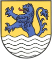
Königslutter
Königslutter | |
|---|---|
Location of Königslutter within Helmstedt district | |
| Country | Germany |
| State | Lower Saxony |
| District | Helmstedt |
| First mentioned | 1150 |
| Subdivisions | 18 Stadtteile |
| Government | |
| • Mayor | Ottomar Lippelt (SPD) |
| Area | |
| • Total | 130.58 km2 (50.42 sq mi) |
| Elevation | 134 m (440 ft) |
| Population (2022-12-31)[1] | |
| • Total | 15,933 |
| • Density | 120/km2 (320/sq mi) |
| Time zone | UTC+01:00 (CET) |
| • Summer (DST) | UTC+02:00 (CEST) |
| Postal codes | 38154 |
| Dialling codes | 05353 |
| Vehicle registration | HE |
| Website | www.koenigslutter.de |
Königslutter am Elm is a city of 17,000 inhabitants (2003) in the district of Helmstedt, Lower Saxony, Germany, near the Elm hills. Königslutter is twinned with Taunton in Somerset, in the southwest of England.
Königslutter is located on the tourist route designated the German Half-Timbered House Road (Deutsche Fachwerkstraße).
In its current form, the city was created in 1974 by joining the following 18 municipalities:


- Beienrode
- Boimstorf
- Bornum am Elm
- Glentorf
- Groß Steinum
- Klein Steimke
- Königslutter
- Lauingen
- Lelm
- Ochsendorf
- Rhode
- Rieseberg
- Rotenkamp
- Rottorf
- Scheppau
- Schickelsheim
- Sunstedt
- Uhry
Königslutter proper is situated on the Lutter stream and developed from the village of Lutter (first mentioned in 1150). It became a market town around 1300, then a city around 1400. In early modern times, beer brewing and Elm limestone mining and cutting were its main industries.
In 1924, the village of Oberlutter and the monastery church of Königslutter were incorporated as a city. The Benedictine monastery was founded near the village of Lutter in 1135 by Holy Roman Emperor Lothar II. The monastery church is known for its sculptural art and the tomb of the emperor.
Notes
External links
Template:Cities and towns in Helmstedt (district)
