Lens, Switzerland
Lens | |
|---|---|
 Coat of arms | |
Location of Lens  | |
 Lens  Lens | |
| Coordinates: 46°16′N 7°26′E / 46.267°N 7.433°E | |
| Country | Switzerland |
| Canton | Valais |
| District | Sierre |
| Government | |
| • Mayor | David Bagnoud |
| Area | |
| • Total | 13.9 km2 (5.4 sq mi) |
| Elevation | 1,129 m (3,704 ft) |
| Population (31 December 2018)[2] | |
| • Total | 4,198 |
| • Density | 300/km2 (780/sq mi) |
| Demonym | Les Lensards |
| Time zone | UTC+01:00 (Central European Time) |
| • Summer (DST) | UTC+02:00 (Central European Summer Time) |
| Postal code(s) | 1978 |
| SFOS number | 6240 |
| Localities | Crans-sur-Sierre, Flanthey, Chelin, Vaas, Les Condémines, Saint-Clément and Valençon |
| Surrounded by | Saint-Léonard, Icogne, Montana, Randogne, Chermignon, Sierre |
| Website | www SFSO statistics |
Lens is a municipality of the district of Sierre in the canton of Valais in Switzerland.
Villages
[change | change source]Crans-sur-Sierre, Flanthey, Chelin, Vaas, Les Condémines, Saint-Clément and Valençon.
Gallery
[change | change source]-
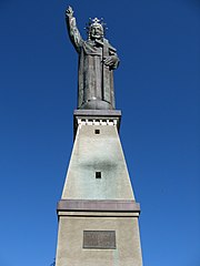
Statue du Christ Roi
-
Chelin
-
Lens


References
[change | change source]- ↑ 1.0 1.1 "Arealstatistik Standard - Gemeinden nach 4 Hauptbereichen". Federal Statistical Office. Retrieved 13 January 2019.
- ↑ "Ständige Wohnbevölkerung nach Staatsangehörigkeitskategorie Geschlecht und Gemeinde; Provisorische Jahresergebnisse; 2018". Federal Statistical Office. 9 April 2019. Retrieved 11 April 2019.
Other websites
[change | change source] Media related to Lens, Switzerland at Wikimedia Commons
- Official website (in French)
- Lens in German, French and Italian in the online Historical Dictionary of Switzerland.