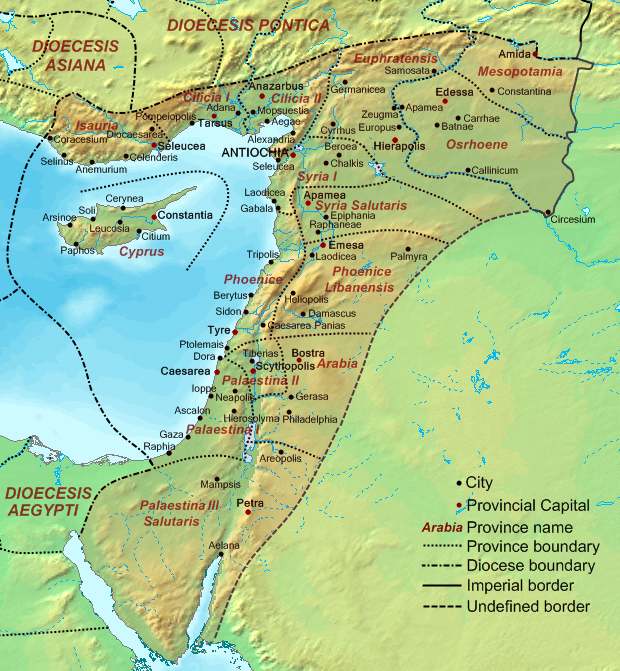
Датотека:Dioecesis Orientis 400 AD.png
Изглед

Величина овог приказа: 554 × 600 пиксела. 2 друге резолуције: 222 × 240 пиксела | 620 × 671 пиксела.
Оригинална датотека (620 × 671 пиксела, величина датотеке: 373 kB, MIME тип: image/png)
Историја датотеке
Кликните на датум/време да бисте видели тадашњу верзију датотеке.
| Датум/време | Минијатура | Димензије | Корисник | Коментар | |
|---|---|---|---|---|---|
| тренутна | 19:48, 19. септембар 2007. | 620 × 671 (373 kB) | Cplakidas | {{Information |Description=Map of the en:Diocese of the East (''Dioecesis Orientis'') ca. 400 AD, showing the subordinate provinces and the major cities. |Source=Base map found at en:Topographic map#Global 1-kilometer map, otherwise self-made. |
Употреба датотеке
5 следећих страница користи ову датотеку:
Глобална употреба датотеке
Други викији који користе ову датотеку:
- Употреба на ar.wikipedia.org
- Употреба на ast.wikipedia.org
- Употреба на azb.wikipedia.org
- Употреба на ba.wikipedia.org
- Употреба на be.wikipedia.org
- Употреба на bg.wikipedia.org
- Употреба на bn.wikipedia.org
- Употреба на br.wikipedia.org
- Употреба на ca.wikipedia.org
- Употреба на cy.wikipedia.org
- Употреба на de.wikipedia.org
- Употреба на el.wikipedia.org
- Употреба на en.wikipedia.org
- Decapolis
- Orient
- Bilad al-Sham
- Arab Christians
- Coele-Syria
- Al-Harith ibn Jabalah
- Antiochia ad Cragum
- Limes Arabicus
- List of revolutions and rebellions
- Mesopotamia (Roman province)
- Diocese of the East
- History of the Roman Empire
- History of Palestine
- Syria Prima
- Al-Mundhir III ibn al-Harith
- History of the Romans in Arabia
- Samaritan revolts
- Euphratensis
- Palaestina Salutaris
- Classical Anatolia
- Transjordan (region)
- Phoenice (Roman province)
Још глобалног коришћења ове датотеке.