বীরনগর
| বীরনগর উলা | |
|---|---|
| শহর | |
 | |
 বীরনগর  বীরনগর | |
| স্থানাঙ্ক: ২৩°১৪′৩৬″ উত্তর ৮৮°৩৩′৩০″ পূর্ব / ২৩.২৪৩৩° উত্তর ৮৮.৫৫৮২° পূর্ব | |
| Country | |
| State | West Bengal |
| District | Nadia |
| সরকার | |
| • ধরন | Municipality |
| • শাসক | Birnagar Municipality |
| আয়তন[১] | |
| • মোট | ৬ বর্গকিমি (২ বর্গমাইল) |
| উচ্চতা | ১৩ মিটার (৪৩ ফুট) |
| জনসংখ্যা (2021) | |
| • মোট | ৪১,২০০ |
| • জনঘনত্ব | ৬,৯০০/বর্গকিমি (১৮,০০০/বর্গমাইল) |
| Languages | |
| • Official | Bengali, English |
| সময় অঞ্চল | IST (ইউটিসি+5:30) |
| ওয়েবসাইট | www |
বীরনগর ভারতের পশ্চিমবঙ্গ রাজ্যের প্রেসিডেন্সি বিভাগের অন্তর্গত নদিয়া জেলার একটি শহর ও পৌরসভা এলাকা।
ইতিহাস[সম্পাদনা]

ব্রিটিশ শাসনামলের আগে গঙ্গাতীরবর্তী বীরনগরের নাম ছিল উলা। দস্যু দমনে স্থানীয় বাঙালী যুবকদের বীরত্ব দেখে ইংরেজরা এর নামকরণ করেছিল বীরনগর বা উলা বীরনগর। এটি নদীয়ার একটি পুরোনো জনপদ ও অন্যতম প্রাচীন পৌরসভা। এই পৌরসভার প্রথম পৌরপিতা ছিলেন কবি নবীনচন্দ্র সেন। বর্তমানে বীরনগর, রাণাঘাট মহকুমার অন্তর্গত। এখানে জোড়বাংলা মন্দির, দ্বাদশ শিবমন্দির ও আরও কিছু সুপ্রাচীন মন্দির আছে। বীরনগরে প্রখ্যাত সাহিত্যিক রাজশেখর বসুর জন্ম হয়।[২]
ভূগোল[সম্পাদনা]
কারিগরি সমস্যার কারণে গ্রাফ এই মূহুর্তে অস্থায়ীভাবে অনুপলব্ধ রয়েছে। |
M: municipal town/ city/notified area, CT: census town, R: rural/ urban centre.
Owing to space constraints in the small map, the actual locations in a larger map may vary slightly
Location[সম্পাদনা]
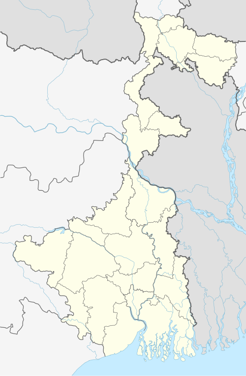
Birnagar is located at ২৩°১৪′৩৬″ উত্তর ৮৮°৩৩′৩০″ পূর্ব / ২৩.২৪৩৩° উত্তর ৮৮.৫৫৮২° পূর্ব.
The maps of Ranaghat I and Ranaghat II CD blocks, in the District Census Handbook 2011, Nadia, shows the census towns of Kamgachhi, Raghabpur, Panpara, Aistala, Satigachha, Anulia, Halalpur Krishnapur, Hijuli and Ranaghat (CT) forming a cluster around Ranaghat. Certain other localities such as Nokari, Nasra, Cooper's Camp, Birnagar, Habibpur, Gopalpur and Parbbatipur are also linked with this cluster.[৩]
Area overview[সম্পাদনা]
Nadia district is mostly alluvial plains lying to the east of Hooghly River, locally known as Bhagirathi. The alluvial plains are cut across by such distributaries as Jalangi, Churni and Ichhamati. With these rivers getting silted up, floods are a recurring feature.[৪] The Ranaghat subdivision has the Bhagirathi on the west, with Purba Bardhaman and Hooghly districts lying across the river. Topographically, Ranaghat subdivision is spread across the Krishnanagar-Santipur Plain, which occupies the central part of the district, and the Ranaghat-Chakdaha Plain, the low-lying area found in the south-eastern part of the district. The Churni separates the two plains. A portion of the east forms the boundary with Bangladesh. The lower portion of the east is covered by a portion of the North 24 Parganas district.[৫] The subdivision has achieved reasonably high urbanisation. 41.68% of the population lives in urban areas and 58.32% lives in rural areas.[৬]
Note: The map alongside presents some of the notable locations in the subdivision. All places marked in the map are linked in the larger full screen map. All the four subdivisions are presented with maps on the same scale – the size of the maps vary as per the area of the subdivision.
জনসংখ্যা[সম্পাদনা]
ভারতের ২০২১ সালের আদমশুমারি অনুসারে বীরনগর শহরের জনসংখ্যা হল ৪১২০০ জন।[৭] এর মধ্যে পুরুষ ৫১% এবং নারী ৪৯%।
এখানে সাক্ষরতার হার ৭৯%। পুরুষদের মধ্যে সাক্ষরতার হার ৮৩% এবং নারীদের মধ্যে এই হার ৭৫%। সারা ভারতের সাক্ষরতার হার ৫৯.৫%, তার চাইতে বীরনগরের এর সাক্ষরতার হার বেশি।
এই শহরের জনসংখ্যার ৯% হল ৬ বছর বা তার কম বয়সী।
ধর্ম বিশ্বাস[সম্পাদনা]
শিল্প ও সংস্কৃতি[সম্পাদনা]
বীরনগর উচ্চ বিদ্যালয় ও বীরনগর শীবকালি উচ্চ বালিকা বিদ্যালয়- দুটি শিক্ষা প্রতিষ্ঠান আছে। বীরনগরে শিল্পকলা ও সংস্কৃতি চর্চার বেশ কিছু বৃহৎ প্রতিষ্ঠান রয়েছে ৷ উল্লেখযোগ্য প্রতিষ্ঠানগুলি দি চিত্রালয় স্কুল অফ আর্ট , মালঞ্চ নাট্যগোষ্ঠী, এডুটেক একডেমি (কম্পিউটার শিক্ষা কেন্দ্র), চ্যাটার্জি নোবেল স্কুল (ইংরেজি মাধ্যম), গুনেন্দ্রনাথ পাবলিক স্কুল (ইংরেজি মাধ্যম), বীরনগর যুব কম্পিউটার সেন্টার, দিল্লী পাবলিক স্কুল, উষাগ্রাম প্রাথমিক বিদ্যালয়, সুরলোক
বীরনগর পৌরসভা[সম্পাদনা]
বীরনগর পৌরসভা 1869 সালে প্রতিষ্ঠিত হয় এবং বীরনগর পৌরসভার প্রথম চেয়ারম্যান ছিলেন কবি নবীনচন্দ্র সেন। বর্তমানে পৌরসভা 5.52 বর্গ কিলোমিটার এলাকা জুড়ে রয়েছে। এবং 14টি ওয়ার্ডে বিভক্ত।
যাতায়াত ব্যবস্থা[সম্পাদনা]
বীরনগর প্রাচীন কালে উলা নামে পরিচিত ছিল।। পৌর অঞ্চল হওয়ার কারণে যাতায়াত ব্যবস্থা বেশ ভাল। শিয়ালদহ থেকে ৮১ কি.মি দূরত্ব হওয়ার স্থানীয় লোকাল ট্রেনের সুবিধা পাওয়া যায়। শিয়ালদহ-কৃষ্ণনগর সিটি মেইন লাইন (ভায়া: রানাঘাট, কল্যানী, নৈহাটি, ব্যারাকপুর, দমদম) / রানাঘাট - লালগোলা মেইন লাইন (ভায়া: পলাসী, মুর্শিদাবাদ, বহরমপুর, লালগোলা)। এছাড়াও বীরনগর বাসস্টান্ড থেকে দওফুলিয়া - শান্তিপুর গামী বাস চলাচল করে। (ভায়া : ফুলিয়া, বীরনগর, আড়ংঘাটা)
17/B রানাঘাট - কৃষ্ণনগর গামী বাস চলাচল করে। (ভায়া : বীরনগর, তাহেরপুর, বাদকুল্লা)।

তথ্যসূত্র[সম্পাদনা]
- ↑ "Birnagar City"।
- ↑ "নদীয়া কাহিনী" (ইংরেজি ভাষায়)। ২৬ ২ নভেম্বর ০১৬। সংগ্রহের তারিখ ২২.০১.১৭। এখানে তারিখের মান পরীক্ষা করুন:
|তারিখ=, |সংগ্রহের-তারিখ=(সাহায্য){{অকার্যকর সংযোগ|তারিখ=মার্চ ২০১৯ [[File:Birnagar.jpg|thumb|left|bot=InternetArchiveBot |ঠিক করার প্রচেষ্টা=yes }} - ↑ "District Census Handbook Nadia, Census of India 2011, Series 20, Part XII A" (পিডিএফ)। Map of Ranaghat I CD block, page 449, and Map of Ranaghat II CD block, page 475। Directorate of census Operations V, West Bengal। সংগ্রহের তারিখ ৮ অক্টোবর ২০২০।
- ↑ Gangopadhyay, Basudev, Paschimbanga Parichay, 2001, (বাংলা ভাষায়), p. 70, Sishu Sahitya Sansad
- ↑ "District Census Handbook, Nadia, 2011, Series 20, Part XII A" (পিডিএফ)। Pages 13,14। Directorate of Census Operations, West Bengal.। সংগ্রহের তারিখ ১৬ অক্টোবর ২০২০।
- ↑ "District Statistical Handbook 2014 Nadia"। Table 2.2, 2.4(a)। Department of Planning and Statistics, Government of West Bengal। সংগ্রহের তারিখ ১৬ অক্টোবর ২০২০।
- ↑ "ভারতের ২০০১ সালের আদম শুমারি"। Archived from the original on ১৬ জুন ২০২১। সংগ্রহের তারিখ অক্টোবর ৭, ২০২১।
- ↑ "Ula Birnagar City Religion 2021"। সংগ্রহের তারিখ ২৩ মার্চ ২০১৭।