Payl:Dnieper Basin River Town Polski.png

Gidak-on ning maong paunang tan-aw: 583 x 600 ka mga piksel. Uban pang mga resoluyon: 233 x 240 ka mga piksel | 467 x 480 ka mga piksel | 746 x 768 ka mga piksel | 1,180 x 1,214 ka mga piksel.
Tibuok resolusyon (1,180 × 1,214 pixels, size sa payl: 129 KB, MIME type: image/png)
| Deskripsyon |
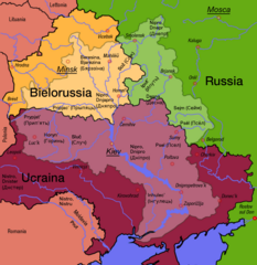
English: Polish map of the Dnepr River Basin
Polski: Zlewnia Dniepru |
||||||||
| Petsa | |||||||||
| Gigikanan | Francis McLloyd | ||||||||
| Tagsulat | Francis McLloyd | ||||||||
| Pagtugot (Paggamit pag-usab niini nga file) |
I, Francis McLloyd, the copyright holder of this work, hereby publishes it under the following licenses:
This file is licensed under the Creative Commons Attribution 2.5 Generic license. Attribution: I, Francis McLloyd
You may select the license of your choice. |
||||||||
| Other versions |
For a map in your language, ask Francis McLloyd.
|


|
Informacje autorskie takie jak dane autora, adresy www lub email, sygnatury itd zostały usunięte z niniejszego obrazu i przeniesione na stronę jego opisu. Dzięki temu obraz jest łatwiejszy do wykorzystania i bardziej neutralny językowo; dodatkowo informacje w formie tekstowej są łatwiejsze do wyszukiwania.
Serwis Commons zdecydowanie odradza umieszczane informacji o autorstwie wprost na obrazie. Miejscem na te informacje są strona opisu pliku i pola EXIF.
|

|
This map image could be re-created using vector graphics as an SVG file. This has several advantages; see Commons:Media for cleanup for more information. If an SVG form of this image is available, please upload it and afterwards replace this template with
{{vector version available|new image name}}.
It is recommended to name the SVG file “Dnieper Basin River Town Polski.svg”—then the template Vector version available (or Vva) does not need the new image name parameter. |
Kaagi sa payl
I-klik ang petsa/oras aron makit-an ang hulagway sa payl niadtong panahona.
| Petsa/Takna | Thumbnail | Mga dimensyon | Tiggamit | Komento | |
|---|---|---|---|---|---|
| kasamtangan | 14:32, 18 Septiyembre 2017 | 1,180 × 1,214 (129 KB) | Nicolay Sidorov | ... | |
| 08:37, 7 Marso 2007 | 1,180 × 1,214 (396 KB) | Dcoetzee | Removed watermark, pngcrushed | ||
| 15:29, 14 Pebrero 2006 | 1,180 × 1,214 (601 KB) | Francis McLloyd | Category:Maps of Ukraine Category:Maps of countries |
Mga paggamit sa payl
Ang mosunod nga mga panid misumpay niining payl:
Global nga paggamit sa payl
Kining ubang wiki naggamit ning maong payl:
- Paggamit sa cs.wikipedia.org
- Paggamit sa da.wikipedia.org
- Paggamit sa de.wikipedia.org
- Paggamit sa en.wikipedia.org
- Paggamit sa fa.wikipedia.org
- Paggamit sa fr.wikipedia.org
- Paggamit sa gl.wikipedia.org
- Paggamit sa id.wikipedia.org
- Paggamit sa nn.wikipedia.org
- Mal:Dnepr
- Dnepr
- Berezina
- Drut
- Pripjat
- Sozj
- Vorskla
- Psel
- Desna
- Vop
- Vjazma ved Dnepr
- Khmost
- Dnepr-reservoaret
- Kamjanske-reservoaret
- Kakhovka-reservoaret
- Kaniv-reservoaret
- Kiev-reservoaret
- Krementsjuk-reservoaret
- Bazavluk
- Inhulets
- Irpin-elva
- Roselva
- Samara ved Dnepr
- Stuhna
- Sulaelva
- Teteriv
- Trubizj
- Tjasmyn
- Zolotonosjka
- Konka
- Paggamit sa pl.wikipedia.org
- Paggamit sa tr.wikipedia.org
- Paggamit sa uk.wikipedia.org