Category:Maps of 7th-century Europe
Jump to navigation
Jump to search
| Preceded by: Maps of 6th-century Europe |
Maps of 7th-century Europe 601 AD-700 AD |
Succeeded by: Maps of 8th-century Europe |
Subcategories
This category has the following 8 subcategories, out of 8 total.
B
E
- Maps of 7th-century England (4 F)
F
- Maps of 7th-century France (1 F)
G
- Maps of 7th-century Greece (3 F)
I
S
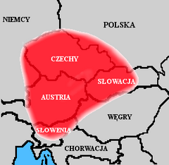
- Maps of Samo's realm (7 F)
Media in category "Maps of 7th-century Europe"
The following 13 files are in this category, out of 13 total.
-
Europe en 600.pdf 1,752 × 1,239; 600 KB
-
626 CE, Europe.svg 512 × 438; 1.51 MB
-
Europa BV042518589.jpg 1,954 × 1,337; 315 KB
-
Europe en 650.pdf 1,752 × 1,239; 605 KB
-
Historical atlas of modern Europe 1903 (135895354).jpg 9,126 × 6,828; 52.5 MB
-
651 CE, Europe.svg 512 × 438; 1.56 MB
-
Europe en 601.pdf 1,752 × 1,239; 599 KB
-
Europe en 651.pdf 1,752 × 1,239; 603 KB
-
Europe VII-e VIII-e siècles.jpg 10,902 × 7,080; 6.84 MB
-
-
Państwo Samona.png 300 × 293; 21 KB
-
Ungarn BV042512105.jpg 1,584 × 1,127; 255 KB
-
Миграции булгар после смерти Кубрата.jpg 1,017 × 721; 403 KB