Category:Mary Tavy
Jump to navigation
Jump to search
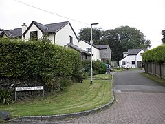
English: Mary Tavy is a village with a population of around 600, located four miles north of Tavistock in Devon in south-west England; it is named after the River Tavy. It used to be home to the world's largest copper mine Wheal Friendship, as well as a number of lead and tin mines. It borders Dartmoor National Park. The village lies a mile or two north of Peter Tavy; both were shown as separate settlements in the Domesday Book entry of 1086.
village in the United Kingdom  | |||||
| Upload media | |||||
| Instance of | |||||
|---|---|---|---|---|---|
| Location | West Devon, Devon, South West England, England | ||||
| Said to be the same as | Mary Tavy (Wikimedia duplicated page, civil parish) | ||||
 | |||||
Subcategories
This category has the following 3 subcategories, out of 3 total.
M
- St Mary's church, Mary Tavy (9 F)
W
- Wheal Betsy (11 F)
Media in category "Mary Tavy"
The following 200 files are in this category, out of 299 total.
(previous page) (next page)-
050715 101 uk dev betsy.jpg 700 × 525; 112 KB
-
A Bend in the Road - geograph.org.uk - 183267.jpg 640 × 413; 97 KB
-
A surviving post office - Mary Tavy - geograph.org.uk - 4126559.jpg 1,024 × 659; 204 KB
-
A twisty A386 heading north - geograph.org.uk - 3462959.jpg 640 × 480; 53 KB
-
A Wesleyan Methodist Church, Mary Tavy - geograph.org.uk - 3483209.jpg 800 × 600; 148 KB
-
A386 below Gibbet Hill.jpg 3,976 × 2,720; 2.48 MB
-
A386 heading north - geograph.org.uk - 3462918.jpg 640 × 480; 57 KB
-
A386 heading north - geograph.org.uk - 3462925.jpg 640 × 480; 101 KB
-
A386 heading north - geograph.org.uk - 3462945.jpg 640 × 480; 64 KB
-
A386 heading north - geograph.org.uk - 3462948.jpg 640 × 480; 58 KB
-
A386 heading north - geograph.org.uk - 3462955.jpg 640 × 480; 48 KB
-
A386 heading north - geograph.org.uk - 3462963.jpg 640 × 480; 67 KB
-
A386 heading north through Mary Tavy - geograph.org.uk - 3462935.jpg 640 × 480; 94 KB
-
A386 near Watervale - geograph.org.uk - 4126587.jpg 1,024 × 648; 147 KB
-
A386 zips through Mary Tavy - geograph.org.uk - 4126561.jpg 1,600 × 1,103; 522 KB
-
Access gate to Dartmoor - geograph.org.uk - 2902938.jpg 800 × 599; 268 KB
-
Access land at Creason - geograph.org.uk - 298249.jpg 640 × 480; 114 KB
-
Access land at Zoar - geograph.org.uk - 2453664.jpg 640 × 428; 214 KB
-
Across the River Burn - geograph.org.uk - 324301.jpg 640 × 480; 99 KB
-
An avenue of trees lining the A386 - geograph.org.uk - 2902855.jpg 800 × 600; 441 KB
-
Back to the car park - geograph.org.uk - 2453729.jpg 640 × 419; 167 KB
-
Bales near Mana Butts - geograph.org.uk - 4042151.jpg 1,920 × 1,395; 353 KB
-
Barn - geograph.org.uk - 5698114.jpg 640 × 426; 47 KB
-
Big tree by West Devon Way - geograph.org.uk - 5698118.jpg 426 × 640; 120 KB
-
Black Down - geograph.org.uk - 1839724.jpg 1,024 × 683; 188 KB
-
Black Down - geograph.org.uk - 417591.jpg 640 × 480; 120 KB
-
Boundary stone on Kingsett Down - geograph.org.uk - 2453711.jpg 640 × 427; 207 KB
-
Bridge and lane, Mary Tavy (geograph 4302864).jpg 1,920 × 2,177; 917 KB
-
Bridge over dismantled railway, Mary Tavy - geograph.org.uk - 4303009.jpg 4,000 × 3,000; 2.42 MB
-
Bridge over mine leat - geograph.org.uk - 421159.jpg 640 × 480; 132 KB
-
Bridleway at Creason - geograph.org.uk - 2453401.jpg 640 × 427; 218 KB
-
Bridleway on Kingsett Down - geograph.org.uk - 2453698.jpg 640 × 428; 169 KB
-
Bridleway to the River Tavy - geograph.org.uk - 5700961.jpg 640 × 426; 101 KB
-
Brookside, Mary Tavy - geograph.org.uk - 1475971.jpg 640 × 468; 104 KB
-
Burn valley - geograph.org.uk - 4303143.jpg 1,920 × 1,440; 753 KB
-
Burn valley - geograph.org.uk - 4303176.jpg 1,920 × 1,440; 670 KB
-
C J Down Coach Hire, Mary Tavy - geograph.org.uk - 3489280.jpg 800 × 600; 87 KB
-
C J Downs coach in Mary Tavy, Devon 1 April 2009.jpg 640 × 434; 46 KB
-
Cattle by the West Devon Way - geograph.org.uk - 3261409.jpg 640 × 480; 84 KB
-
Cattle grazing - geograph.org.uk - 5698102.jpg 640 × 426; 77 KB
-
Cattle grid between Horndon and Zoar - geograph.org.uk - 3207774.jpg 1,024 × 768; 520 KB
-
Cattle grid north of Zoar - geograph.org.uk - 3207799.jpg 1,024 × 769; 624 KB
-
Cattle on the West Devon Way - geograph.org.uk - 2441554.jpg 640 × 361; 207 KB
-
Chapel, Horndon - geograph.org.uk - 5902663.jpg 4,000 × 3,000; 4.98 MB
-
Cherrybrook Cross - geograph.org.uk - 3458797.jpg 640 × 480; 51 KB
-
Cholwell Brook - geograph.org.uk - 5700909.jpg 640 × 426; 103 KB
-
Cholwell Brook - geograph.org.uk - 5700914.jpg 640 × 426; 124 KB
-
Cholwell Brook - geograph.org.uk - 5700915.jpg 640 × 426; 123 KB
-
Chowell Brook Valley - geograph.org.uk - 1838379.jpg 1,024 × 683; 205 KB
-
Church and horse lorry in Mary Tavy - geograph.org.uk - 3444901.jpg 640 × 480; 130 KB
-
Church of St Mary, Mary Tavy - geograph.org.uk - 5902639.jpg 4,000 × 3,000; 4.92 MB
-
Cider Press, Mary Tavy - geograph.org.uk - 5120617.jpg 1,200 × 1,600; 628 KB
-
Clapper bridge over mine leat - geograph.org.uk - 1839687.jpg 1,024 × 683; 280 KB
-
Climbing up to Gibbet Hill - geograph.org.uk - 1475193.jpg 640 × 480; 117 KB
-
Coach hire company in Mary Tavy - geograph.org.uk - 2902883.jpg 800 × 600; 321 KB
-
Cottage at Mary Tavy (geograph 2441522).jpg 640 × 468; 241 KB
-
Cottage, Mary Tavy - geograph.org.uk - 4302800.jpg 1,920 × 2,560; 733 KB
-
Cottage, Mary Tavy - geograph.org.uk - 5908096.jpg 4,000 × 3,000; 4.71 MB
-
Crossings Close, Mary Tavy - geograph.org.uk - 1476035.jpg 640 × 480; 82 KB
-
Dartmoor(taken from A386) (2161645813).jpg 3,500 × 2,343; 6.52 MB
-
Devon pasture, Tavy Valley - geograph.org.uk - 5698123.jpg 640 × 426; 77 KB
-
Downs bus garage, Mary Tavy - geograph.org.uk - 1476002.jpg 640 × 480; 56 KB
-
Downs Garage - Mary Tavy - geograph.org.uk - 4101715.jpg 4,886 × 3,165; 3.75 MB
-
Entry to Willsworthy Range - geograph.org.uk - 4302419.jpg 1,920 × 1,249; 444 KB
-
Fallen tree in River Burn - geograph.org.uk - 325822.jpg 640 × 480; 137 KB
-
Farm buildings in Horndon - geograph.org.uk - 3207770.jpg 800 × 599; 87 KB
-
Farmland off the A386 - geograph.org.uk - 3462939.jpg 640 × 480; 64 KB
-
Farmland, Burntown - geograph.org.uk - 3462923.jpg 640 × 480; 53 KB
-
Field and house, Mary Tavy - geograph.org.uk - 4052371.jpg 1,920 × 1,440; 726 KB
-
Field boundary by the West Devon Way - geograph.org.uk - 3261378.jpg 640 × 480; 79 KB
-
Field boundary by the West Devon Way - geograph.org.uk - 3261691.jpg 480 × 640; 104 KB
-
Field near Horndon Down - geograph.org.uk - 298244.jpg 640 × 480; 89 KB
-
Foals, Higher Creason - geograph.org.uk - 5899003.jpg 4,000 × 3,000; 4.76 MB
-
Footbridge over Cholwell Brook - geograph.org.uk - 5700911.jpg 640 × 426; 110 KB
-
Footbridge over the River Tavy - geograph.org.uk - 157639.jpg 640 × 427; 148 KB
-
Footbridge over the River Tavy - geograph.org.uk - 5700971.jpg 640 × 426; 128 KB
-
Footpath from the A386 to Burntown farm - geograph.org.uk - 2902854.jpg 800 × 541; 239 KB
-
Footpath junction on West Devon Way - geograph.org.uk - 5700894.jpg 640 × 426; 60 KB
-
Fork in the lane near Mana Butts - geograph.org.uk - 4303268.jpg 1,920 × 1,274; 494 KB
-
Former railway track by River Burn - geograph.org.uk - 325826.jpg 640 × 480; 172 KB
-
Garden in Mary Tavy - geograph.org.uk - 2441488.jpg 640 × 428; 244 KB
-
Gate latch, Mary Tavy - geograph.org.uk - 4303005.jpg 1,920 × 2,669; 1.2 MB
-
Gate near Cholwell - geograph.org.uk - 4302468.jpg 1,920 × 1,359; 664 KB
-
Gate, West Devon Way - geograph.org.uk - 5700898.jpg 640 × 426; 59 KB
-
Geese, near Kingsett - geograph.org.uk - 1475455.jpg 640 × 480; 83 KB
-
Gibbet Hill - geograph.org.uk - 1839735.jpg 1,024 × 683; 204 KB
-
Gibbet Hill - geograph.org.uk - 1839740.jpg 1,024 × 683; 207 KB
-
Gibbet Hill pano.jpg 9,918 × 2,985; 6.26 MB
-
Gibbet Hill trig point and White Tor.jpg 4,008 × 2,848; 2.54 MB
-
-
Glenside, Mary Tavy - geograph.org.uk - 1476542.jpg 640 × 480; 69 KB
-
Gliders - geograph.org.uk - 183229.jpg 640 × 427; 77 KB
-
Goodbye Mary Tavy - geograph.org.uk - 4126562.jpg 640 × 412; 79 KB
-
Gorse bushes in flower on the moor - geograph.org.uk - 3444891.jpg 640 × 480; 184 KB
-
Gorse, above the Burn Valley - geograph.org.uk - 1476558.jpg 640 × 462; 86 KB
-
Grass Field - geograph.org.uk - 183289.jpg 640 × 427; 116 KB
-
Grassy West Devon Way - geograph.org.uk - 5700900.jpg 640 × 426; 73 KB
-
Gravel heaps, Willsworthy - geograph.org.uk - 4302412.jpg 1,920 × 1,217; 779 KB
-
Grazing horses, near Ley - geograph.org.uk - 1475488.jpg 640 × 480; 77 KB
-
Grazing off the A386 - geograph.org.uk - 3462954.jpg 640 × 480; 65 KB
-
Grazing towards Henscott Farm - geograph.org.uk - 3462957.jpg 640 × 480; 57 KB
-
Grazing, Wringworthy Farm - geograph.org.uk - 3462917.jpg 640 × 480; 75 KB
-
Green lane, near Kingsett - geograph.org.uk - 1475371.jpg 640 × 480; 94 KB
-
Harford Bridge camp site - geograph.org.uk - 196357.jpg 640 × 480; 69 KB
-
Henscott Farm - geograph.org.uk - 1995157.jpg 1,024 × 678; 241 KB
-
Higher Spring - geograph.org.uk - 324405.jpg 640 × 480; 104 KB
-
-
Hillside above the Burn - geograph.org.uk - 4303204.jpg 1,920 × 1,250; 672 KB
-
Hillside of gorse - geograph.org.uk - 5700893.jpg 640 × 426; 49 KB
-
Horndon , Small Lane - geograph.org.uk - 4631706.jpg 4,288 × 2,848; 6.5 MB
-
Horses and sheep, Zoar - geograph.org.uk - 5902661.jpg 4,000 × 3,000; 4.83 MB
-
House at Mana Butts - geograph.org.uk - 183278.jpg 640 × 427; 108 KB
-
House on the ridge - geograph.org.uk - 5695129.jpg 640 × 426; 51 KB
-
House, Mary Tavy - geograph.org.uk - 4302938.jpg 1,920 × 1,440; 416 KB
-
Houses near Mary Tavy church (geograph 2441501).jpg 640 × 477; 223 KB
-
Houses on the southern edge of Mary Tavy - geograph.org.uk - 2902862.jpg 800 × 600; 306 KB
-
Inclement weather over Dartmoor - geograph.org.uk - 6276906.jpg 4,032 × 3,024; 3.2 MB
-
Is it worth painting^ - geograph.org.uk - 4126557.jpg 1,600 × 978; 429 KB
-
Kent House, Mary Tavy - geograph.org.uk - 4302834.jpg 1,920 × 2,566; 1.17 MB
-
Kingsett - geograph.org.uk - 324476.jpg 640 × 480; 78 KB
-
Kingsett Down - geograph.org.uk - 6291196.jpg 2,592 × 1,944; 1.2 MB
-
Kingsett Down workings - geograph.org.uk - 1839706.jpg 1,024 × 683; 260 KB
-
Kingsett Farm - geograph.org.uk - 1475417.jpg 640 × 480; 81 KB
-
Lane heading west - geograph.org.uk - 3462924.jpg 640 × 480; 75 KB
-
Lane junction, Mary Tavy - geograph.org.uk - 4303007.jpg 1,920 × 2,200; 841 KB
-
Lane near Mary Tavy - geograph.org.uk - 4042144.jpg 1,920 × 2,296; 979 KB
-
Lane near Mary Tavy - geograph.org.uk - 4302530.jpg 1,920 × 2,395; 1.2 MB
-
Lane to Horndon - geograph.org.uk - 2441493.jpg 640 × 424; 217 KB
-
Lane to Mary Tavy - geograph.org.uk - 4303193.jpg 1,920 × 1,251; 605 KB
-
Lane to Mary Tavy - geograph.org.uk - 4303284.jpg 1,920 × 2,179; 948 KB
-
Le Tour du monde-11-p356.jpg 1,881 × 1,398; 995 KB
-
Le Tour du monde-11-p357.jpg 1,893 × 963; 818 KB
-
Le Tour du monde-11-p358.jpg 792 × 954; 344 KB
-
Le Tour du monde-11-p359.jpg 1,413 × 936; 655 KB
-
Le Tour du monde-11-p360.jpg 966 × 1,431; 594 KB
-
Le Tour du monde-11-p361.jpg 2,820 × 1,881; 2.42 MB
-
Le Tour du monde-11-p362.jpg 1,422 × 960; 611 KB
-
Leat at Brimhill - geograph.org.uk - 324493.jpg 480 × 640; 94 KB
-
Leat from River Tavy - geograph.org.uk - 2872304.jpg 1,944 × 2,592; 2.52 MB
-
Leaving Mary Tavy on the A386 - geograph.org.uk - 3489286.jpg 800 × 600; 74 KB
-
Looking south across the moor - geograph.org.uk - 1830838.jpg 640 × 480; 134 KB
-
Lower Creason - geograph.org.uk - 298261.jpg 480 × 640; 124 KB
-
Mare and foal on Kingsett Down - geograph.org.uk - 2453708.jpg 640 × 427; 175 KB
-
Mary Tavy , The A386 - geograph.org.uk - 4631707.jpg 4,288 × 2,848; 5.64 MB
-
Mary Tavy - geograph.org.uk - 203349.jpg 640 × 480; 81 KB
-
Mary Tavy Community Compost Scheme - geograph.org.uk - 5700916.jpg 640 × 426; 110 KB
-
Mary Tavy Community Composting Scheme - geograph.org.uk - 5120621.jpg 1,600 × 1,200; 771 KB
-
Mary Tavy in decline - geograph.org.uk - 4126558.jpg 792 × 1,024; 224 KB
-
Mary Tavy Inn, Mary Tavy, Dartmoor - geograph.org.uk - 3483182.jpg 800 × 600; 144 KB
-
Mary Tavy Inn, Mary Tavy, Dartmoor - geograph.org.uk - 3483190.jpg 600 × 800; 184 KB
-
Mary Tavy morning (March).jpg 3,068 × 1,847; 982 KB
-
Mary Tavy war memorial - geograph.org.uk - 2902884.jpg 800 × 600; 383 KB
-
Mary Tavy War Memorial - geograph.org.uk - 3462936.jpg 640 × 480; 80 KB
-
-
Mary Tavy, farm at Horndon - geograph.org.uk - 1001871.jpg 640 × 427; 244 KB
-
Mary Tavy, fields near Horndon - geograph.org.uk - 1001921.jpg 640 × 427; 156 KB
-
Mary Tavy, fish pass and weir - geograph.org.uk - 1001896.jpg 640 × 427; 274 KB
-
Mary Tavy, Hillbridge leat - geograph.org.uk - 1001878.jpg 640 × 427; 244 KB
-
Mary Tavy, Hillbridge leat 2 - geograph.org.uk - 1001882.jpg 640 × 427; 327 KB
-
Mary Tavy, Hillbridge leat 3 - geograph.org.uk - 1001889.jpg 640 × 427; 337 KB
-
Mary Tavy, Hillbridge leat 4 - geograph.org.uk - 1001892.jpg 640 × 427; 330 KB
-
Mary Tavy, old railway embankments - geograph.org.uk - 49245.jpg 640 × 427; 135 KB
-
Mary Tavy, on Horndon Down - geograph.org.uk - 2485230.jpg 640 × 427; 350 KB
-
Mary Tavy, path to Horndon - geograph.org.uk - 1002520.jpg 640 × 427; 337 KB
-
Mary Tavy, Tavy valley near Horndon - geograph.org.uk - 1001867.jpg 640 × 427; 115 KB
-
Mary-Tavy-banner.jpg 2,005 × 268; 234 KB
-
Midlands Farm - geograph.org.uk - 3207749.jpg 1,024 × 768; 553 KB
-
Midlands Farm - geograph.org.uk - 5908090.jpg 4,000 × 3,000; 4.87 MB
-
Milestone by A386 near Henscott - geograph.org.uk - 3207717.jpg 1,024 × 769; 453 KB
-
Milestone by A386 near Wheal Betsy - geograph.org.uk - 3207723.jpg 1,024 × 769; 463 KB
-
Milestone near Mana Butts - geograph.org.uk - 4303289.jpg 1,920 × 2,263; 1.28 MB
-
Mine leat above Cholwell - geograph.org.uk - 417534.jpg 640 × 480; 100 KB
-
Mine Leat on Gibbet Hill.jpg 3,900 × 2,804; 3.76 MB
-
Mine leat, near Gibbet Hill - geograph.org.uk - 1475263.jpg 640 × 480; 116 KB
-
Mining spoil on Gibbet Hill - geograph.org.uk - 1839744.jpg 1,024 × 683; 186 KB
-
-
Moorland near Cholwell - geograph.org.uk - 4302479.jpg 1,920 × 1,354; 727 KB
-
Moorland near Henscott Farm - geograph.org.uk - 1992081.jpg 1,024 × 678; 199 KB
-
Moorland near the A386 - geograph.org.uk - 4302513.jpg 1,920 × 1,327; 580 KB
-
Moorland with Brentor on the horizon - geograph.org.uk - 1830847.jpg 640 × 480; 94 KB
-
Moorland, Willsworthy Range - geograph.org.uk - 4302431.jpg 1,920 × 1,440; 895 KB
-
NCN 27 - geograph.org.uk - 421211.jpg 640 × 480; 117 KB
-
-
Old mine leat near Gibbet Hill - geograph.org.uk - 4302500.jpg 1,920 × 1,440; 691 KB
-
Old mine leat near Gibbet Hill - geograph.org.uk - 4302506.jpg 3,982 × 2,792; 2.67 MB
-
Old mine tips by the Cholwell Brook - geograph.org.uk - 324468.jpg 640 × 480; 104 KB
-
Old railway bridge at Mary Tavy - geograph.org.uk - 4099099.jpg 1,713 × 1,170; 1.45 MB
-
Old Telephone Exchange - Mary Tavy - geograph.org.uk - 6113292.jpg 2,448 × 3,264; 3.66 MB
-
On Horndon Down - geograph.org.uk - 2453668.jpg 640 × 429; 233 KB
-
On the A386 - geograph.org.uk - 6276894.jpg 3,936 × 2,952; 2.82 MB
-
On the A386 - geograph.org.uk - 6276896.jpg 4,032 × 3,024; 2.71 MB
-
On the A386 - geograph.org.uk - 6276902.jpg 4,032 × 3,024; 2.66 MB
-
On the A386 towards Mary Tavy - geograph.org.uk - 2895930.jpg 640 × 427; 77 KB
-
On the Spar of the moment - geograph.org.uk - 2453721.jpg 640 × 432; 183 KB
-
Openworks on Gibbet Hill.jpg 4,168 × 2,848; 2.62 MB
-
Ordnance Survey 1GL Bolt - geograph.org.uk - 4933676.jpg 640 × 600; 129 KB
-
Ordnance Survey 1GL Bolt - geograph.org.uk - 4933679.jpg 622 × 640; 169 KB
-
OS Flush Bracket OSBM 11102, Mary Tavy - geograph.org.uk - 6113288.jpg 2,448 × 3,264; 3.67 MB
-
Palmer House, Mary Tavy - geograph.org.uk - 1476045.jpg 640 × 473; 58 KB
-
Pasture - geograph.org.uk - 5700920.jpg 640 × 426; 43 KB