Category:Old maps of North Macedonia
Jump to navigation
Jump to search
Countries of Europe: Albania · Andorra · Armenia‡ · Austria · Azerbaijan‡ · Belarus · Belgium · Bosnia and Herzegovina · Bulgaria · Croatia · Cyprus‡ · Czech Republic · Denmark · Estonia · Finland · France‡ · Georgia‡ · Germany · Greece · Hungary · Iceland · Republic of Ireland · Italy · Kazakhstan‡ · Latvia · Liechtenstein · Lithuania · Luxembourg · Malta · Moldova · Monaco · Montenegro · Netherlands‡ · North Macedonia · Norway · Poland · Portugal‡ · Romania · Russia‡ · San Marino · Serbia · Slovakia · Slovenia · Spain‡ · Sweden · Switzerland · Turkey‡ · Ukraine · United Kingdom · Vatican City
Specific status: Faroe Islands · Gibraltar · Bailiwick of Guernsey · Isle of Man · Jersey · Svalbard – Limited recognition: Kosovo · Transnistria
‡: partly located in Europe
Specific status: Faroe Islands · Gibraltar · Bailiwick of Guernsey · Isle of Man · Jersey · Svalbard – Limited recognition: Kosovo · Transnistria
‡: partly located in Europe
Subcategories
This category has the following 3 subcategories, out of 3 total.
Media in category "Old maps of North Macedonia"
The following 3 files are in this category, out of 3 total.
-
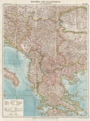
1915 map - Flemmings Kriegskarte von Serbien und Mazedonien mit den Nachbargebieten.tif 7,650 × 10,302; 41.61 MB
-
Carte de la Macédoine - btv1b53058363g.jpg 7,992 × 6,056; 6.87 MB
-
Села во Каршијак.png 1,812 × 1,694; 8.3 MB