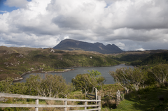
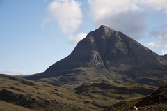
Category:Quinag
Jump to navigation
Jump to search
mountain in Highland, Scotland, UK  | |||||
| Upload media | |||||
| Instance of | |||||
|---|---|---|---|---|---|
| Location | Highland, Scottish Highlands, Scotland | ||||
 | |||||
Media in category "Quinag"
The following 62 files are in this category, out of 62 total.
-
2011 Schotland Inchnadamph en Quinag 2-06-2011 17-31-21.png 2,914 × 1,821; 7.62 MB
-
2011 Schotland Nedd met Loch Nedd en Quinag 30-05-2011 18-24-36.png 4,288 × 2,848; 18.31 MB
-
-
2011 Schotland Quinag vanaf A894 3-06-2011 11-17-45.png 2,914 × 1,821; 9.35 MB
-
2011 Schotland Sàil Gharb van het massief Quinag in Sutherland 30-05-2011 18-55-05.png 4,288 × 2,848; 16.47 MB
-
2011 Schotland Sàil Gharb vanaf A894 3-06-2011 11-40-22.png 2,914 × 1,821; 8.04 MB
-
2011 Sutherland Inchnadamph en Quinag 2-06-2011 17-31-21.jpg 2,914 × 1,821; 889 KB
-
2011 Sutherland Nedd met Loch Nedd en Quinag 30-05-2011 18-24-36.jpg 4,288 × 2,848; 1.92 MB
-
-
2011 Sutherland Quinag vanaf A894 3-06-2011 11-17-45.jpg 2,914 × 1,821; 1.43 MB
-
2011 Sutherland Sàil Gharb van het massief Quinag in Sutherland 30-05-2011 18-55-05.jpg 4,288 × 2,848; 1.43 MB
-
2011 Sutherland Sàil Gharb vanaf A894 3-06-2011 11-40-22.jpg 2,914 × 1,821; 926 KB
-
-
-
Assynt Landscape - geograph.org.uk - 155380.jpg 640 × 425; 215 KB
-
Beach on Loch Assynt - geograph.org.uk - 827059.jpg 640 × 480; 105 KB
-
Bealach a' Chornaidh, Quinag - geograph.org.uk - 61815.jpg 640 × 480; 43 KB
-
Car Park for Quinag - geograph.org.uk - 191930.jpg 640 × 384; 72 KB
-
Drifting cloud on Sail Garbh, Quinag - geograph.org.uk - 2431867.jpg 800 × 502; 48 KB
-
Footbridge on the Path up Quinag - geograph.org.uk - 189521.jpg 640 × 480; 103 KB
-
Frozen Lochain on Slopes of Breabag - geograph.org.uk - 179229.jpg 640 × 480; 136 KB
-
-
Loch Assynt - geograph.org.uk - 62817.jpg 640 × 480; 123 KB
-
Loch Bealach a' Bhuirich - geograph.org.uk - 212372.jpg 640 × 480; 186 KB
-
Loch Drumbeg - geograph.org.uk - 135982.jpg 640 × 480; 100 KB
-
-
Loch Nedd - geograph.org.uk - 2911.jpg 502 × 293; 106 KB
-
Looking at Quinag from the Road - geograph.org.uk - 120921.jpg 640 × 480; 92 KB
-
Looking back to Quinag from Kylesku - geograph.org.uk - 751324.jpg 640 × 425; 93 KB
-
Ordnance Survey One-Inch Sheet 13 Loch Inver & Loch Assynt, Published 1959.jpg 7,750 × 9,218; 10.28 MB
-
Ordnance Survey One-Inch Sheet 15 Lochinver & Loch Assynt, Published 1947.jpg 12,196 × 9,283; 11.15 MB
-
Paved ridge - geograph.org.uk - 83701.jpg 640 × 438; 112 KB
-
Quinag (7358766960).jpg 3,648 × 2,736; 4.58 MB
-
Quinag - geograph.org.uk - 564547.jpg 640 × 426; 41 KB
-
-
Quinag - Sail Gharbh from B869 - geograph.org.uk - 225126.jpg 640 × 480; 98 KB
-
Quinag - Sail Gorm from B869 - geograph.org.uk - 225127.jpg 640 × 480; 91 KB
-
Quinag and a lovely old Road Bridge - geograph.org.uk - 120917.jpg 640 × 480; 122 KB
-
Quinag from mountain Lochain - geograph.org.uk - 187827.jpg 640 × 480; 97 KB
-
Quinag from the east - geograph.org.uk - 9028.jpg 640 × 516; 267 KB
-
Quinag South Eastern Slopes - geograph.org.uk - 134688.jpg 640 × 480; 104 KB
-
Quinag's eastern corrie - geograph.org.uk - 783306.jpg 640 × 429; 86 KB
-
Quinag, Sutherland, Scotland, 14 April 2011 - Flickr - PhillipC (1).jpg 4,288 × 2,848; 2.22 MB
-
Quinag, Sutherland, Scotland, 14 April 2011 - Flickr - PhillipC (2).jpg 4,288 × 2,848; 2.02 MB
-
Quinag, Sutherland, Scotland, 14 April 2011 - Flickr - PhillipC (3).jpg 4,288 × 2,848; 2.01 MB
-
Quinag, Sutherland, Scotland, 14 April 2011 - Flickr - PhillipC.jpg 3,810 × 2,366; 1.44 MB
-
Quinag.JPG 1,280 × 865; 648 KB
-
Quinag.jpg 416 × 266; 29 KB
-
-
Sail Gorm, Quinag - geograph.org.uk - 87395.jpg 640 × 480; 81 KB
-
Slopes of Breabag. - geograph.org.uk - 44990.jpg 640 × 375; 47 KB
-
-
Suilven from Sron Gharbh, Cul Mor - geograph.org.uk - 1765415.jpg 800 × 533; 103 KB
-
Summit of Spidean Coinich on Quinag. - geograph.org.uk - 115313.jpg 640 × 422; 61 KB
-
Summit of the Corbett Glas Bheinn. - geograph.org.uk - 187318.jpg 640 × 480; 89 KB
-
The col west of Sail Gharbh - geograph.org.uk - 738286.jpg 1,000 × 668; 933 KB
-
Torridonian- Cambrian Unconformity - geograph.org.uk - 9023.jpg 640 × 447; 278 KB
-
View from the Kylesku Ferry - geograph.org.uk - 1651718.jpg 460 × 640; 54 KB
-
View south west from Quinag - geograph.org.uk - 738283.jpg 640 × 416; 79 KB
-
View towards Spidean Coinich - geograph.org.uk - 738269.jpg 1,000 × 673; 284 KB
-
View west from Sail na Slataich - geograph.org.uk - 189693.jpg 640 × 480; 69 KB
-
Quinag from Achnahaird - geograph.org.uk - 7285.jpg 640 × 314; 104 KB