Category:Colorado State Highway 7
Jump to navigation
Jump to search
 | number: | (seven) |
|---|---|---|
| State highways in Colorado: | 1 · 2 · 3 · 5 · 7 · 8 · 9 · 10 · 11 · 12 · 13 · 14 · 15 · 16 · 17 · 21 · 22 · 23 · 26 |
state highway in Colorado, United States   | |||||
| Upload media | |||||
| Instance of | |||||
|---|---|---|---|---|---|
| Location |
| ||||
| Transport network | |||||
| Connects with | |||||
| Owned by | |||||
| Maintained by | |||||
| Length |
| ||||
| Terminus | |||||
| Partially coincident with | |||||
| |||||
English: Media related to Colorado State Highway 7, an 81.64-mile (131.39 km) state highway in Colorado, United States, that connects U.S. Route 36 in Estes Park with the west Frontage Road for Interstate 76/U.S. Route 6 in Brighton.
Subcategories
This category has only the following subcategory.
Media in category "Colorado State Highway 7"
The following 9 files are in this category, out of 9 total.
-
Colorado 7.svg 601 × 601; 4 KB
-
Baseline Road (Colorado).JPG 5,522 × 3,706; 12.27 MB
-
CO SH 7 Allenspark 20090825.jpg 2,592 × 1,944; 4.67 MB
-
CO SH 7 Allenspark2 20090825.jpg 2,592 × 1,944; 3.91 MB
-
CO SH 7 St Vrain.jpg 3,577 × 2,683; 6.24 MB
-
Colorado State Highway 7 Map.svg 1,028 × 609; 1.01 MB
-
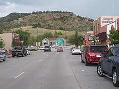
Downtown Lyons, CO IMG 5242.JPG 4,000 × 3,000; 2.85 MB
-
Lyons Intersection.jpg 2,272 × 1,375; 296 KB
-
North St. Vrain Creek Bridge.jpg 2,816 × 2,112; 2.34 MB