Category:Kasteel Rhijnestein
Jump to navigation
Jump to search
| Object location | | View all coordinates using: OpenStreetMap |
|---|
 | |||||
| Upload media | |||||
| Instance of | |||||
|---|---|---|---|---|---|
| Part of | |||||
| Location | Cothen, Utrecht, Netherlands | ||||
| Street address |
| ||||
| Heritage designation |
| ||||
 | |||||
|
This is a category about rijksmonumentcomplex number 507443
|
Hoofdgebouw:
|
This is a category about rijksmonument number 507442
|
Historische park- en tuinaanleg:
|
This is a category about rijksmonument number 507444
|
Poortgbouw met aangebouwd koetshuis:
|
This is a category about rijksmonument number 507445
|
Kasgebouw:
|
This is a category about rijksmonument number 507446
|
Koude bakken:
|
This is a category about rijksmonument number 507447
|
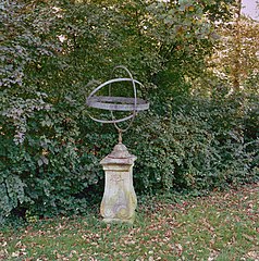
Zonnewijzer:
|
This is a category about rijksmonument number 507448
|
Toegangsbrug:
|
This is a category about rijksmonument number 507449
|
Brug:
|
This is a category about rijksmonument number 507450
|
Tuinmanswoning:
|
This is a category about rijksmonument number 507451
|
Hekwerk Rhijnestein:
|
This is a category about rijksmonument number 526272
|
| Address |
|
Subcategories
This category has the following 2 subcategories, out of 2 total.
K
- Kassen, Rhijnestein (10 F)
T
- Tuinmanswoning, Rhijnestein (2 F)
Media in category "Kasteel Rhijnestein"
The following 51 files are in this category, out of 51 total.
-
3945 Cothen, Netherlands - panoramio (5).jpg 2,048 × 1,148; 667 KB
-
3945 Cothen, Netherlands - panoramio (7).jpg 2,048 × 1,148; 756 KB
-
Achtergevel - Cothen - 20047253 - RCE.jpg 1,200 × 1,200; 439 KB
-
Cothen RM Brug over de Cother Grift.jpg 4,101 × 2,156; 4.81 MB
-
Cothen RM Brug over Kromme Rijn.jpg 4,200 × 2,877; 6.41 MB
-
Cothen RM Rhijnestein 1 Poortgebouw.jpg 3,810 × 3,049; 5.57 MB
-
Cothen RM Rhijnestein 2 Hoofdgebouw.jpg 4,322 × 3,445; 6.98 MB
-
Cothen RM Rhijnestein Hekwerk.jpg 4,301 × 2,707; 6.67 MB
-
Exterieur OVERZICHT - Cothen - 20308514 - RCE.jpg 1,187 × 1,200; 397 KB
-
Exterieur OVERZICHT GROENTENTUIN - Cothen - 20308518 - RCE.jpg 1,186 × 1,200; 431 KB
-
Exterieur OVERZICHT GROENTENTUIN - Cothen - 20308521 - RCE.jpg 1,189 × 1,200; 513 KB
-
Exterieur OVERZICHT GROENTENTUIN - Cothen - 20308522 - RCE.jpg 1,194 × 1,200; 514 KB
-
Exterieur OVERZICHT PARK - Cothen - 20308516 - RCE.jpg 1,189 × 1,200; 353 KB
-
Exterieur OVERZICHT PARK - Cothen - 20308517 - RCE.jpg 1,190 × 1,200; 468 KB
-
Exterieur OVERZICHT POORTGEBOUW - Cothen - 20308515 - RCE.jpg 1,199 × 1,200; 366 KB
-
Exterieur OVERZICHT TUIN - Cothen - 20308519 - RCE.jpg 1,198 × 1,200; 466 KB
-
Exterieur ZONNEWIJZER - Cothen - 20308523 - RCE.jpg 1,190 × 1,200; 516 KB
-
Hekwerk Rhijnestein..JPG 1,600 × 1,067; 1.14 MB
-
Houten zonwering voor op kas - Cothen - 20404851 - RCE.jpg 1,187 × 1,200; 435 KB
-
-
-
-
Inrijpoort - Cothen - 20047303 - RCE.jpg 1,200 × 806; 243 KB
-
Interieur gang - Cothen - 20047260 - RCE.jpg 1,192 × 1,200; 235 KB
-
Interieur hal begane grond - Cothen - 20047259 - RCE.jpg 1,197 × 1,200; 227 KB
-
Interieur kamer - Cothen - 20047261 - RCE.jpg 1,200 × 1,200; 269 KB
-
Interieur kamer - Cothen - 20047263 - RCE.jpg 1,200 × 1,200; 295 KB
-
Interieur kamer - Cothen - 20047264 - RCE.jpg 1,195 × 1,200; 265 KB
-
Interieur werkkamer - Cothen - 20047265 - RCE.jpg 1,188 × 1,200; 243 KB
-
Interieur woonkamer - Cothen - 20047262 - RCE.jpg 1,190 × 1,200; 326 KB
-
Kasteel Rhijnestein in Cothen.jpg 3,706 × 2,471; 7.59 MB
-
Kerk en kasteel vanuit het noorden - Cothen - 20047268 - RCE.jpg 1,200 × 962; 276 KB
-
Kerk en Kasteel vanuit het noorden - Cothen - 20047271 - RCE.jpg 1,200 × 962; 364 KB
-
Koepelkamer achtergevel - Cothen - 20047254 - RCE.jpg 1,188 × 1,200; 511 KB
-
Linker zijgevel - Cothen - 20047252 - RCE.jpg 1,185 × 1,200; 481 KB
-
Oud Rijnestein-Beijer.jpg 1,957 × 1,151; 658 KB
-
Overzicht poortgebouw, voorgevel en rechter zijgevel - Cothen - 20375469 - RCE.jpg 1,200 × 1,186; 254 KB
-
Overzicht poortgebouw, voorgevel en rechter zijgevel - Cothen - 20375471 - RCE.jpg 1,200 × 1,184; 307 KB
-
Overzicht van tuinmuur - Cothen - 20404852 - RCE.jpg 1,190 × 1,200; 428 KB
-
Poortgebouw - Cothen - 20047255 - RCE.jpg 1,192 × 1,200; 527 KB
-
Poortgebouw - Cothen - 20047256 - RCE.jpg 1,200 × 1,200; 554 KB
-
Poortgebouw - Cothen - 20047257 - RCE.jpg 1,190 × 1,200; 413 KB
-
Poortgebouw - Cothen - 20047258 - RCE.jpg 1,192 × 1,200; 383 KB
-
Rhijnestein poortgebouw.jpg 3,008 × 2,000; 1.89 MB
-
Rhijnestein.jpg 3,008 × 2,000; 6.02 MB
-
-
Voorgevel - Cothen - 20047251 - RCE.jpg 1,200 × 1,200; 405 KB
-
Wandfonteintje - Cothen - 20047266 - RCE.jpg 1,192 × 1,200; 215 KB
-
Wapen Rhijnestein - Buchelius.png 83 × 64; 13 KB
-
Wapen Rynestein uit Buchelius' Inscriptiones.jpg 306 × 328; 74 KB
-
Waterwagen - Cothen - 20404853 - RCE.jpg 1,199 × 1,200; 433 KB