File:Map Kingdom of Holland 1807-de.svg
Jump to navigation
Jump to search

Size of this PNG preview of this SVG file: 664 × 599 pixels. Other resolutions: 266 × 240 pixels | 532 × 480 pixels | 851 × 768 pixels | 1,135 × 1,024 pixels | 2,269 × 2,048 pixels | 677 × 611 pixels.
Original file (SVG file, nominally 677 × 611 pixels, file size: 159 KB)
Captions
Captions
Add a one-line explanation of what this file represents
Summary
[edit]| Description |
[]
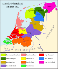
Deutsch: Königreich Holland im Jahr 1807. English: Map of the Kingdom of Holland in 1807 Español: Mapa del Reino de Holanda en 1807 Français : Carte du Royaume de Hollande en 1807 Magyar: A Holland Királyság 1807-ben Nederlands: Kaart van het Koninkrijk Holland Ελληνικά: Χάρτη του Βασιλείου της Ολλανδίας το 1807 |
||
| Date | |||
| Source |
This file was derived from: Map Kingdom of Holland 1807-nl.svg
|
||
| Author |
|
||
| Permission (Reusing this file) |
I, the copyright holder of this work, hereby publish it under the following licenses:
This file is licensed under the Creative Commons Attribution-Share Alike 4.0 International license.
You may select the license of your choice. |
||
| Other versions |
[]
|
||
| SVG development | This map was created with Adobe Illustrator. |


File history
Click on a date/time to view the file as it appeared at that time.
| Date/Time | Thumbnail | Dimensions | User | Comment | |
|---|---|---|---|---|---|
| current | 17:15, 28 March 2020 | 677 × 611 (159 KB) | Furfur (talk | contribs) | Kosmetik | |
| 01:30, 8 March 2020 | 677 × 611 (159 KB) | Furfur (talk | contribs) | == {{int:filedesc}} == {{Information |Description={{User:Medium69/Traduction}} {{de|1=Königreich Holland im Jahr 1807.}} {{nl|1=De Fransche tijd. Koninkrijk Holland 1807.}} {{en|1=Kingdom of Holland in 1807.}} |Source={{Derived from|Map Kingdom of Holland 1807-nl.svg}} |Date=2020-03-08 |Author=* Map Kingdom of Holland 1807-nl.svg: {{U|Joostik}} *this file: {{U|Furfur}} |Permission={{self|GFDL|cc-by-sa-4.0}} |Other versions= |Other fields={{Igen|A|+... |
You cannot overwrite this file.
File usage on Commons
The following 19 pages use this file:
- User:Magog the Ogre/Maps of conflicts/2020 March
- User:Magog the Ogre/Multilingual legend/2020 March 1-10
- User:Magog the Ogre/Multilingual legend/2020 March 21-31
- User:Paris 16/Recent uploads/2020 March 26-28
- User:Paris 16/Recent uploads/2020 March 8-10
- File:1807koninkrijk holland crop.png
- File:Map Kingdom of Holland 1807-da.svg
- File:Map Kingdom of Holland 1807-de.svg
- File:Map Kingdom of Holland 1807-el.svg
- File:Map Kingdom of Holland 1807-en.svg
- File:Map Kingdom of Holland 1807-es.svg
- File:Map Kingdom of Holland 1807-fr.svg
- File:Map Kingdom of Holland 1807-fy.svg
- File:Map Kingdom of Holland 1807-hu.svg
- File:Map Kingdom of Holland 1807-id.svg
- File:Map Kingdom of Holland 1807-lb.svg
- File:Map Kingdom of Holland 1807-nl.svg
- File:Map Kingdom of Holland 1807-tr.svg
- Template:Other versions/Map Kingdom of Holland 1807
File usage on other wikis
The following other wikis use this file:
- Usage on de.wikipedia.org
- Usage on fr.wikipedia.org