From Wikipedia, the free encyclopedia
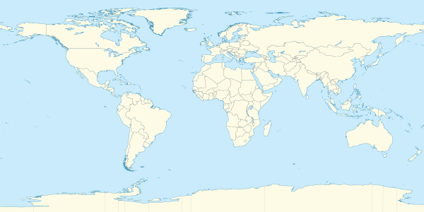
The 2nd parallel north is a circle of latitude that is 2 degrees north of the Earth's equatorial plane. It crosses the Atlantic Ocean, Africa, the Indian Ocean, Southeast Asia, the Pacific Ocean and South America.
Starting at the Prime Meridian and heading eastwards, the parallel 2° north passes through:
| Co-ordinates
|
Country, territory or sea
|
Notes
|
| 2°0′N 0°0′E / 2.000°N 0.000°E / 2.000; 0.000 (Prime Meridian)
|
Atlantic Ocean
|
Gulf of Guinea
|
| 2°0′N 9°47′E / 2.000°N 9.783°E / 2.000; 9.783 (Equatorial Guinea)
|
 Equatorial Guinea Equatorial Guinea
|
|
| 2°0′N 11°20′E / 2.000°N 11.333°E / 2.000; 11.333 (Gabon)
|
 Gabon Gabon
|
|
| 2°0′N 13°14′E / 2.000°N 13.233°E / 2.000; 13.233 (Republic of the Congo)
|
 Republic of the Congo Republic of the Congo
|
|
| 2°0′N 15°2′E / 2.000°N 15.033°E / 2.000; 15.033 (Cameroon)
|
 Cameroon Cameroon
|
For about 9km
|
| 2°0′N 15°7′E / 2.000°N 15.117°E / 2.000; 15.117 (Republic of the Congo)
|
Republic of the Congo
|
For about 17km
|
| 2°0′N 15°16′E / 2.000°N 15.267°E / 2.000; 15.267 (Cameroon)
|
Cameroon
|
|
| 2°0′N 16°3′E / 2.000°N 16.050°E / 2.000; 16.050 (Republic of the Congo)
|
Republic of the Congo
|
|
| 2°0′N 18°5′E / 2.000°N 18.083°E / 2.000; 18.083 (Democratic Republic of the Congo)
|
 Democratic Republic of the Congo Democratic Republic of the Congo
|
|
| 2°0′N 31°3′E / 2.000°N 31.050°E / 2.000; 31.050 (Lake Albert)
|
Lake Albert
|
The border with Uganda is in the lake at 2°0′N 31°14′E / 2.000°N 31.233°E / 2.000; 31.233 (Uganda)
|
| 2°0′N 31°24′E / 2.000°N 31.400°E / 2.000; 31.400 (Uganda)
|
 Uganda Uganda
|
|
| 2°0′N 34°59′E / 2.000°N 34.983°E / 2.000; 34.983 (Kenya)
|
 Kenya Kenya
|
|
| 2°0′N 41°0′E / 2.000°N 41.000°E / 2.000; 41.000 (Somalia)
|
 Somalia Somalia
|
|
| 2°0′N 45°17′E / 2.000°N 45.283°E / 2.000; 45.283 (Indian Ocean)
|
Indian Ocean
|
Passing just south of Mogadishu, Somalia
|
| 2°0′N 73°21′E / 2.000°N 73.350°E / 2.000; 73.350 (Maldives)
|
 Maldives Maldives
|
Laamu Atoll
|
| 2°0′N 73°33′E / 2.000°N 73.550°E / 2.000; 73.550 (Indian Ocean)
|
Indian Ocean
|
Passing just south of the Banyak Islands,  Indonesia Indonesia
|
| 2°0′N 98°27′E / 2.000°N 98.450°E / 2.000; 98.450 (Indonesia)
|
Indonesia
|
Islands of Sumatra and Rupat
|
| 2°0′N 101°46′E / 2.000°N 101.767°E / 2.000; 101.767 (Strait of Malacca)
|
Strait of Malacca
|
|
| 2°0′N 102°35′E / 2.000°N 102.583°E / 2.000; 102.583 (Malaysia)
|
 Malaysia Malaysia
|
Johor
|
| 2°0′N 104°6′E / 2.000°N 104.100°E / 2.000; 104.100 (South China Sea)
|
South China Sea
|
|
| 2°0′N 109°35′E / 2.000°N 109.583°E / 2.000; 109.583 (Indonesia)
|
Indonesia
|
Kalimantan, Borneo - for about 3km
|
| 2°0′N 109°37′E / 2.000°N 109.617°E / 2.000; 109.617 (Malaysia)
|
Malaysia
|
Sarawak, Borneo - for about 3km
|
| 2°0′N 109°39′E / 2.000°N 109.650°E / 2.000; 109.650 (South China Sea)
|
South China Sea
|
|
| 2°0′N 111°10′E / 2.000°N 111.167°E / 2.000; 111.167 (Malaysia)
|
Malaysia
|
Sarawak, Borneo
|
| 2°0′N 114°52′E / 2.000°N 114.867°E / 2.000; 114.867 (Indonesia)
|
Indonesia
|
Kalimantan, Borneo
|
| 2°0′N 117°50′E / 2.000°N 117.833°E / 2.000; 117.833 (Celebes Sea)
|
Celebes Sea
|
|
| 2°0′N 125°17′E / 2.000°N 125.283°E / 2.000; 125.283 (Molucca Sea)
|
Molucca Sea
|
Passing just south of the island of Biaro, Indonesia
|
| 2°0′N 127°46′E / 2.000°N 127.767°E / 2.000; 127.767 (Indonesia)
|
Indonesia
|
Island of Halmahera
|
| 2°0′N 127°57′E / 2.000°N 127.950°E / 2.000; 127.950 (Pacific Ocean)
|
Pacific Ocean
|
|
| 2°0′N 128°16′E / 2.000°N 128.267°E / 2.000; 128.267 (Indonesia)
|
Indonesia
|
Island of Morotai - for about 1km
|
| 2°0′N 128°17′E / 2.000°N 128.283°E / 2.000; 128.283 (Pacific Ocean)
|
Pacific Ocean
|
Passing just north of Abaiang atoll,  Kiribati Kiribati
|
| 2°0′N 173°15′E / 2.000°N 173.250°E / 2.000; 173.250 (Kiribati)
|
Kiribati
|
Marakei atoll
|
| 2°0′N 173°18′E / 2.000°N 173.300°E / 2.000; 173.300 (Pacific Ocean)
|
Pacific Ocean
|
|
| 2°0′N 157°47′W / 2.000°N 157.783°W / 2.000; -157.783 (Kiribati)
|
Kiribati
|
Kiritimati atoll
|
| 2°0′N 157°40′W / 2.000°N 157.667°W / 2.000; -157.667 (Pacific Ocean)
|
Pacific Ocean
|
|
| 2°0′N 78°39′W / 2.000°N 78.650°W / 2.000; -78.650 (Colombia)
|
 Colombia Colombia
|
|
| 2°0′N 68°13′W / 2.000°N 68.217°W / 2.000; -68.217 (Brazil)
|
 Brazil Brazil
|
Amazonas - for about 3km
|
| 2°0′N 68°11′W / 2.000°N 68.183°W / 2.000; -68.183 (Colombia)
|
Colombia
|
|
| 2°0′N 67°39′W / 2.000°N 67.650°W / 2.000; -67.650 (Brazil)
|
Brazil
|
Amazonas
|
| 2°0′N 67°18′W / 2.000°N 67.300°W / 2.000; -67.300 (Colombia)
|
Colombia
|
|
| 2°0′N 67°7′W / 2.000°N 67.117°W / 2.000; -67.117 (Venezuela)
|
 Venezuela Venezuela
|
|
| 2°0′N 63°46′W / 2.000°N 63.767°W / 2.000; -63.767 (Brazil)
|
Brazil
|
Amazonas
Roraima
|
| 2°0′N 59°44′W / 2.000°N 59.733°W / 2.000; -59.733 (Area disputed between Guyana and Venezuela)
|
Disputed area
|
Controlled by  Guyana, claimed by Venezuela Guyana, claimed by Venezuela
|
| 2°0′N 58°28′W / 2.000°N 58.467°W / 2.000; -58.467 (Guyana)
|
Guyana
|
|
| 2°0′N 57°55′W / 2.000°N 57.917°W / 2.000; -57.917 (Area disputed between Guyana and Suriname)
|
Disputed area
|
Controlled by Guyana, claimed by  Suriname Suriname
|
| 2°0′N 57°9′W / 2.000°N 57.150°W / 2.000; -57.150 (Brazil)
|
Brazil
|
Pará - for about 8km
|
| 2°0′N 57°4′W / 2.000°N 57.067°W / 2.000; -57.067 (Area disputed between Guyana and Suriname)
|
Disputed area
|
Controlled by Guyana, claimed by Suriname
|
| 2°0′N 56°38′W / 2.000°N 56.633°W / 2.000; -56.633 (Suriname)
|
Suriname
|
|
| 2°0′N 55°55′W / 2.000°N 55.917°W / 2.000; -55.917 (Brazil)
|
Brazil
|
Pará
Amapá - mainland and the island of Maracá
|
| 2°0′N 50°17′W / 2.000°N 50.283°W / 2.000; -50.283 (Atlantic Ocean)
|
Atlantic Ocean
|
|
See also