Corinne, Utah
Corinne, Utah | |
|---|---|
City | |
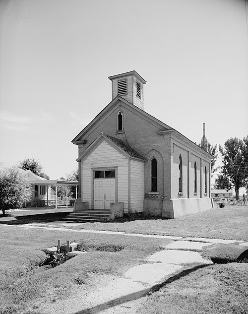 Corinne Methodist Episcopal Church | |
| Nickname: "Gateway to the Golden Spike" | |
 Location in Box Elder County and the state of Utah | |
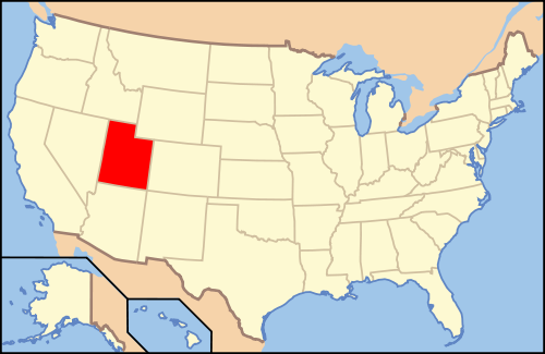 Location of Utah in the United States | |
| Coordinates: 41°32′55″N 112°6′50″W / 41.54861°N 112.11389°W | |
| Country | United States |
| State | Utah |
| County | Box Elder |
| Founded | 1869 |
| Incorporated | February 18, 1870 |
| Founded by | Mark A. Gilmore |
| Named for | Corinne Williamson |
| Area | |
| • Total | 3.84 sq mi (9.95 km2) |
| • Land | 3.78 sq mi (9.79 km2) |
| • Water | 0.06 sq mi (0.16 km2) |
| Elevation | 4,226 ft (1,288 m) |
| Population (2020) | |
| • Total | 809 |
| • Density | 210/sq mi (81/km2) |
| Time zone | UTC-7 (MST) |
| • Summer (DST) | UTC-6 (MDT) |
| ZIP code | 84307 |
| Area code | 435 |
| FIPS code | 49-15830[3] |
| GNIS feature ID | 1439951[2] |
| Website | corinnecity |

Corinne (/kəˈrɪn/ kə-RIN) is a city in Box Elder County, Utah, United States. The population was 809 at the 2020 census,[4] up from the 2010 figure of 685.[5]
Geography
Corinne is located in southeastern Box Elder County, on the west side of the Bear River. It is the last town on the river before it enters the marsh complexes leading to the Great Salt Lake. Brigham City is 6 miles (9.7 km) to the southeast, and Bear River City is 5 miles (8 km) to the north.
According to the United States Census Bureau, the city has a total area of 3.9 square miles (10.1 km2), of which 3.8 square miles (9.9 km2) is land and 0.08 square miles (0.2 km2), or 1.53%, is water.[5]
Demographics
| Census | Pop. | Note | %± |
|---|---|---|---|
| 1900 | 323 | — | |
| 1910 | 231 | −28.5% | |
| 1920 | 394 | 70.6% | |
| 1930 | 352 | −10.7% | |
| 1940 | 411 | 16.8% | |
| 1950 | 427 | 3.9% | |
| 1960 | 510 | 19.4% | |
| 1970 | 471 | −7.6% | |
| 1980 | 512 | 8.7% | |
| 1990 | 639 | 24.8% | |
| 2000 | 621 | −2.8% | |
| 2010 | 685 | 10.3% | |
| 2020 | 809 | 18.1% | |
| U.S. Decennial Census[6] | |||
As of the census[3] of 2000, there were 621 people, 190 households, and 159 families residing in the city. The population density was 173.4 people per square mile (67.0/km2). There were 208 housing units at an average density of 58.1 per square mile (22.4/km2). The racial makeup of the city was 89.86% White, 0.48% Native American, 2.42% Asian, 0.32% Pacific Islander, 5.96% from other races, and 0.97% from two or more races. Hispanic or Latino of any race were 8.21% of the population.
There were 190 households, of which 46.3% had children under 18 living with them, 72.6% were married couples living together, 6.3% had a female householder with no husband present, and 16.3% were non-families. 15.8% of all households were made up of individuals, and 7.4% had someone living alone who was 65 years of age or older. The average household size was 3.27, and the average family size was 3.64.
The 2000 population distribution was 34.3% under 18, 10.3% from 18 to 24, 26.2% from 25 to 44, 19.8% from 45 to 64, and 9.3% of 65 or more years of age. The median age was 31 years. For every 100 females, there were 101.6 males. For every 100 females aged 18 and over, there were 104.0 males.
The median income for a household in the city was $42,125, and the median income for a family was $45,208. Males had a median income of $32,344 versus $19,205 for females. The per capita income for the city was $16,053. About 6.2% of families and 8.5% of the population were below the poverty line, including 10.9% of those under age 18 and 12.9% of those aged 65 or over.
Schools
For several years an elementary school operated in Corinne, but it was closed, and its students merged with Century Elementary School in Bear River City.
See also
References
- ^ "2019 U.S. Gazetteer Files". United States Census Bureau. Retrieved August 7, 2020.
- ^ a b U.S. Geological Survey Geographic Names Information System: Corinne
- ^ a b "U.S. Census website". United States Census Bureau. Retrieved January 31, 2008.
- ^ "2020 Census Redistricting Data: Corinne city, Utah". Census Data Explorer. United States Census Bureau. September 16, 2021. Retrieved February 3, 2023.
- ^ a b "Geographic Identifiers: 2010 Demographic Profile Data (G001): Corinne city, Utah". U.S. Census Bureau, American Factfinder. Archived from the original on February 12, 2020. Retrieved April 23, 2014.
- ^ "Census of Population and Housing". Census.gov. Retrieved June 4, 2015.
External links
Places adjacent to Corinne, Utah | |
|---|---|
Municipalities and communities of Box Elder County, Utah, United States | ||
|---|---|---|
| Cities |  | |
| Towns | ||
| CDPs | ||
| Unincorporated areas | ||
| Ghost towns | ||
| Indian reservation | ||
| International | |
|---|---|
| National | |