Enewetak Atoll
 | |
| Geography | |
|---|---|
| Location | North Pacific |
| Coordinates | 11°30′N 162°20′E / 11.500°N 162.333°E |
| Archipelago | Ralik |
| Highest elevation | 5 m (16 ft) |
| Administration | |
| Demographics | |
| Population | 853 |

Enewetak Atoll (or Eniwetok Atoll, sometimes also spelled Eniewetok; Marshallese: Ānewetak, [æ‿ʲ, æ‿ˠ, ɛ̯ɑ‿ˠ, æ‿ʷ, ɛ̯ɒ‿ʷ], or Āne-wātak, [æ‿ʲ, æ‿ˠ, ɛ̯ɑ‿ˠ, æ‿ʷ, ɛ̯ɒ‿ʷ][1]) is a large coral atoll of 40 islands in the Pacific Ocean, and forms a legislative district of the Ralik Chain of the Marshall Islands. Its land area totals less than 5.85 square kilometres (2.26 sq mi), surrounding a deep central lagoon, 80 kilometres (50 mi) in circumference. It is the second westernmost atoll of the Ralik Chain, and is located 305 kilometres (190 mi) west from Bikini Atoll. The U.S. government referred to the atoll as "Eniwetok" until 1974, when it changed its official spelling to "Enewetak" (along with many other Marshall Islands place names) to more properly reflect their proper pronunciation by the Marshall Islanders.[2]
History
Humans have inhabited the atoll for at least 2,000 years.[3] The first European visitor to Enewetak, Spanish explorer Alvaro de Saavedra, arrived in 1527.[citation needed] In 1794 sailors aboard the British merchant sloop Walpole called the islands "Brown's Range" (thus the Japanese name "Brown Atoll"). It was visited by about a dozen ships before the establishment of the German colony of the Marshall Islands in 1885. Along with the rest of the Marshalls, Enewetak was captured by the Imperial Japanese Navy in 1914 during World War I and mandated to the Empire of Japan by the League of Nations in 1920. The Japanese administered the island under the South Pacific Mandate, but mostly left local affairs in hands of traditional local leaders until the start of World War II.
In November 1942, the Japanese built an airfield on Engebi Island; because they used it only for refueling planes between Truk and islands to the east, no flying personnel were stationed there and the island had only token defenses. When the Gilberts fell to the United States, the Imperial Japanese Army assigned the 1st Amphibious Brigade, a unit formed from the 3rd Independent Garrison unit previously stationed in Manchukuo, to defend the atoll. The 1st Amphibious arrived on January 4, 1944. Of the 3,940 men in the brigade, 2,586 were left to defend Eniwetok Atoll, supplemented by aviation personnel, civilian employees, and laborers, but were unable to finish fortifying the island before the American assault. During the Battle of Eniwetok in February 1944, the United states captured Enewetak in a five-day amphibious operation, with major combat on Engebi Islet, the most important Japanese installation on the atoll. Combat also occurred on the main islet of Enewetak itself and on Parry Island, site of a Japanese seaplane base.
Following its capture, the anchorage at Enewetak became a major forward naval base for the U.S. Navy. The daily average of ships present during the first half of July[when?] was 488; during the second half of July the daily average number of ships at Enewetak was 283. By the end of July Commodore Worrall R. Carter flew to Pearl Harbor to participate in planning the move of Servron 10 facilities from Eniwetok to Ulithi.
Following the end of World War II, Enewetak came under the control of the United States as part of the Trust Territory of the Pacific Islands until the independence of the Marshall Islands in 1986. During its tenure, the United States evacuated the local residents many times, often involuntarily,[citation needed] and the atoll was used for nuclear testing as part of the Pacific Proving Grounds. Before testing commenced, the U.S. exhumed the bodies of United States servicemen killed in the Battle of Enewetak and buried there and returned them to the United States to be re-buried by their families. Forty-three nuclear tests were fired at Enewetak from 1948 to 1958.[citation needed] The first hydrogen bomb test, code-named Ivy Mike, occurred in late 1952 as part of Operation Ivy; it vaporized the islet of Elugelab. This test included the use of B-17 Flying Fortress drones to fly through the radioactive cloud for the purpose of testing onboard samples. B-17 mother ships controlled the drones while flying within visual distance of them. In all 16 to 20 B-17s took part in this operation, of which half were controlling aircraft and half were drones. For examination of the explosion clouds of the nuclear bombs in 1957/58 several rockets (mostly from rockoons) were launched.

Local residents were permitted to return in the 1970s, and on May 15, 1977 the United States government directed the military to decontaminate the islands. As part of the decontamination process the military mixed the contaminated soil and debris from the various islands with Portland cement and buried it in one of the blast craters. The crater was at the northern end of Runit Island 11°33′8.84″N 162°20′50.22″E / 11.5524556°N 162.3472833°E, on the eastern side of the atoll. This continued until the crater became a spherical mound 25 feet (7.6 m) high. The crater was then covered with an 18-inch (460 mm) thick concrete cap, dubbed "Cactus Dome".[4] U.S. Army, Navy and Air Forces services participated in this effort, with DOE monitoring. The United States government declared the islands safe for habitation in 1980.
In 2000, the Marshall Islands Nuclear Claims Tribunal awarded in excess of $340 million to the people of Enewetak for loss of use, hardship, medical difficulties and further nuclear cleanup. This award did not include the approximately $6 million annually budgeted by the United States for education and health programs in the Marshall Islands.[citation needed]
List of nuclear tests at Enewetak
Operation Sandstone
| Bomb | Date | Location | Yield |
|---|---|---|---|
| X-Ray | 18:17 am 14. April 1948 (GMT) | Engebi Islet | 37 kT |
| Yoke | 18:09 30. April 1948 (GMT) | Aomon Islet | 49 kT |
| Zebra | 18:04 14. May 1948 (GMT) | Runit Islet | 18 kT |
Operation Greenhouse
| Bomb | Date | Location | Yield |
|---|---|---|---|
| Dog | 18:34 7 April 1951 (GMT) | Runit Islet | 81 kT |
| Easy | 18:26 20 April 1951 (GMT) | Enjebi Islet | 47 kT |
| George | 21:30 8 May 1951 (GMT) | Eberiru Islet | 225 kT |
| Item | 18:17 24 May 1951 (GMT) | Enjebi Islet | 45.5 kT |
Operation Ivy
| Bomb | Date | Location | Yield |
|---|---|---|---|
| Mike | 19:14:59.4 31. October 1952 (GMT) | Elugelab Islet | 10.4 MT |
| King | 23:30 15 November 1952 (GMT) | Runit Islet | 500 kT |
Operation Redwing
| Bomb | Date | Location | Yield |
|---|---|---|---|
| Lacrosse | 18:25 4 May 1956 (GMT) | Runit Islet | 40 kT |
| Yuma | 19:56 27 May 1956 (GMT) | Aomon Islet | 0.19 kT |
| Erie | 18:15 30 May 1956 (GMT) | Runit Islet | 14.9 kT |
| Seminole | 00:55 6 June 1956 (GMT) | Bogon Islet | 13.7 kT |
| Blackfoot | 18:26 11 June 1956 (GMT) | Runit Islet | 8 kT |
| Kickapoo | 23:26 13 June 1956 (GMT) | Aomon Islet | 1.49 kT |
| Osage | 01:14 16 June 1956 (GMT) | Runit Islet | 1.7 kT |
| Inca | 21:26 21 June 1956 (GMT) | Rujoru Islet | 15.2 kT |
| Mohawk | 18:06 2 July 1956 (GMT) | Eberiru Islet | 360 kT |
| Apache | 18:06 8 July 1956 (GMT) | Crater from Ivy Mike | 1.85 MT |
| Huron | 18:12 21 July 1956 (GMT) | Off Flora Islet | 250 kT |
Operation Hardtack I
| Bomb | Date | Location | Yield |
|---|---|---|---|
| Yucca | 18:15 28 April 1958 (GMT) | 157 KM N of Eniwetok-Atoll | 1.7 kT |
| Cactus | 18:15 5 May 1958 (GMT) | Runit Islet | 18 kT |
| Fir | 17:50 11 May 1958 (GMT) | Eniwetok-Atoll | 1360 kT |
| Butternut | 18:15 11 May 1958 (GMT) | Eniwetok-Atoll | 81 kT |
| Koa | 18:30 12 May 1958 (GMT) | Eniwetok-Atoll | 1370 kT |
| Wahoo | 01:30 16 May 1958 (GMT) | Eniwetok-Atoll | 9 kT |
| Holly | 18:30 20 May 1958 (GMT) | Eniwetok-Atoll | 5.9 kT |
| Nutmeg | 21:20 21 May 1958 (GMT) | Bikini-Atoll | 25.1 kT |
| Yellowwood | 2:00 26 May 1958 (GMT) | Eniwetok Lagoon | 330 kT |
| Magnolia | 18:00 26 May 1958 (GMT) | Eniwetok-Atoll | 57 kT |
| Tobacco | 02:50 30 May 1958 (GMT) | Eniwetok-Atoll | 11.6 kT |
| Sycamore | 03:00 31 May 1958 (GMT) | Bikini-Atoll 3,5 m underwater | 92 kT (5000 kT) |
| Rose | 18:45 2 June 1958 (GMT) | Eniwetok-Atoll | 15 kT |
| Umbrella | 23:15 8 June 1958 (GMT) | Eniwetok Lagoon | 8 kT |
| Walnut | 18:30 14 June 1958 (GMT) | Eniwetok-Atoll | 1.45 kT |
| Linden | 03:00 18 June 1958 (GMT) | Eniwetok-Atoll | 11 kT |
| Elder | 18:30 27 June 1958 (GMT) | Eniwetok-Atoll | 880 kT |
| Oak | 19:30 28 June 1958 (GMT) | Eniwetok Lagoon | 8.9 MT |
| Sequoia | 18:30 1 July 1958 (GMT) | Eniwetok-Atoll | 5.2 kT |
| Dogwood | 18:30 5 July 1958 (GMT) | Eniwetok-Atoll | 397 kT |
| Scaevola | 04:00 14 July 1958 (GMT) | Eniwetok-Atoll | 0 kT |
| Pisonia | 23:00 17 July 1958 (GMT) | Eniwetok-Atoll | 255 kT |
| Olive | 18:15 22 July 1958 (GMT) | Eniwetok-Atoll | 202 kT |
| Pine | 20:30 26 July 1958 (GMT) | Eniwetok-Atoll | 2000 kT |
| Quince | 02:15 6 August 1958 (GMT) | Eniwetok-Atoll | 0 kT |
| Fig | 04:00 18 August 1958 (GMT) | Eniwetok-Atoll | 0.02 kT |
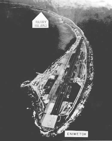
Enewetak Airfield
An 6800-foot airstrip was built on the atoll in February–March 1944 by U.S. forces for bomber missions in the area. It was later named for Lieutenant John H. Stickell. The airstrip is now abandoned and surface partially covered by sand.
Gallery
-
Battle of Eniwetok
-
Operation Sandstone
-
Ivy Mike test, October 31, 1952
-
Operation Greenhouse test
-
Ivy King test, November 1952
-
Red-wing Seminole test
-
Red-wing Seminole test
-
Hardtack Umbrella test
-
Video clips of three test nuclear explosions in Eniwetok, Marshall Islands


Notes
This article incorporates public domain material from the Air Force Historical Research Agency
- ^ Marshallese-English Dictionary – Place Name Index
- ^ Barton C. Hacker, Elements of controversy : the Atomic Energy Commission and radiation safety in nuclear weapons testing, 1947–1974 (Berkeley, CA: University of California Press, 1994): p. 14.
- ^ http://www.archive.org/details/naturalhistoryof02deva p. 333
- ^ http://atlasobscura.com/place/cactus-dome
External links
- Marshall Islands site
- Entry at Oceandots.com
- Annotated bibliography for Eniwetok Atoll from the Alsos Digital Library for Nuclear Issues
- Information on legal judgements to the people of Enewetak
- Nursing a nuclear test hangover (www.watoday.com.au report on Runit Dome, August 18, 2008)
Marshall Islands articles | |||||||
|---|---|---|---|---|---|---|---|
| History | |||||||
| Geography |
| ||||||
| Politics |
| ||||||
| Economy | |||||||
| Culture |
| ||||||
| |||||||