Alps: Difference between revisions
Tag: section blanking |
Undid revision 318675518 by 84.92.224.90 (talk) |
||
| Line 28: | Line 28: | ||
{{main|Geography of the Alps}} |
{{main|Geography of the Alps}} |
||
===Subdivisions=== |
|||
sex!!11 |
|||
[[Image:Alps in the Chamonix Valley, near the Mer de Glace.jpg|thumb|right|The west face of the [[Aiguille du Dru|Petit Dru]] above the [[Chamonix]] valley near the [[Mer de Glace]].]] |
|||
[[Image:Alpenrelief 02.jpg|thumb|The Alps with international borders marked]] |
|||
[[Image:Grossglockner from SW.jpg|thumb|right|The [[Großglockner]], south of Salzburg, Austria]] |
|||
The Alps are generally divided into the [[Western Alps]] and the [[Eastern Alps]]. The division is along the line between [[Lake Constance]] and [[Lake Como]], following the rivers [[Rhine]], [[Liro (Sondrio)|Liro]] and [[Mera River|Mera]]. The Western Alps are higher, but their central chain is shorter and curved; they are located in [[Italy]], [[France]] and [[Switzerland]]. The Eastern Alps (main [[ridge]] system elongated and broad) belong to [[Italy]], [[Austria]], [[Switzerland]], [[Germany]], [[Liechtenstein]] and [[Slovenia]]. |
|||
The highest peak of the Western Alps is [[Mont Blanc]], at {{convert|4808|m|ft|0}}. The highest peak of the Eastern Alps is [[Piz Bernina]], at {{convert|4049|m|ft|0}}. The [[Dufourspitze]], {{convert|4634|m|ft|0}} and [[Ortler]],<ref>Excluding the [[Piz Zupò]] and [[Piz Roseg]] located in the Bernina range, close to Piz Bernina.</ref> {{convert|3905|m|ft|0}}, are the second-highest, respectively. |
|||
The '''Eastern Alps''' are commonly subdivided according to the different [[lithology]] (rock composition) of the more central parts of the Alps and the groups at its northern and southern fringes: |
|||
* [[Northern Limestone Alps]] (from the [[Wienerwald]] to [[Bregenzerwald]]), including the [[Flyschzone]]; peaks up to {{convert|3000|m|ft|-1}} |
|||
* [[Central Eastern Alps]] (Austria, Switzerland); peaks up to {{convert|4050|m|ft|-1}} |
|||
* [[Southern Limestone Alps]] |
|||
The border between the Central Alps and the Southern Limestone Alps is the [[Periadriatic Seam]]. The Northern Limestone Alps are separated from the Central Eastern Alps by the [[Greywacke zone]]. |
|||
The '''Western Alps''' are commonly subdivided with respect to [[geography]]: |
|||
*[[Ligurian Alps]] |
|||
*[[Maritime Alps]] |
|||
*[[Cottian Alps]] |
|||
*[[Dauphiné Alps]] |
|||
*[[Graian Alps]] |
|||
*[[Chablais Alps]] |
|||
*[[Pennine Alps]] |
|||
*[[Bernese Alps]] |
|||
*[[Lepontine Alps]] |
|||
*[[Glarus Alps]] |
|||
*[[Appenzell Alps]]. |
|||
Series of lower mountain ranges run parallel to the main chain of the Alps, including the [[French Prealps]]. (See [[Geography of the Alps|Alpine geography]].) |
|||
The geologic subdivision is different and makes no difference between the Western and Eastern Alps: the [[Helvetic nappes|Helveticum]] in the north, the [[Penninic nappes|Penninicum]] and [[Austroalpine nappes|Austroalpine system]] in the center and, south of the Periadriatic Seam, the [[Southern Alps (geology)|Southern Alpine system]] and parts of the [[Dinarides]] (see [[Geology of the Alps|Alpine geology]]). Geographically, the [[Jura Mountains]] do not belong to the Alps; geologically, however, they do. |
|||
===Main chain=== |
===Main chain=== |
||
Revision as of 15:43, 8 October 2009
Template:Geobox The Alps (German: Alpen; Italian: Alpi; French: Alpes; Occitan: Aups/Alps; Romansh: Alps; Slovene: Alpe) are one of the great mountain range systems of Europe, stretching from Austria and Slovenia in the east; through Italy, Switzerland, Liechtenstein and Germany; to France in the west.
The highest mountain in the Alps is Mont Blanc, at 4,808 metres (15,774 ft), on the Italian–French border. All the main peaks of the Alps can be found in the list of mountains of the Alps and list of Alpine peaks by prominence.
The English name "Alps" was taken via French from Latin Alpes, which may be ultimately cognate with Latin albus ("white"). The German Albe, Alpe or Alp (f., Old High German alpâ, plural alpûn) in the singular means "alpine pasture", and only in the plural may also refer to the mountain range as a whole.[1]
Geography
Subdivisions


The Alps are generally divided into the Western Alps and the Eastern Alps. The division is along the line between Lake Constance and Lake Como, following the rivers Rhine, Liro and Mera. The Western Alps are higher, but their central chain is shorter and curved; they are located in Italy, France and Switzerland. The Eastern Alps (main ridge system elongated and broad) belong to Italy, Austria, Switzerland, Germany, Liechtenstein and Slovenia. The highest peak of the Western Alps is Mont Blanc, at 4,808 metres (15,774 ft). The highest peak of the Eastern Alps is Piz Bernina, at 4,049 metres (13,284 ft). The Dufourspitze, 4,634 metres (15,203 ft) and Ortler,[2] 3,905 metres (12,812 ft), are the second-highest, respectively.
The Eastern Alps are commonly subdivided according to the different lithology (rock composition) of the more central parts of the Alps and the groups at its northern and southern fringes:
- Northern Limestone Alps (from the Wienerwald to Bregenzerwald), including the Flyschzone; peaks up to 3,000 metres (9,840 ft)
- Central Eastern Alps (Austria, Switzerland); peaks up to 4,050 metres (13,290 ft)
- Southern Limestone Alps
The border between the Central Alps and the Southern Limestone Alps is the Periadriatic Seam. The Northern Limestone Alps are separated from the Central Eastern Alps by the Greywacke zone.
The Western Alps are commonly subdivided with respect to geography:
- Ligurian Alps
- Maritime Alps
- Cottian Alps
- Dauphiné Alps
- Graian Alps
- Chablais Alps
- Pennine Alps
- Bernese Alps
- Lepontine Alps
- Glarus Alps
- Appenzell Alps.
Series of lower mountain ranges run parallel to the main chain of the Alps, including the French Prealps. (See Alpine geography.)
The geologic subdivision is different and makes no difference between the Western and Eastern Alps: the Helveticum in the north, the Penninicum and Austroalpine system in the center and, south of the Periadriatic Seam, the Southern Alpine system and parts of the Dinarides (see Alpine geology). Geographically, the Jura Mountains do not belong to the Alps; geologically, however, they do.
Main chain

The main chain of the Alps follows the watershed from the Mediterranean Sea to the Wienerwald, passing over many of the highest and most famous peaks in the Alps. From the Colle di Cadibona to Col de Tende it runs westwards, before turning to the northwest and then, near the Colle della Maddalena, to the north. Upon reaching the Swiss border, the line of the main chain heads approximately east-northeast, a heading it follows until its end near Vienna.
sex is good!!!!!!!!!!!1
Four-thousanders
The Union Internationale des Associations d'Alpinisme (UIAA) has defined a list of 82 "official" Alpine 4,000-metre (13,123 ft) summits. The list contains many subpeaks with little prominence, but important for mountaineering. Here are the twelve four-thousanders with at least 1 km prominence.
| Name | Height (metres, feet) | Range |
|---|---|---|
| Mont Blanc | 4,810 m (15,781 ft) | Graian Alps |
| Monte Rosa | 4,634 m (15,203 ft) | Pennine Alps |
| Dom | 4,545 m (14,911 ft) | Pennine Alps |
| Weisshorn | 4,505 m (14,780 ft) | Pennine Alps |
| Matterhorn | 4,478 m (14,692 ft) | Pennine Alps |
| Grand Combin | 4,314 m (14,154 ft) | Pennine Alps |
| Finsteraarhorn | 4,273 m (14,019 ft) | Bernese Alps |
| Aletschhorn | 4,192 m (13,753 ft) | Bernese Alps |
| Barre des Écrins | 4,102 m (13,458 ft) | Dauphiné Alps |
| Gran Paradiso | 4,061 m (13,323 ft) | Graian Alps |
| Piz Bernina | 4,049 m (13,284 ft) | Bernina Range |
| Weissmies | 4,023 m (13,199 ft) | Pennine Alps |
Karl Blodig was the first person to climb all the major four-thousand metre peaks, circa 1900.
Geology and orogeny
The Alps form a part of a Tertiary orogenic belt of mountain chains, called the Alpide belt, that stretches through southern Europe and Asia from the Atlantic all the way to the Himalayas. This belt of mountain chains was formed during the Alpine orogeny. A gap in these mountain chains in central Europe separates the Alps from the Carpathians off to the east. Orogeny took place continuously and tectonic subsidence is to blame for the gaps in between.
The Alps arose as a result of the collision of the African and European tectonic plates, in which the western part of the Tethys Ocean, which was formerly in between these continents, disappeared. Enormous stress was exerted on sediments of the Tethys Ocean basin and its Mesozoic and early Cenozoic strata were pushed against the stable Eurasian landmass by the northward-moving African landmass. Most of this occurred during the Oligocene and Miocene epochs. The pressure formed great recumbent folds, or nappes, that rose out of what had become the Tethys Sea and pushed northward, often breaking and sliding one over the other to form gigantic thrust faults. Crystalline basement rocks, which are exposed in the higher central regions, are the rocks forming Mont Blanc, the Matterhorn, and high peaks in the Pennine Alps and Hohe Tauern.
The formation of the Mediterranean Sea is a more recent development, and does not mark the northern shore of the African landmass.
Climate

The Alps are a classic example of what happens when a temperate area at lower altitude gives way to higher-elevation terrain. Elevations around the world which have cold climates similar to those found in polar areas have been called Alpine. A rise from sea level into the upper regions of the atmosphere causes the temperature to decrease (see adiabatic lapse rate). The effect of mountain chains on prevailing winds is to carry warm air belonging to the lower region into an upper zone, where it expands in volume at the cost of a proportionate loss of heat, often accompanied by the precipitation in the form of snow or rain.
Political and cultural history
Little is known of the early dwellers of the Alps, save from scanty accounts preserved by Roman and Greek historians and geographers. A few details have come down to us of the conquest of many of the Alpine tribes by Augustus. Also, recent research into Mitochondrial DNA indicates that MtDNA Haplogroup K very likely originated in or near the southeastern Alps approximately 12–15,000 years ago.
During the Second Punic War in 218 BC, the Carthaginian general Hannibal successfully crossed the Alps along with an army numbering 38,000 infantry, 8,000 cavalry, and 37 war elephants.[3] This was one of the most celebrated achievements of any military force in ancient warfare.[3]
Much of the Alpine region was gradually settled by Germanic tribes (Langobards, Alemanni, Bavarii) from the 6th to the 13th centuries, the latest expansion corresponding to the Walser migrations.
Not until after the final breakup of the Carolingian Empire in the 10th and 11th century can the local history of the Alps be traced out.
Travel and tourism
The Alps are popular both in summer and in winter as a destination for sightseeing and sports. Winter sports (Alpine and Nordic skiing, snowboarding, tobogganing, snowshoeing, ski tours) can be practised in most regions from December to April. In summer, the Alps are popular with hikers, mountain bikers, paragliders, mountaineers, while many alpine lakes attract swimmers, sailors and surfers. The lower regions and larger towns of the Alps are well served by motorways and main roads, but higher passes and by-roads can be treacherous even in summer. Many passes are closed in winter. A multitude of airports around the Alps (and some within), as well as long-distance rail links from all neighbouring countries, afford large numbers of travellers easy access from abroad. The Alps typically see more than 100 million visitors a year.
Flora
A natural vegetation limit with altitude is given by the presence of the chief deciduous trees—oak, beech, ash and sycamore maple. These do not reach exactly to the same elevation, nor are they often found growing together; but their upper limit corresponds accurately enough to the change from a temperate to a colder climate that is further proved by a change in the presence of wild herbaceous vegetation. This limit usually lies about 1,200 metres (3,940 ft) above the sea on the north side of the Alps, but on the southern slopes it often rises to 1,500 metres (4,920 ft), sometimes even to 1,700 metres (5,580 ft).
This region is not always marked by the presence of the characteristic trees. Human interference has nearly exterminated them in many areas, and, except for the beech forests of the Austrian Alps, forests of deciduous trees are rarely found. In many districts where such woods once existed, they have been replaced by the Scots pine and Norway spruce, which are less sensitive to the ravages of goats who are the worst enemies of such trees.
Above the forestry, there is often a band of short pine trees (Pinus mugo), which is in turn superseded by dwarf shrubs, typically Rhododendron ferrugineum (on acid soils) or Rhododendron hirsutum (on alkaline soils). Above this is the alpine meadow, and even higher, the vegetation becomes more and more sparse. At these higher altitudes, the plants tend to form isolated cushions. In the Alps, several species of flowering plants have been recorded above 4,000 metres (13,120 ft), including Ranunculus glacialis, Androsace alpina and Saxifraga biflora.
-
mountain pine
(Pinus mugo) -
rusty-leaved Alpenrose
(Rhododendron ferrugineum) -
Edelweiss
(Leontopodium alpinum) -
stemless gentian
(Gentiana acaulis) -
Alpine dwarf orchid
(Chamorchis alpina) -
Alpine pasque-flower
(Pulsatilla alpina) -
Alpine rock-jasmine (Androsace alpina)
-
glacier buttercup
(Ranunculus glacialis)


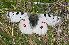
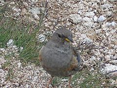
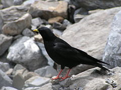
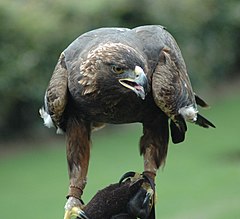
Fauna
Species common to the Alps.


See also
Definitions from Wiktionary
Media from Commons
News from Wikinews
Quotations from Wikiquote
Texts from Wikisource
Textbooks from Wikibooks
Resources from Wikiversity
References
- ^ Jacob Grimm, Deutsches Wörterbuch, s.v. "Albe", "Alpe". The original meaning being "white" (in reference to the permanent snow. The term may be common Italo-Celtic, since Celtic languages also have terms for high mountains derived from alp. German Alpen is the accusative in origin, but was made the nominative in Modern German, whence also Alm.
- ^ Excluding the Piz Zupò and Piz Roseg located in the Bernina range, close to Piz Bernina.
- ^ a b Lancel, Serge, Hannibal, p. 71
External links
- Satellite photo of the Alps, taken on 31 August 2005 by MODIS aboard Terra
- Artistic landscapes of the Western Alps
- Template:It Images from the Alps Many images from Alps, landscape, flowers and wildlife.
- 360° Panoramic Views in Alps
- A virtual visit of Western Alps with 360° panoramic images
- A online picture collection of the Alps More than 2000 pictures of climbing, backcountry skiing, hiking, landscape
- Photos - Italian Alps - Santa Catarina
- Transclusion error: {{En}} is only for use in File namespace. Use {{lang-en}} or {{in lang|en}} instead. Photos of alpin swiss landscapes and wildlife (Valais)
- Discover wildlife of the Alps with 60 representative photos
| Branches |
| ||||||||
|---|---|---|---|---|---|---|---|---|---|
| Techniques and tools |
| ||||||||
| Institutions | |||||||||
| Education | |||||||||
 | ||