Zacharia, Cyprus
Zacharia
Ζαχαριά | |
|---|---|
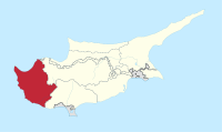
 Zacharia Location in Cyprus | |
| Coordinates: 34°58′55″N 32°31′55″E / 34.98194°N 32.53194°E | |
| Country | |
| District | Paphos District |
| Population (2001)[1] | |
| • Total | 0 |
| Time zone | UTC+2 (EET) |
| • Summer (DST) | UTC+3 (EEST) |
| Postal code | 6317 |
Zacharia (Greek: Ζαχαριά, Turkish: Tatlıca) is an abandoned Turkish Cypriot village in the Paphos District of Cyprus, located 4 km south of Lysos.
References
[edit]This Cyprus location article is a stub. You can help Wikipedia by expanding it. |