Whitsunday Islands
 | |
| Geography | |
|---|---|
| Location | Queensland, Australia |
| Coordinates | 20°18′S 148°56′E / 20.300°S 148.933°E |
| Administration | |
Australia | |


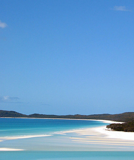
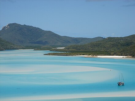
The Whitsunday Islands are a collection of continental islands of various sizes off the central coast of Queensland, Australia, situated between just south of Bowen and to the north of Mackay, some 900 kilometres (560 mi) north of Brisbane. The island group is centred on Whitsunday Island, while the group's commercial centre is Hamilton Island.
Naming
The term is a mis-nomer, based as it is on Captain Cook’s naming of what is now known as the Whitsunday Passage (in Cook’s Journal, Whitsunday’s Passage) in the belief that the passage was discovered on Whitsunday whereas, because of an error in time-keeping, it was actually Whit-Monday.[citation needed]
Contention has existed as to exactly what islands are within the informally-named Whitsunday Islands, in particular as to the southern extremity and the inclusions to the west. What is certain is that they lie within the chain named Cumberland Isles by Captain Cook (now officially approved as the Cumberland Islands) and a reasonably defined section of that chain and surrounding waters have become known world-wide as The Whitsundays based on a contraction of the Whitsunday Islands designation.
Tourism
The Whitsunday islands are a popular tourist destination for travelers to Queensland and the Great Barrier Reef. The island received about 700,000 visitors between March 2008 and March 2009.[1]
Components
Listed below are islands of The Whitsundays, divided by group locality. Named rocks and islets can be found listed within the entry for the nearest island to that feature.
The Whitsunday Group

- Bird Island
- Black Island
- Border Island
- Cid Island
- Cowrie Island
- Deloraine Island
- Dent Island
- Dumbbell Island
- Dungarra Island
- Esk Island
- Fitzalan Island
- Hamilton Island
- Harold Island
- Haslewood Island
- Hayman Island
- Henning Island
- Hook Island
- Ireby Island
- Langford Island
- Long Island
- Lupton Island
- Nicolson Island
- Perseverance Island
- Plum Pudding Island
- Teague Island
- Titan Island
- Whitsunday Island
- Wirrainbela Island
- Workington Island
Lindeman Group
The Lindeman Group of islands is located at 20°27′S 149°04′E / 20.450°S 149.067°E. Situated within the Great Barrier Reef Marine Park the Lindeman Islands are part of the greater Whitsunday Islands.
The islands in the Lindeman Group include:
- Baynham Island
- Cornston Island
- Gaibirra Island
- Triangle Island
- Keyser Island
- Lindeman Island
- Little Lindeman Island
- Maher Island
- Mansell Island
- Pentecost Island
- Seaforth Island
- Shaw Island
- Thomas Island
- Volskow Island
The Molle Group
- Daydream Island (formerly West Molle Island)
- Denman Island
- Goat Island
- Mid Molle Island
- North Molle Island
- Planton Island
- South Molle Island
Northern Group
- Armit Island
- Double Cone Island
- Eshelby Island
- Gloucester Island
- Grassy Island
- Gumbrell Island
- Olden Island
- Rattray Island
- Saddleback Island
See also
References
- ^ Andrew Bain (21 November 2009). "The alternative Whitsunday". Brisbane Times. Fairfax Digital. Retrieved 1 February 2010.
This article needs additional citations for verification. (February 2010) |
