York, Ontario
York | |
|---|---|
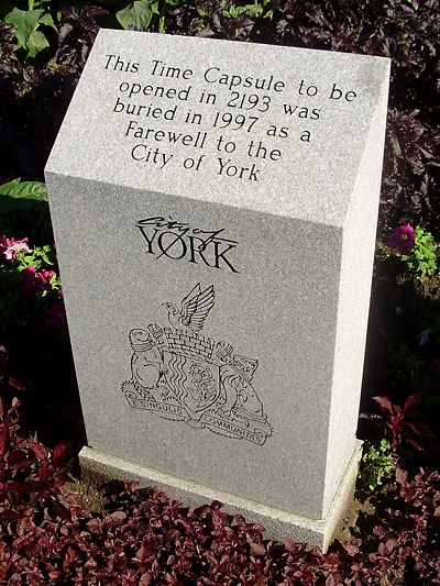 This time capsule outside the York Civic Centre is intended to be sealed for 196 years. It also depicts the city's logo and coat of arms, which contains the city's motto in Latin. The other former municipalities of Metropolitan Toronto all have mottoes in English. | |
| Motto(s): From individuals, a community (translated from Latin: E singulis communitas) | |
 Location of York (red), as compared with the rest of Toronto. | |
| Country | |
| Province | |
| Municipality | |
| Incorporated | 1793 (township) 1 January 1967 (borough) June 1983 (city) |
| Changed Region | 1954 |
| Amalgamated | 1 January 1998 into Toronto |
| Government | |
| • Councillors | Josh Colle, Joe Mihevc, Frances Nunziata, Cesar Palacio |
| • MPs | Carolyn Bennett, Andrew Cash, Joe Oliver, Mike Sullivan |
| • MPPs | Laura Albanese, Eric Hoskins, Mike Colle, Jonah Schein |
| Area | |
| • Total | 23.18 km2 (8.95 sq mi) |
| Population (2011)[1] | |
| • Total | 133,361 |
| • Density | 6,482.1/km2 (16,789/sq mi) |
| Time zone | UTC-5 (EST) |
| • Summer (DST) | UTC-4 (EDT) |
| Area code(s) | 416, 647 |
York is a former municipality within the current city of Toronto, Ontario, Canada. It is located northwest of Old Toronto, southwest of North York and east of Etobicoke, where it is bounded by the Humber River. Formerly a separate city, it was one of six municipalities that amalgamated in 1998 to form the current city of Toronto. The City of York itself was the amalgamation of several villages, including the present day neighbourhoods of Lambton Mills and Weston.
History
York Township was incorporated by Canada West in 1850 (Canada West later became Ontario in 1867 due to the Confederation), bounded in the west by the Humber River, in the east by what would become Victoria Park Avenue, and in the north by what would become Steeles Avenue. Etobicoke Township and Scarborough Township were located west and east, respectively, while the townships of Vaughan and Markham bordered on the north.
Humewood–Cedarvale was developed in the 1910s to attract development in the growing township. Oakwood–Vaughan was also developed during this time. In the 1920s, the character of the township changed, with its southern reaches abutting the city of Toronto taking on a more urban character, compared with the very rural character of the north. The decision was made to split the township in two, with the northern, rural portion becoming North York. The remaining, two pockets of unincorporated urban development at the north end of the city, were split by the village of North Toronto, which was by then a part of the City of Toronto. Within years, the Province of Ontario saw that this arrangement was impractical, and further subdivided York, creating the township of East York out of the eastern pocket. The Township of York contracted streetcar and bus services from the Toronto Transportation Commission (later became Toronto Transit Commission in 1954), but remained independent from Toronto. During this time, American novelist Ernest Hemingway resided in the Humewood–Cedarvale community, writing for The Toronto Star.
Runnymede Collegiate Institute on Jane Street, along with York Memorial Collegiate Institute at Eglinton Avenue, and George Harvey Collegiate Institute on Keele Street, and Vaughan Road Collegiate Institute (renamed Vaughan Road Academy in 1997) served as the high schools in the old York Township.
York was part of the federation of twelve suburban municipalities that joined Toronto in 1954 to form Metropolitan Toronto. In 1967, it absorbed the village of Weston, and became the Borough of York, later known as the City of York. It was amalgamated into the new City of Toronto on 1 January 1998. Its former council and administrative building, York Civic Centre, is located at 2700 Eglinton Avenue West, between Black Creek Drive and Keele Street.
York's first public library was the Mount Dennis branch, that operated out of rented premises since 1923.[1] In 1945, the Township of York Public Library Board was established, and proceeded to build three new library buildings, that opened in 1951, including the Jane/Dundas library, Main Library (Eglinton Avenue), and the Mount Dennis Library.[1][2][3]
Future
The Eglinton Crosstown line will run between Mount Dennis and Kennedy Station in Scarborough.
Reeves and mayors
Following the 1966 election, the chief magistrate of York, formerly known as the reeve, assumed the title of mayor.
The following are the reeves of the Township of York:
- George Stewart Henry (1906–1910) — later as Premier of Ontario
- R.J. Stuart (1934–1935)
- W.M. Magwood (1936–1937)
- F.J. MacRae (1938–1946)
- C.J. McMaster (1947–1948)
- William George Beech (1949–1951)
- Fred W. Hall (1952–1956)
- Chris A. Tonks (1957–1960) — father of Alan Tonks
- Fred C. Taylor (1961)
- Walter Saunders (1962)
The following individuals served as York's mayor:
- Jack Mould (1966–1969)
- Philip White (1970–1978)
- Gayle Christie (1978–1982)
- Alan Tonks (1982–1988)
- Fergy Brown (1988–1994)
- Frances Nunziata (1994–1997)