Gedaylu
Gedaylu
Persian: گدايلو | |
|---|---|
Village | |
 Gedaylu | |
| Coordinates: 39°23′15″N 47°24′54″E / 39.38750°N 47.41500°E[1] | |
| Country | Iran |
| Province | Ardabil |
| County | Ardabil |
| District | Central |
| Rural District | Aslan Duz-e Gharbi |
| Population (2016)[2] | |
| • Total | 661 |
| Time zone | UTC+3:30 (IRST) |
Gedaylu (Persian: گدايلو)[a] is a village in, and the capital of, Aslan Duz-e Gharbi Rural District[b] of the Central District of Aslan Duz County, Ardabil province, Iran.[4] The rural district was previously administered from Aslan Duz.[5]
Demographics
[edit]Population
[edit]At the time of the 2006 National Census, the village's population was 587 in 95 households, when it was in Aslan Duz Rural District[c] of the former Aslan Duz District of Parsabad County.[6] The following census in 2011 counted 552 people in 136 households.[7] The 2016 census measured the population of the village as 661 people in 172 households.[2]
In 2017, the district was separated from the county in the establishment of Aslan Duz County. The rural district was transferred to the new Central District and renamed Aslan Duz-e Gharbi Rural District.[4]
See also
[edit]Notes
[edit]- ^ Also romanized as Gedāylū; also known as Gedāylī[3]
- ^ Formerly Aslan Duz Rural District
- ^ Renamed Aslan Duz-e Gharbi Rural District
References
[edit]- ^ OpenStreetMap contributors (19 August 2024). "Gedaylu, Aslan Duz County" (Map). openstreetmap.org (OpenStreetMap) (in Persian). Retrieved 19 August 2024.
- ^ a b Census of the Islamic Republic of Iran, 1395 (2016): Ardabil Province. amar.org.ir (Report) (in Persian). The Statistical Center of Iran. Archived from the original (Excel) on 22 March 2019. Retrieved 19 December 2022.
- ^ Gedaylu can be found at GEOnet Names Server, at this link, by opening the Advanced Search box, entering "-3816744" in the "Unique Feature Id" form, and clicking on "Search Database".
- ^ a b Jahangiri, Ishaq (24 March 2017) [Approved 7 December 1397]. Approval letter regarding national divisions in Parsabad County of Ardabil province. rc.majlis.ir (Report) (in Persian). Ministry of the Interior, Council of Ministers. Notification 164180/T55515H. Archived from the original on 15 March 2019. Retrieved 26 March 2023 – via Islamic Parliament Research Center of the Islamic Republic of Iran.
- ^ Mousavi, Mirhossein (18 May 1366). "Creation and formation of 13 rural districts including villages, farms and places in Moghan County under East Azerbaijan province". rc.majlis.ir (Islamic Council Research Center) (in Persian). Ministry of the Interior, Board of Ministers. Archived from the original on 2 September 2012. Retrieved 28 November 2023.
- ^ Census of the Islamic Republic of Iran, 1385 (2006): Ardabil Province. amar.org.ir (Report) (in Persian). The Statistical Center of Iran. Archived from the original (Excel) on 20 September 2011. Retrieved 25 September 2022.
- ^ Census of the Islamic Republic of Iran, 1390 (2011): Ardabil Province. irandataportal.syr.edu (Report) (in Persian). The Statistical Center of Iran. Archived from the original (Excel) on 15 January 2023. Retrieved 19 December 2022 – via Iran Data Portal, Syracuse University.
| Capital | 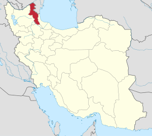 | ||||||||||||||||||||||
|---|---|---|---|---|---|---|---|---|---|---|---|---|---|---|---|---|---|---|---|---|---|---|---|
| Counties and cities |
| ||||||||||||||||||||||
| Landmarks |
| ||||||||||||||||||||||
| Places | |||||||||||||||||||||||
This Ardabil province location article is a stub. You can help Wikipedia by expanding it. |