File:India Jharkhand location map.svg

此 SVG 檔案的 PNG 預覽的大小:800 × 596 像素。 其他解析度:320 × 238 像素 | 640 × 476 像素 | 1,024 × 762 像素 | 1,280 × 953 像素 | 2,560 × 1,906 像素 | 1,162 × 865 像素。
原始檔案 (SVG 檔案,表面大小:1,162 × 865 像素,檔案大小:611 KB)
摘要
| 描述 |
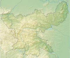
Location map of Jharkhand Geographic limits of the map:
|
| 日期 | |
| 來源 | |
| 作者 |
|
| 其他版本 |
|
授權條款
此檔案採用共享創意 姓名標示-相同方式分享 3.0 未在地化版本授權條款。
- 您可以自由:
- 分享 – 複製、發佈和傳播本作品
- 重新修改 – 創作演繹作品
- 惟需遵照下列條件:
- 姓名標示 – 您必須指名出正確的製作者,和提供授權條款的連結,以及表示是否有對內容上做出變更。您可以用任何合理的方式來行動,但不得以任何方式表明授權條款是對您許可或是由您所使用。
- 相同方式分享 – 如果您利用本素材進行再混合、轉換或創作,您必須基於如同原先的相同或兼容的條款,來分布您的貢獻成品。
檔案歷史
點選日期/時間以檢視該時間的檔案版本。
| 日期/時間 | 縮圖 | 尺寸 | 用戶 | 備註 | |
|---|---|---|---|---|---|
| 目前 | 2023年3月14日 (二) 16:00 | 1,162 × 865(611 KB) | C1MM | Updated bounds | |
| 2021年5月21日 (五) 04:00 | 848 × 631(285 KB) | C1MM | Corrected districts and river boundaries | ||
| 2020年11月28日 (六) 01:57 | 829 × 617(317 KB) | C1MM | The state was shaped wrongly, the southwestern part was shaped very differently. Fixed shape of districts, which were not accurate according to maps on district websites. | ||
| 2020年4月25日 (六) 05:58 | 856 × 714(142 KB) | C1MM | Rivers and small coastline | ||
| 2020年3月26日 (四) 21:42 | 856 × 714(116 KB) | C1MM | New districts | ||
| 2013年5月31日 (五) 09:30 | 854 × 712(159 KB) | Milenioscuro | User created page with UploadWizard |
檔案用途
全域檔案使用狀況
以下其他 wiki 使用了這個檔案:
- anp.wikipedia.org 的使用狀況
- azb.wikipedia.org 的使用狀況
- پتاروار
- ساراسدانقال
- کالیاسول
- سالقون
- مانوسموریا
- کابرا خورد
- سوداق (هیندوستان)
- سییالجوری
- جاتودیه
- جاموا (هیندوستان)
- ماکدیها
- سیلادون
- ماهواتاند
- ماهوادانر
- شیامسوندارپور
- ماهسیادیقی
- جاقاناتپور-پارولیا
- مادهوبان, جیریدیه
- ایچاک (هیندوستان)
- ایچاقاره
- لوکاینایانپور
- پوپونکی
- هسلا (هیندوستان)
- پرادهان خونتا
- پوراییاهات
- هانسدیها
- پوکلا (هیندوستان)
- پیرتاند
- پیندراجورا
- قورهار
- پارولیا
- توندی (هیندوستان)
- پانددیه
- تیسری, جیریدیه
- قاوان, جیریدیه
- قاری کالان
- پادما, هازاریباق
- قاندی (هیندوستان)
- دئوری, جیریدیه
- دارو-خاریکا
- دارو, هازاریباق
- چورچو (هیندوستان)
- چیترشور
- دومری, جیریدیه
- ناوادیه
- چهاروا
- چاوب, هازاریباق
檢視此檔案的更多全域使用狀況。