Warrenton, North Carolina
Warrenton, North Carolina | |
|---|---|
 | |
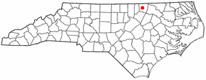 Location of Warrenton, North Carolina | |
| Coordinates: 36°23′58″N 78°09′27″W / 36.39944°N 78.15750°W | |
| Country | United States |
| State | North Carolina |
| County | Warren |
| Area | |
| • Total | 1.09 sq mi (2.81 km2) |
| • Land | 1.08 sq mi (2.81 km2) |
| • Water | 0.00 sq mi (0.00 km2) |
| Elevation | 384 ft (117 m) |
| Population | |
| • Total | 851 |
| • Density | 784.33/sq mi (302.83/km2) |
| Time zone | UTC-5 (EST) |
| • Summer (DST) | UTC-4 (EDT) |
| ZIP code | 27589 |
| Area code | 252 |
| FIPS code | 37-71100[4] |
| GNIS feature ID | 2406832[2] |
| Website | www |
Warrenton is a town in and the county seat of Warren County, North Carolina, United States. 851 people lived here at the 2020 census.[3]
References
- ↑ "ArcGIS REST Services Directory". United States Census Bureau. Retrieved September 20, 2022.
- ↑ 2.0 2.1 U.S. Geological Survey Geographic Names Information System: Warrenton, North Carolina
- ↑ 3.0 3.1 "Profile of General Population and Housing Characteristics: 2020 Demographic Profile Data (DP-1): Warrenton town, North Carolina". United States Census Bureau. Retrieved February 26, 2024.
- ↑ "U.S. Census website". United States Census Bureau. Retrieved 2008-01-31.