Виљас де Каса Бланка (Плајас де Росарито) — разлика између измена
Садржај обрисан Садржај додат
м . |
м Бот: уколоњени ␣ код референци |
||
| Ред 86: | Ред 86: | ||
| p2 = <!-- etc., up to p50: for separate parts to be listed--> |
| p2 = <!-- etc., up to p50: for separate parts to be listed--> |
||
<!-- government type, leaders --> |
<!-- government type, leaders --> |
||
| government_footnotes = <!-- for references: use |
| government_footnotes = <!-- for references: use<ref> tags --> |
||
| government_type = |
| government_type = |
||
| governing_body = |
| governing_body = |
||
| Ред 98: | Ред 98: | ||
| unit_pref = <!-- enter: Imperial, to display imperial before metric --> |
| unit_pref = <!-- enter: Imperial, to display imperial before metric --> |
||
<!-- area --> |
<!-- area --> |
||
| area_footnotes = <!-- for references: use |
| area_footnotes = <!-- for references: use<ref> tags --> |
||
| area_magnitude = <!-- use only to set a special wikilink --> |
| area_magnitude = <!-- use only to set a special wikilink --> |
||
| dunam_link = <!-- If dunams are used, this specifies which dunam to link. --> |
| dunam_link = <!-- If dunams are used, this specifies which dunam to link. --> |
||
| Ред 117: | Ред 117: | ||
| area_water_dunam = <!-- used in Middle East articles only --> |
| area_water_dunam = <!-- used in Middle East articles only --> |
||
| area_water_percent = |
| area_water_percent = |
||
| area_urban_footnotes = <!-- for references: use |
| area_urban_footnotes = <!-- for references: use<ref> tags --> |
||
| area_urban_km2 = |
| area_urban_km2 = |
||
| area_urban_sq_mi = |
| area_urban_sq_mi = |
||
| Ред 123: | Ред 123: | ||
| area_urban_acre = |
| area_urban_acre = |
||
| area_urban_dunam = <!-- used in Middle East articles only --> |
| area_urban_dunam = <!-- used in Middle East articles only --> |
||
| area_rural_footnotes = <!-- for references: use |
| area_rural_footnotes = <!-- for references: use<ref> tags --> |
||
| area_rural_km2 = |
| area_rural_km2 = |
||
| area_rural_sq_mi = |
| area_rural_sq_mi = |
||
| Ред 129: | Ред 129: | ||
| area_rural_acre = |
| area_rural_acre = |
||
| area_rural_dunam = <!-- used in Middle East articles only --> |
| area_rural_dunam = <!-- used in Middle East articles only --> |
||
| area_metro_footnotes = <!-- for references: use |
| area_metro_footnotes = <!-- for references: use<ref> tags --> |
||
| area_metro_km2 = |
| area_metro_km2 = |
||
| area_metro_sq_mi = |
| area_metro_sq_mi = |
||
| Ред 139: | Ред 139: | ||
<!-- dimensions --> |
<!-- dimensions --> |
||
| dimensions_footnotes = <!-- for references: use |
| dimensions_footnotes = <!-- for references: use<ref> tags --> |
||
| length_km = |
| length_km = |
||
| length_mi = |
| length_mi = |
||
| Ред 150: | Ред 150: | ||
| elevation_ft = |
| elevation_ft = |
||
| elevation_point = <!-- for denoting the measurement point --> |
| elevation_point = <!-- for denoting the measurement point --> |
||
| elevation_max_footnotes = <!-- for references: use |
| elevation_max_footnotes = <!-- for references: use<ref> tags --> |
||
| elevation_max_m = |
| elevation_max_m = |
||
| elevation_max_ft = |
| elevation_max_ft = |
||
| elevation_max_point = <!-- for denoting the measurement point --> |
| elevation_max_point = <!-- for denoting the measurement point --> |
||
| elevation_max_rank = |
| elevation_max_rank = |
||
| elevation_min_footnotes = <!-- for references: use |
| elevation_min_footnotes = <!-- for references: use<ref> tags --> |
||
| elevation_min_m = |
| elevation_min_m = |
||
| elevation_min_ft = |
| elevation_min_ft = |
||
| Ред 198: | Ред 198: | ||
<!-- demographics (section 1) --> |
<!-- demographics (section 1) --> |
||
| demographics_type1 = |
| demographics_type1 = |
||
| demographics1_footnotes = <!-- for references: use |
| demographics1_footnotes = <!-- for references: use<ref> tags --> |
||
| demographics1_title1 = |
| demographics1_title1 = |
||
| demographics1_info1 = <!-- etc., up to demographics1_title5 / demographics1_info5 --> |
| demographics1_info1 = <!-- etc., up to demographics1_title5 / demographics1_info5 --> |
||
| Ред 204: | Ред 204: | ||
<!-- demographics (section 2) --> |
<!-- demographics (section 2) --> |
||
| demographics_type2 = |
| demographics_type2 = |
||
| demographics2_footnotes = <!-- for references: use |
| demographics2_footnotes = <!-- for references: use<ref> tags --> |
||
| demographics2_title1 = |
| demographics2_title1 = |
||
| demographics2_info1 = <!-- etc., up to demographics2_title5 / demographics2_info5 --> |
| demographics2_info1 = <!-- etc., up to demographics2_title5 / demographics2_info5 --> |
||
Верзија на датум 9. мај 2024. у 06:03
| Виљас де Каса Бланка Villas de Casa Blanca (шпански) | |
|---|---|
| Насеље | |
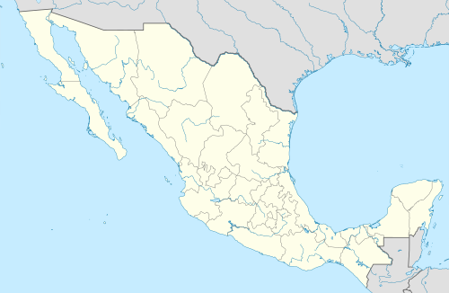 Виљас де Каса Бланка Локација у Мексику | |
| Координате: 32° 9′ 10″ N 116° 34′ 32″ W / 32.15278° С; 116.57556° З[1] | |
| Држава | |
| Савезна држава | Доња Калифорнија |
| Општина | Плајас де Росарито |
| Надморска висина[1] | 33 m (108 ft) |
| Становништво (2010)[1] | |
| • Укупно | 2 |
| Временска зона | UTC−8 |
| • Лети (DST) | UTC−7 (UTC) |
| INEGI код | 020050363 |
Виљас де Каса Бланка (шп. Villas de Casa Blanca) насеље је у Мексику у савезној држави Доња Калифорнија у општини Плајас де Росарито. Насеље се налази на надморској висини од 33 м.[2]
Становништво
Према подацима из 2010. године у насељу су живела 2 становника.[1]
Хронологија
| Година | 2010 |
|---|---|
| Становништво | 2 |
Попис
| # | Индикатор | Вредност |
|---|---|---|
| 1 | Укупно домаћинстава | 6 |
| 2 | Укупно насељених домаћинстава | 1 |
| 3 | Величина локације | 1 |
Види још
Референце
- ^ а б в г д ђ „Instituto Nacional de Estadística y Geografía”. www.inegi.org.mx. Aguascalientes, Mexico: INEG.
- ^ „The GeoNames geographical database”. 2012.
Спољашње везе