Арыгінальны файл (977 × 797 кропак, аб’ём файла: 53 KB, тып MIME: image/png)
Гэты файл з на Вікісховішчы і можа выкарыстоўвацца іншымі праектамі. Апісанне на яго старонцы ў Wikimedia Commons прыведзена ніжэй.
This historical map image could be re-created using vector graphics as an SVG file. This has several advantages; see Commons:Media for cleanup for more information. If an SVG form of this image is available, please upload it and afterwards replace this template with {{vector version available|new image name}}.
It is recommended to name the SVG file “Roszczenia litewskie.svg”—then the template Vector version available (or Vva) does not need the new image name parameter.
АпісаннеRoszczenia litewskie.PNG
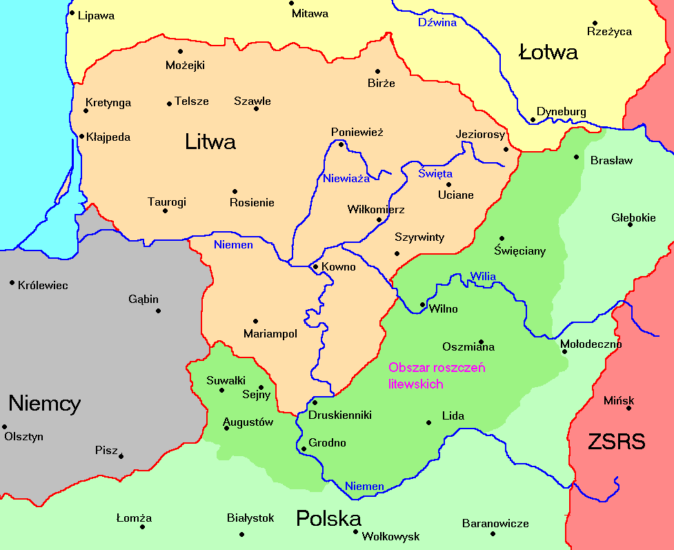
English: Territories of Lithuania 1920-1940 and Polish terrietories claimed by Lithuania
Polski: Litwa 1920-1940 i jej roszczenia terytorialne względem Polski
GNU Free Documentation License, version 1.2 or later<\/a>\u00a0\u0430\u043d\u0433\u043b\u0456\u0439\u0441\u043a\u0430\u044f<\/sup>"}},"text\/plain":{"be":{"P275":"GNU Free Documentation License, version 1.2 or later"}}}}" class="wbmi-entityview-statementsGroup wbmi-entityview-statementsGroup-P275 oo-ui-layout oo-ui-panelLayout oo-ui-panelLayout-framed">
{{Information |Description={{en|1=Territories of Lithuania 1920-1940 and Polish terrietories given by Soviet Union to Lithuania during Polish-Soviet war.}} {{pl|1=Litwa 1920-1940 i jej roszczenia terytorialne względem Polski}} |Source={{own}}, based on h