Lawrence County (kondado sa Tinipong Bansa, Missouri) : Kalainan tali sa mga rebisyon
Fixing grammar & climate chart |
m Lsjbot moved page Lawrence County (kondado sa Estados Unidos, Missouri) to Lawrence County (kondado sa Tinipong Bansa, Missouri): Moving article |
||
| ( 2 intermediate nga rebisyon sa samang user wala gipakita) | |||
| Linya 1: | Linya 1: | ||
{{paghimo ni bot|Lsjbot| |
{{paghimo ni bot|Lsjbot|Tinipong Bansa|date=2017-06}} |
||
:''Alang sa ubang mga dapit sa mao gihapon nga ngalan, tan-awa [[Lawrence County]].'' |
:''Alang sa ubang mga dapit sa mao gihapon nga ngalan, tan-awa ang [[Lawrence County]].'' |
||
{{geobox |
{{geobox |
||
| 1 = Region |
| 1 = Region |
||
| Linya 19: | Linya 19: | ||
| symbol = |
| symbol = |
||
<!-- *** Admin *** --> |
<!-- *** Admin *** --> |
||
| country = {{flag| |
| country = {{flag|Tinipong Bansa}} |
||
| country_flag = |
| country_flag = |
||
| state = [[Missouri (estado)|Missouri]] |
| state = [[Missouri (estado)|Missouri]] |
||
| Linya 132: | Linya 132: | ||
}} |
}} |
||
'''Lawrence County''' ([[Prinanses]]: '''Comté de Lawrence''', [[Kinatsila]]: '''Condado de Lawrence''') |
<!--A.ADM2-->[[administratibo nga mga dibisyon sa Tinipong Bansa|Kondado]] ang '''Lawrence County''' ([[Prinanses]]: '''Comté de Lawrence''', [[Kinatsila]]: '''Condado de Lawrence''') sa [[Tinipong Bansa]].<ref name = "gn4394702"/> Nahimutang ni sa estado sa <!--ADM1-->[[Missouri (estado)|Missouri]], sa habagatan-sidlakang bahin sa nasod, {{formatnum:1500}} km sa kasadpan sa [[Washington, D.C.]] Adunay <!--pop-->{{formatnum:38634}} ka molupyo.<ref name = "gn4394702"/> Naglangkob kin og {{formatnum:399}} ka kilometro kwadrado. Lawrence County mopakigbahin sa usa ka utlanan sa [[Dade County (kondado sa Tinipong Bansa, Missouri)|Dade County]], ug [[Barry County (kondado sa Tinipong Bansa, Missouri)|Barry County]] ang ulohan sa nasod. |
||
Ang yuta sa Lawrence County kay patag.{{efn|group=saysay|Kalkulado gikan sa gitas-on data (DEM 3") gikan sa Viewfinder Panoramas.<ref name = "vp"/> Ang bug-os nga algoritmo anaa [https://sv.wikipedia.org/wiki/Wikipedia:Projekt_DotNetWikiBot_Framework/Lsjbot/Make-Geonames dinhi].}} |
Ang yuta sa Lawrence County kay patag.{{efn|group=saysay|Kalkulado gikan sa gitas-on data (DEM 3") gikan sa Viewfinder Panoramas.<ref name = "vp"/> Ang bug-os nga algoritmo anaa [https://sv.wikipedia.org/wiki/Wikipedia:Projekt_DotNetWikiBot_Framework/Lsjbot/Make-Geonames dinhi].}} |
||
Lawrence County may sa mosunod nga mga subdibisyon: |
Lawrence County may sa mosunod nga mga subdibisyon: |
||
* [[Mount Vernon (kapital sa kondado sa |
* [[Mount Vernon (kapital sa kondado sa Tinipong Bansa, Missouri)|Mount Vernon]] |
||
Mga lungsod sa Lawrence County: |
Mga lungsod sa Lawrence County: |
||
* [[Aurora (lungsod sa |
* [[Aurora (lungsod sa Tinipong Bansa, Missouri)|Aurora]] |
||
* [[Mount Vernon (kapital sa kondado sa |
* [[Mount Vernon (kapital sa kondado sa Tinipong Bansa, Missouri)|Mount Vernon]] |
||
* [[Marionville]] |
* [[Marionville]] |
||
* [[Pierce City]] |
* [[Pierce City]] |
||
* [[Miller (lungsod sa |
* [[Miller (lungsod sa Tinipong Bansa, Missouri)|Miller]] |
||
* [[Verona (lungsod sa |
* [[Verona (lungsod sa Tinipong Bansa, Missouri)|Verona]] |
||
* [[Stotts City]] |
* [[Stotts City]] |
||
* [[Halltown (lungsod)|Halltown]] |
* [[Halltown (lungsod)|Halltown]] |
||
| Linya 155: | Linya 155: | ||
* Mga suba: |
* Mga suba: |
||
:* [[Billies Creek (suba sa |
:* [[Billies Creek (suba sa Tinipong Bansa, Missouri)|Billies Creek]] (<!--H.STM-->[[suba]]) |
||
:* [[Chat Creek]] (<!--H.STM-->[[suba]]) |
:* [[Chat Creek]] (<!--H.STM-->[[suba]]) |
||
:* [[Chesapeake Branch]] (<!--H.STM-->[[suba]]) |
:* [[Chesapeake Branch]] (<!--H.STM-->[[suba]]) |
||
:* [[Douger Branch]] (<!--H.STM-->[[suba]]) |
:* [[Douger Branch]] (<!--H.STM-->[[suba]]) |
||
:* [[Dry Fork (suba sa |
:* [[Dry Fork (suba sa Tinipong Bansa, Missouri, Lawrence County, lat 37,15, long -93,90)|Dry Fork]] (<!--H.STM-->[[suba]]) |
||
:* [[Eddington Branch]] (<!--H.STM-->[[suba]]) |
:* [[Eddington Branch]] (<!--H.STM-->[[suba]]) |
||
:* [[Elm Branch (suba sa |
:* [[Elm Branch (suba sa Tinipong Bansa, Missouri, Lawrence County)|Elm Branch]] (<!--H.STM-->[[suba]]) |
||
:* [[Goose Creek (suba sa |
:* [[Goose Creek (suba sa Tinipong Bansa, Missouri, Lawrence County, lat 37,19, long -93,69)|Goose Creek]] (<!--H.STM-->[[suba]]) |
||
:* [[Hemphill Branch (suba sa |
:* [[Hemphill Branch (suba sa Tinipong Bansa, Missouri)|Hemphill Branch]] (<!--H.STM-->[[suba]]) |
||
:* [[Hewlett Branch (suba sa |
:* [[Hewlett Branch (suba sa Tinipong Bansa, Missouri)|Hewlett Branch]] (<!--H.STM-->[[suba]]) |
||
:* [[Hillhouse Branch]] (<!--H.STM-->[[suba]]) |
:* [[Hillhouse Branch]] (<!--H.STM-->[[suba]]) |
||
:* [[Honey Creek (suba sa |
:* [[Honey Creek (suba sa Tinipong Bansa, Missouri, Lawrence County, lat 37,08, long -93,86)|Honey Creek]] (<!--H.STM-->[[suba]]) |
||
:* [[Johnson Creek (suba sa |
:* [[Johnson Creek (suba sa Tinipong Bansa, Missouri, Lawrence County)|Johnson Creek]] (<!--H.STM-->[[suba]]) |
||
:* [[Mill Branch (suba sa |
:* [[Mill Branch (suba sa Tinipong Bansa, Missouri, Lawrence County, lat 37,25, long -93,73)|Mill Branch]] (<!--H.STM-->[[suba]]) |
||
:* [[Province Branch]] (<!--H.STM-->[[suba]]) |
:* [[Province Branch]] (<!--H.STM-->[[suba]]) |
||
:* [[Pruitt Branch (suba sa |
:* [[Pruitt Branch (suba sa Tinipong Bansa, Missouri)|Pruitt Branch]] (<!--H.STM-->[[suba]]) |
||
:* [[Sardine Creek (suba sa |
:* [[Sardine Creek (suba sa Tinipong Bansa, Missouri)|Sardine Creek]] (<!--H.STM-->[[suba]]) |
||
:* [[Stahl Creek (suba sa |
:* [[Stahl Creek (suba sa Tinipong Bansa, Missouri)|Stahl Creek]] (<!--H.STM-->[[suba]]) |
||
:* [[Sycamore Branch (suba sa |
:* [[Sycamore Branch (suba sa Tinipong Bansa, Missouri, Lawrence County)|Sycamore Branch]] (<!--H.STM-->[[suba]]) |
||
:* [[Truitt Creek (suba sa |
:* [[Truitt Creek (suba sa Tinipong Bansa, Missouri)|Truitt Creek]] (<!--H.STM-->[[suba]]) |
||
:* [[Williams Creek (suba sa |
:* [[Williams Creek (suba sa Tinipong Bansa, Missouri, Lawrence County)|Williams Creek]] (<!--H.STM-->[[suba]]) |
||
:* [[Wright Branch (suba sa |
:* [[Wright Branch (suba sa Tinipong Bansa, Missouri)|Wright Branch]] (<!--H.STM-->[[suba]]) |
||
* Mga tubud: |
* Mga tubud: |
||
:* [[Clarkson Spring]] (<!--H.SPNG-->[[tubud]]) |
:* [[Clarkson Spring]] (<!--H.SPNG-->[[tubud]]) |
||
:* [[Cove Spring (tubud sa |
:* [[Cove Spring (tubud sa Tinipong Bansa, Missouri, Lawrence County)|Cove Spring]] (<!--H.SPNG-->[[tubud]]) |
||
:* [[Parish Springs]] (<!--H.SPNG-->[[tubud]]) |
:* [[Parish Springs]] (<!--H.SPNG-->[[tubud]]) |
||
:* [[Polk Spring (tubud sa |
:* [[Polk Spring (tubud sa Tinipong Bansa, Missouri)|Polk Spring]] (<!--H.SPNG-->[[tubud]]) |
||
* Mga lanaw: |
* Mga lanaw: |
||
| Linya 198: | Linya 198: | ||
* Mga walog: |
* Mga walog: |
||
:* [[Browning Hollow (walog sa |
:* [[Browning Hollow (walog sa Tinipong Bansa, Missouri, Lawrence County, lat 36,95, long -93,80)|Browning Hollow]] (<!--T.VAL-->[[walog]]) |
||
:* [[Browning Hollow (walog sa |
:* [[Browning Hollow (walog sa Tinipong Bansa, Missouri, Lawrence County, lat 37,02, long -93,82)|Browning Hollow]] (<!--T.VAL-->[[walog]]) |
||
:* [[Carmen Hollow]] (<!--T.VAL-->[[walog]]) |
:* [[Carmen Hollow]] (<!--T.VAL-->[[walog]]) |
||
:* [[Colley Hollow]] (<!--T.VAL-->[[walog]]) |
:* [[Colley Hollow]] (<!--T.VAL-->[[walog]]) |
||
:* [[Dry Hollow (walog sa |
:* [[Dry Hollow (walog sa Tinipong Bansa, Missouri, Lawrence County, lat 37,13, long -93,98)|Dry Hollow]] (<!--T.VAL-->[[walog]]) |
||
:* [[Hickory Hollow (walog sa |
:* [[Hickory Hollow (walog sa Tinipong Bansa, Missouri, Lawrence County)|Hickory Hollow]] (<!--T.VAL-->[[walog]]) |
||
:* [[Marti Hollow]] (<!--T.VAL-->[[walog]]) |
:* [[Marti Hollow]] (<!--T.VAL-->[[walog]]) |
||
:* [[Piper Hollow (walog sa |
:* [[Piper Hollow (walog sa Tinipong Bansa, Missouri)|Piper Hollow]] (<!--T.VAL-->[[walog]]) |
||
:* [[Pleasant Valley (walog sa |
:* [[Pleasant Valley (walog sa Tinipong Bansa, Missouri, Lawrence County)|Pleasant Valley]] (<!--T.VAL-->[[walog]]) |
||
:* [[Sycamore Hollow (walog sa |
:* [[Sycamore Hollow (walog sa Tinipong Bansa, Missouri, Lawrence County)|Sycamore Hollow]] (<!--T.VAL-->[[walog]]) |
||
:* [[Turner Hollow (walog sa |
:* [[Turner Hollow (walog sa Tinipong Bansa, Missouri, Lawrence County)|Turner Hollow]] (<!--T.VAL-->[[walog]]) |
||
* Kabukiran: |
* Kabukiran: |
||
| Linya 238: | Linya 238: | ||
|} |
|} |
||
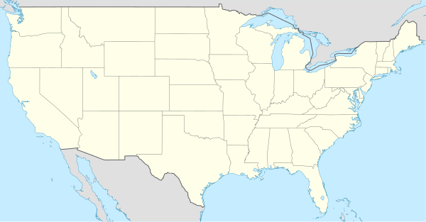
{{Location map|United States |float = right |width=300 | caption = |
{{Location map|United States |float = right |width=300 | caption = Nahimutangan sa Lawrence County sa Tinipong Bansa. | label = Lawrence County|position=right|background=white|lat=37.10635|long=-93.83294}} |
||
== Saysay == |
== Saysay == |
||
Rebisyon sa kasamtangan sa taknang 12:13, 5 Agosto 2019
Paghimo ni bot Lsjbot. |
- Alang sa ubang mga dapit sa mao gihapon nga ngalan, tan-awa ang Lawrence County.
| Lawrence County (Comté de Lawrence) | |
| Condado de Lawrence | |
| Kondado | |
 | |
| Nasod | |
|---|---|
| Estado | Missouri |
| Gitas-on | 364 m (1,194 ft) |
| Tiganos | 37°06′23″N 93°49′59″W / 37.10635°N 93.83294°W |
| Capital | Mount Vernon |
| Area | 399.00 km2 (154 sq mi) |
| Population | 38,634 (2013-03-07) [1] |
| Density | 97 / km2 (251 / sq mi) |
| Timezone | CST (UTC-6) |
| - summer (DST) | CDT (UTC-5) |
| GeoNames | 4394702 |
 | |
Kondado ang Lawrence County (Prinanses: Comté de Lawrence, Kinatsila: Condado de Lawrence) sa Tinipong Bansa.[1] Nahimutang ni sa estado sa Missouri, sa habagatan-sidlakang bahin sa nasod, 1,500 km sa kasadpan sa Washington, D.C. Adunay 38,634 ka molupyo.[1] Naglangkob kin og 399 ka kilometro kwadrado. Lawrence County mopakigbahin sa usa ka utlanan sa Dade County, ug Barry County ang ulohan sa nasod.
Ang yuta sa Lawrence County kay patag.[saysay 1]
Lawrence County may sa mosunod nga mga subdibisyon:
Mga lungsod sa Lawrence County:
Sa mosunod nga mga natural nga mga bahin makita sa Lawrence County:
- Mga suba:
- Billies Creek (suba)
- Chat Creek (suba)
- Chesapeake Branch (suba)
- Douger Branch (suba)
- Dry Fork (suba)
- Eddington Branch (suba)
- Elm Branch (suba)
- Goose Creek (suba)
- Hemphill Branch (suba)
- Hewlett Branch (suba)
- Hillhouse Branch (suba)
- Honey Creek (suba)
- Johnson Creek (suba)
- Mill Branch (suba)
- Province Branch (suba)
- Pruitt Branch (suba)
- Sardine Creek (suba)
- Stahl Creek (suba)
- Sycamore Branch (suba)
- Truitt Creek (suba)
- Williams Creek (suba)
- Wright Branch (suba)
- Mga tubud:
- Mga lanaw:
- Nga bato nga pormasyon:
- Mga walog:
- Kabukiran:
Ang klima umogon ug subtropikal.[3] Ang kasarangang giiniton 13 °C. Ang kinainitan nga bulan Agosto, sa 24 °C, ug ang kinabugnawan Enero, sa 0 °C.[4] Ang kasarangang pag-ulan 1,268 milimetro matag tuig. Ang kinabasaan nga bulan Oktubre, sa 180 milimetro nga ulan, ug ang kinaugahan Nobiyembre, sa 58 milimetro.[5]
| ||||||||||||||||||||||||||||||||||||||||||||||||||||||||||||||||||||||||||||||||||||||||||||||||||||||||||||||||||||||||||||
Saysay
[usba | usba ang wikitext]- ↑ Kalkulado gikan sa gitas-on data (DEM 3") gikan sa Viewfinder Panoramas.[2] Ang bug-os nga algoritmo anaa dinhi.
Ang mga gi basihan niini
[usba | usba ang wikitext]- ↑ 1.0 1.1 1.2 Lawrence County sa Geonames.org (cc-by); post updated 2013-03-07; database download sa 2017-02-28
- ↑ "Viewfinder Panoramas Digital elevation Model". 2015-06-21.
- ↑ Peel, M C; Finlayson, B L. "Updated world map of the Köppen-Geiger climate classification". Hydrology and Earth System Sciences. 11: 1633–1644. doi:10.5194/hess-11-1633-2007. Retrieved 30 Enero 2016.
{{cite journal}}: CS1 maint: unflagged free DOI (link) - ↑ 4.0 4.1 "NASA Earth Observations Data Set Index". NASA. Retrieved 30 Enero 2016.
- ↑ "NASA Earth Observations: Rainfall (1 month - TRMM)". NASA/Tropical Rainfall Monitoring Mission. Retrieved 30 Enero 2016.
Gikan sa gawas nga tinubdan
[usba | usba ang wikitext]| Aduna'y mga payl ang Wikimedia Commons nga may kalabotan sa artikulong: Lawrence County. |