Category:Bennachie
Jump to navigation
Jump to search
range of hills in Aberdeenshire, Scotland, UK  | |||||
| Upload media | |||||
| Instance of | |||||
|---|---|---|---|---|---|
| Location | Aberdeenshire, Scotland | ||||
| Topographic prominence |
| ||||
| Elevation above sea level |
| ||||
 | |||||
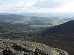
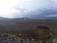
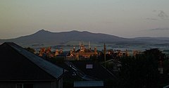
Bennachie is a range of hills in Aberdeenshire, Scotland. It has several tops, the highest of which, Oxen Craig, has a height of 528 m.
Media in category "Bennachie"
The following 51 files are in this category, out of 51 total.
-
Bennachie from the east.jpg 640 × 427; 80 KB
-
Bennachie from the North.jpg 800 × 216; 80 KB
-
Bennachie panorama by Bruce McAdam.jpg 9,731 × 1,989; 2.34 MB
-
Cairn on Millstone Hill. - geograph.org.uk - 117146.jpg 640 × 434; 115 KB
-
Cluny School - geograph.org.uk - 9816.jpg 640 × 480; 66 KB
-
Farmland in early Autumn, Aberdeenshire - geograph.org.uk - 44503.jpg 640 × 426; 118 KB
-
-
-
-
Mither Tap from the South - geograph.org.uk - 55769.jpg 640 × 427; 65 KB
-
Mither tap summit.jpg 800 × 600; 107 KB
-
Mither tap view north.jpg 800 × 600; 199 KB
-
MonymuskBennachie1.jpg 2,849 × 888; 993 KB
-
MonymuskBennachie2.JPG 3,072 × 1,167; 1.65 MB
-
Mount Battock summit Trig Point - geograph.org.uk - 1458346.jpg 640 × 427; 85 KB
-
New Gordon Way Marker.JPG 3,072 × 2,048; 2.59 MB
-
Ordnance Survey Half-inch Sheet 15 Aberdeen and Banff, Published 1912.jpg 8,376 × 11,256; 38.57 MB
-
Oxen Craig - geograph.org.uk - 1083682.jpg 640 × 427; 237 KB
-
-
Oxen Craig path from Mither Tap - geograph.org.uk - 1262103.jpg 640 × 480; 61 KB
-
Oxen Craig View Indicator - geograph.org.uk - 1083698.jpg 640 × 427; 274 KB
-
Oxen Craig Viewpoint Indicator - geograph.org.uk - 22489.jpg 640 × 400; 38 KB
-
Oxen craig.jpg 800 × 600; 86 KB
-
P-SCO MonymuskBennachie.jpg 2,753 × 401; 552 KB
-
Standing Stones - geograph.org.uk - 356735.jpg 640 × 480; 51 KB
-
Standing Stones - geograph.org.uk - 356742.jpg 640 × 480; 70 KB
-
Summit Indicator on Oxen Craig - geograph.org.uk - 976019.jpg 640 × 480; 91 KB
-
-
Sunrise over Meldrum.jpg 640 × 334; 24 KB
-
The Gouk Stone, Bennachie.jpg 4,032 × 1,960; 5.12 MB
-
The Summit Shelter Oxen Craig - geograph.org.uk - 773029.jpg 640 × 480; 65 KB
-
Track in Bennachie Forest - geograph.org.uk - 516247.jpg 640 × 480; 81 KB
-
View from Oxen Craig - geograph.org.uk - 1083695.jpg 640 × 406; 244 KB
-
View from Oxen Craig - geograph.org.uk - 976017.jpg 640 × 480; 47 KB
-
View from Oxen Craig to Craigshannoch - geograph.org.uk - 1083690.jpg 640 × 427; 237 KB
-
-
Barmekin Hill trig - geograph.org.uk - 361047.jpg 640 × 480; 98 KB
-
Distant view of Bennachie' - geograph.org.uk - 265653.jpg 640 × 480; 44 KB
-
-
Little Oxencraig. - geograph.org.uk - 134103.jpg 640 × 430; 64 KB
-
Looking across farmland towards Bennachie - geograph.org.uk - 21138.jpg 640 × 480; 101 KB
-
Maiden Causeway, on Bennachie. - geograph.org.uk - 159719.jpg 424 × 640; 112 KB
-
Mither Tap of Bennachie - geograph.org.uk - 4372.jpg 640 × 422; 231 KB
-
Mither Tap of Bennachie from southeast - geograph.org.uk - 97294.jpg 640 × 545; 182 KB
-
Moorland on Bennachie - geograph.org.uk - 4370.jpg 640 × 311; 41 KB
-
Muir of Alford - geograph.org.uk - 374390.jpg 640 × 480; 82 KB
-
River Don at Monymusk - geograph.org.uk - 288325.jpg 640 × 480; 100 KB
-
River Don Looking NE - geograph.org.uk - 279795.jpg 640 × 400; 79 KB
-
Rothmaise trig point in summer - geograph.org.uk - 205342.jpg 640 × 480; 121 KB
-
The Bennachie Centre - geograph.org.uk - 12084.jpg 640 × 406; 168 KB
-
View of Bennachie - geograph.org.uk - 258504.jpg 640 × 480; 51 KB