Category:Maps of Germany
Jump to navigation
Jump to search
Countries of Europe: Albania · Andorra · Armenia‡ · Austria · Azerbaijan‡ · Belarus · Belgium · Bosnia and Herzegovina · Bulgaria · Croatia · Cyprus‡ · Czech Republic · Denmark · Estonia · Finland · France‡ · Georgia‡ · Germany · Greece · Hungary · Iceland · Republic of Ireland · Italy · Kazakhstan‡ · Latvia · Liechtenstein · Lithuania · Luxembourg · Malta · Moldova · Monaco · Montenegro · Netherlands‡ · North Macedonia · Norway · Poland · Portugal‡ · Romania · Russia‡ · San Marino · Serbia · Slovakia · Slovenia · Spain‡ · Sweden · Switzerland · Turkey‡ · Ukraine · United Kingdom · Vatican City
Specific status: Akrotiri and Dhekelia‡ · Faroe Islands · Gibraltar · Bailiwick of Guernsey · Isle of Man · Jersey · Svalbard – Limited recognition: Abkhazia‡ · Gagauzia · Kosovo · South Ossetia‡ · Transnistria · Northern Cyprus‡ · United Nations Buffer Zone in Cyprus‡
‡: partly located in Europe
Specific status: Akrotiri and Dhekelia‡ · Faroe Islands · Gibraltar · Bailiwick of Guernsey · Isle of Man · Jersey · Svalbard – Limited recognition: Abkhazia‡ · Gagauzia · Kosovo · South Ossetia‡ · Transnistria · Northern Cyprus‡ · United Nations Buffer Zone in Cyprus‡
‡: partly located in Europe
Use the appropriate category for maps showing all or a large part of Germany. See subcategories for smaller areas:
| If the map shows | Category to use |
|---|---|
| Germany on a recently created map | Category:Maps of Germany or its subcategories |
| Germany on a map created more than 70 years ago | Category:Old maps of Germany or its subcategories |
| the history of Germany on a recently created map | Category:Maps of the history of Germany or its subcategories |
| the history of Germany on a map created more than 70 years ago | Category:Old maps of the history of Germany or its subcategories |
Wikimedia category | |||||
| Upload media | |||||
| Instance of | |||||
|---|---|---|---|---|---|
| Category combines topics | |||||
 | |||||

Subcategories
This category has the following 24 subcategories, out of 24 total.
Pages in category "Maps of Germany"
The following 2 pages are in this category, out of 2 total.
Media in category "Maps of Germany"
The following 34 files are in this category, out of 234 total.
(previous page) (next page)-
Rankenheim auf der Karte der Provinz Brandenburg (Brockhaus 1894).png 476 × 600; 839 KB
-
Regionale Verteilung .de Domain 2020.svg 946 × 1,253; 678 KB
-
RegionalWikisInGermanyAustriaSwitzerland2016.jpg 700 × 700; 126 KB
-
RuhrtalRadweg 2006.jpg 2,272 × 1,704; 890 KB
-
Satellitenbild von unten (9236260169).jpeg 4,159 × 5,879; 7.13 MB
-
Schlacht bei Moeckern.jpg 7,574 × 8,115; 19.66 MB
-
Shape-germany-and-state-of-berlin.png 226 × 301; 62 KB
-
Shape-germany-and-states.png 226 × 301; 60 KB
-
Sheet 3545 3rd Edition - DPLA - a2137bd0744b478accda601843970869.jpg 8,685 × 6,600; 16.26 MB
-
Sheet 3926 - DPLA - 72748a8ee3dcf82e8cff81e586cf5ba1.JPG 8,960 × 8,020; 15.81 MB
-
Sheet 5607 2nd Edition - DPLA - bbc2c2f23bd4d4d0193ea2b28ada96b2.JPG 6,671 × 6,528; 14.83 MB
-
Sheet 6003 5th Edition - DPLA - 1260c6dd44c89906bf5a8d2db7e5e498.JPG 8,704 × 6,612; 10.24 MB
-
Sheet 6004 2nd Edition - DPLA - 484c3bc99336224af0943195ea7d22ed.JPG 8,704 × 6,643; 8.14 MB
-
Special Charte Des Gesamten Fürstenthums Coburg.jpg 7,796 × 6,914; 18.79 MB
-
Standortekarte Atommüllreport.jpg 2,571 × 3,636; 2.58 MB
-
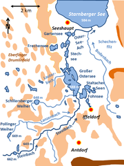
Steinbach Ostersee catchment.png 594 × 792; 137 KB
-
-
-
Sueddeutschland2.png 2,360 × 1,650; 1.8 MB
-
SuV 2013 krs.png 2,000 × 2,158; 868 KB
-
UBBasel Map 1576 Kartenslg AA 23 Deutschlandt.tiff 12,022 × 9,812, 2 pages; 337.51 MB
-
Verbreitung des Familienname Mähl Deutschland - relativ.png 1,060 × 865; 265 KB
-
Verteilung Nachname Kipf DE.png 2,814 × 3,841; 1.31 MB
-
Verteilung von Büttel-Orten in Deutschland.png 865 × 1,200; 257 KB
-
Villa Stürcke, Erfurt, Gorkistraße 6, Lageplan.png 595 × 549; 94 KB
-
Volksbank Osterburg-Lüchow-Dannenberg Filialkarte 2012.gif 738 × 528; 159 KB
-
Wand-Karte von Deutschland für Schulen (II. verbesserk Auflage) - btv1b53027475w.jpg 12,877 × 15,452; 31.14 MB
-
Wehrhoff Stasi Akte Grenzgebiet Flucht 08.06.1989.jpg 2,338 × 1,700; 1.2 MB
-
WikipediaWeekly episode 2.png 300 × 300; 46 KB
-
WWF Karte Deutschland 2015.png 2,480 × 2,480; 192 KB
-
Übersichtskarte.png 1,979 × 2,518; 7.62 MB
-
Консульські округи України в Німеччині.svg 630 × 840; 95 KB
-
فرانكيا الشرقية في عام 871.png 3,590 × 3,590; 188 KB
-
神圣罗马帝国地图-1789(中文).png 2,650 × 2,160; 2.66 MB