Flag map of the world: Difference between revisions
Tags: Mobile edit Mobile web edit |
Tags: Mobile edit Mobile web edit |
||
| Line 1,115: | Line 1,115: | ||
Flag-map of Sevastopol.svg|Sevastopol City |
Flag-map of Sevastopol.svg|Sevastopol City |
||
Flag-map of Sumy Oblast.svg|Sumy Oblast |
Flag-map of Sumy Oblast.svg|Sumy Oblast |
||
Ternopil-flag-map.png|Ternopil Oblast |
|||
Flag-map of Vinnytsia Oblast.svg|Vinnytsia Oblast |
Flag-map of Vinnytsia Oblast.svg|Vinnytsia Oblast |
||
Flag-map of Volyn Oblast.svg|Volyn Oblast |
Flag-map of Volyn Oblast.svg|Volyn Oblast |
||
Revision as of 13:51, 5 September 2022
The Flag map set has some common characteristics for all its flag-maps:
World flags
For a list of countries and their flags, see the following links to the English Wikipedia:
- African countries
- Flag of Antarctica
- Asian countries
- European countries
- North American countries
- Oceanian countries
- South American countries
The ultimate goal is a scalable, recognizable flag for every country in the world. Currently there is the following set, grouped by continent and alphabetically by country;
Syntax
Flag-map of ("country, entry, state, department, province, community, organization" ).svg
What is SVG?
Scalable vector graphics (SVG) is an XML specification and file format for describing two-dimensional vector graphics, both static and animated. It is stored plain-text or compressed (binary). It allows embedding of raster graphics (bitmaps) and text. See:
- Scalable Vector Graphics for detailed description
- SVG examples
SVG file type tags
For making use of elements from other SVG images available on Commons, please use {{AttribSVG}} – see Category:Vector images using elements from other vector images
All validated SVGs should be tagged {{Image generation}}, you will find them automatically sorted at Category:Valid SVG. Please do not categorize directly.
North America
-
Canada
-
Greenland
-
Mexico
-
Belize
-
Costa Rica
-
El Salvador
-
Guatemala
-
Honduras
-
Nicaragua
-
Panama
-
United States


Canada
-
Alberta
-
British Columbia
-
Manitoba
-
New Brunswick
-
Newfoundland and Labrador
-
Northwest Territories
-
Nova Scotia
-
Nunavut
-
Ontario
-
Prince Edward Island
-
Quebec
-
Saskatchewan
-
Yukon Territory


Canadian Cities
-
Calgary (Alberta)
-
Montreal (Quebec)
-
Ottawa (Ontario)
-
Quebec City (Quebec)
-
Toronto (Ontario)
-
Vancouver (British Columbia)


United States
States
-
Alabama
-
Alaska
-
Arizona
-
Arkansas
-
California
-
Colorado
-
Connecticut
-
Delaware
-
Florida
-
Georgia
-
Hawaii
-
Idaho
-
Illinois
-
Indiana
-
Iowa
-
Kansas
-
Kentucky
-
Louisiana
-
Maine
-
Maryland
-
Massachusetts
-
Michigan
-
Minnesota
-
Mississippi
-
Missouri
-
Montana
-
Nebraska
-
Nevada
-
New Hampshire
-
New Jersey
-
New Mexico
-
New York
-
North Carolina
-
North Dakota
-
Ohio
-
Oklahoma
-
Oregon
-
Pennsylvania
-
Rhode Island
-
South Carolina
-
South Dakota
-
Tennessee
-
Texas
-
Utah
-
Vermont
-
Virginia
-
Washington
-
West Virginia
-
Wisconsin
-
Wyoming


Federal District
-
District of Columbia

United States Territories
-
American Samoa
-
Guam
-
Northern Mariana Islands
-
Puerto Rico
-
U.S. Virgin Islands
-
USNB Guantanamo Bay


United States Minor Outlying Islands
-
Baker Island
-
Howland Island
-
Jarvis Island
-
Johnston Atoll
-
Kingman Reef
-
Midway Atoll
-
Navassa Island
-
Palmyra Atoll
-
Wake Island


United States Counties and Cities
-
Chicago City (Illinois)
-
Detroit City (Michigan)
-
Hagåtña (Guam)
-
Honolulu (Hawaii)
-
Los Angeles City (California)
-
Los Angeles County (California)
-
New York City (New York)
-
Philadelphia City and County (Pennsylvania)
-
San Francisco City and County (California)


Mexico
-
Aguascalientes
-
Baja California
-
Baja California Sur
-
Campeche
-
Chiapas


Central America
-
Belize
-
Costa Rica
-
El Salvador
-
Guatemala
-
Honduras
-
Nicaragua
-
Panama
Caribbean
-
Antigua and Barbuda
-
Bahamas
-
Barbados
-
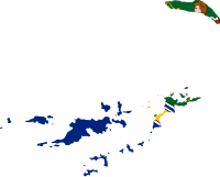
Cuba
-
Dominica
-
Dominican Republic
-
Grenada
-
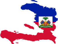
Haiti
-
Jamaica
-
Puerto Rico
-
Saint Kitts and Nevis
-
Saint Lucia
-
Saint Vincent and the Grenadines
-
Trinidad and Tobago


Antigua and Barbuda
-
Barbuda

Dependencies
-
Anguilla
-
Aruba
-
Bajo Nuevo Bank
-
British Virgin Islands
-
Bonaire
-
Cayman Islands
-
Curaçao
-
Guadeloupe
-
Martinique
-
Montserrat
-
Puerto Rico
-
Saba
-
Saint Barthélemy
-
Sint Eustatius
-
Sint Maarten
-
Saint Martin
-
Saint Pierre and Miquelon
-
Turks and Caicos Islands
-
USNB Guantanamo Bay
-
United States Virgin Islands


South America
-
Argentina
-
Bolivia
-
Brazil
-
Chile
-
Colombia
-
Ecuador
-
Falkland Islands
-
French Guiana
-
Guyana
-
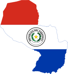
Paraguay
-
Peru
-
South Georgia and the South Sandwich Islands
-
Suriname
-
Uruguay
-
Venezuela


Dependencies
-
Falkland Islands
-
French Guiana
-
Pitcairn Islands
-
South Georgia and the South Sandwich Islands
Argentina
-
Autonomous City of Buenos Aires
-
Buenos Aires
-
Chaco
-
Chubut
-
Córdoba
-
Corrientes
-
Entre Rios
-
Formosa
-
Jujuy
-
La Pampa
-
La Rioja
-
Mendoza
-
Misiones
-
Rio Negro
-
Salta
-
San Luis
-
Santa Cruz
-
Santa Fe
-
Tierra del Fuego, Antarctica and South Atlantic Islands
-
Tucumán


Brazil
-
Acre
-
Alagoas
-
Amapa
-
Amazonas
-
Bahia
-
Ceará
-
Distrito Federal
-
Espirito Santo
-
Goias
-
Maranhão
-
Mato Grosso
-
Mato Grosso do Sul
-
Minas Gerais
-
Para
-
Paraíba
-
Parana
-
Pernambuco
-
Piaui
-
Rio de Janeiro
-
Rio Grande do Norte
-
Rio Grande do Sul
-
Rondônia
-
Roraima
-
Santa Catarina
-
São Paulo
-
São Paulo (State)
-
Sergipe
-
Tocantins


Chile
-
Antofagasta
-
Arica y Parinacota
-
Atacama
-
Chilean Antarctic Territory
-
Easter Island
-
Magallanes y Antártica Chilena
-
Santiago de Chile


Colombia
-
Atlántico
-
Casanare
-
Cundinamarca
-
San Andrés, Providencia and Santa Catalina


Ecuador
-
Azuay
-
Bolivar
-
Cañar
-
Chimborazo
-
Cotopaxi
-
El Oro
-
Esmeraldas
-
Galapagos Islands
-
Guayas
-
Imbabura
-
Loja
-
Los Rios
-
Manabi
-
Morona Santiago
-
Napo
-
Orellana
-
Pastaza
-
Pichincha
-
Santa Elena
-
Santo Domingo de los Tsachilas
-
Sucumbios
-
Tungurahua
-
Zamora Chinchipe


Peru
-
Amazonas
-
Ancash
-
Apurimac
-
Arequipa
-
Ayacucho
-
Cajamarca
-
Callao
-
Cusco
-
Huancavelica
-
Huánuco
-
Ica
-
Junín
-
La Libertad
-
Lambayeque
-
Lima Region
-
Loreto
-
Madre de Dios
-
Moquegua
-
Pasco
-
Piura
-
Puno
-
San Martin
-
Tacna
-
Tumbes
-
Ucayali


Cities
-
Arequipa
-
Chiclayo
-
Chimbote
-
Callao
-
Cusco
-
Huancayo
-
Iquitos
-
Lima
-
Piura
-
Trujillo


Asia
-
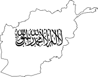
Afghanistan
-
Armenia
-
Azerbaijan
-
Bahrain
-
Bangladesh
-
Bhutan
-
Brunei
-
Cambodia
-
China
-
Cyprus
-
East Timor
-
Georgia
-
India
-
Indonesia
-
Iran
-
Iraq
-
Israel
-
Japan
-
Jordan
-
Kazakhstan
-
Kuwait
-
Kyrgyzstan
-
Laos
-
Lebanon
-
Malaysia
-
Maldives
-
Mongolia
-
Myanmar
-
Nepal
-
North Korea
-
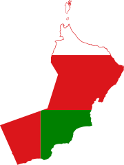
Oman
-
Pakistan
-
Palestine
-
Philippines
-
Qatar
-
Saudi Arabia
-
Singapore
-
South Korea
-
Sri Lanka
-
Syria
-
Tajikistan
-
Thailand
-
Turkey
-
Turkmenistan
-
United Arab Emirates
-
Uzbekistan
-
Vietnam
-
Yemen


Unrecognized states
-
Abkhazia
-
Adjara
-
Artsakh
-
Kurdistan
-
Northern Cyprus
-
South Ossetia
-
Republic of China (Taiwan)


Dependencies
-
Akrotiri and Dhekelia
-
British Indian Ocean Territory
-
Christmas Island
-
Cocos (Keeling) Islands
-
Hong Kong
-
Macau


Azerbaijan
-
Artsakh
-
Nakhchivan
-
Talyshistan


People's Republic of China
-
Hong Kong
-
Inner Mongolia (Unofficial Flag)
-
Macau
-
Taiwan (Chinese Claim)
-
Tibet
-
Xinjiang


Georgia
-
Abkhazia
-
South Ossetia

India
-
Jammu and Kashmir

Indonesia
-
Aceh
-
Bangka Belitung
-
Bengkulu
-
East Kalimantan
-
Jambi
-
Lampang
-
North Sumatra
-
Riau
-
Riau Islands
-
South Sumatra
-
West Sumatra


Japan
-
Aichi
-
Akita
-
Aomori
-
Chiba
-
Ehime
-
Fukui
-
Fukuoka
-
Fukushima
-
Gifu
-
Gunma
-
Hiroshima
-
Hokkaido
-
Hyōgo
-
Ibaraki
-
Ishikawa
-
Iwate
-
Kagawa
-
Kagoshima
-
Kanagawa
-
Kōchi
-
Kumamoto
-
Kyoto
-
Mie
-
Miyagi
-
Miyazaki
-
Nagano
-
Nagasaki
-
Nara
-
Niigata
-
Ōita
-
Okayama
-
Okinawa
-
Osaka
-
Saga
-
Saitama
-
Shiga
-
Shimane
-
Shizuoka
-
Tochigi
-
Tokushima
-
Tokyo
-
Tottori
-
Toyama
-
Wakayama
-
Yamagata
-
Yamaguchi
-
Yamanashi


Malaysia
-
Johor
-
Kelantan
-
Kuala Lumpur
-
Labuan
-
Malacca
-
Negeri Sembilan
-
Pahang
-
Penang
-
Perak
-
Perlis
-
Putrajaya
-
Selangor
-
Sabah
-
Sarawak
-
Terengganu


Myanmar
-
Chin
-
Shan
-
Yangon


Pakistan
-
Azad Jammu and Kashmir
-
Balochistan

Sri Lanka
-
Central
-
Eastern
-
North Central
-
Northern
-
North Western
-
Sabaragamuwa
-
Southern
-
Uva
-
Western


Vietnam
-
Hanoi

Oceania
-
Australia
-
Federated States of Micronesia
-
Fiji
-
Kiribati
-
Marshall Islands
-
Nauru
-
New Zealand
-
Palau
-
Papua New Guinea
-
Samoa
-
Solomon Islands
-
Tonga
-
Tuvalu
-
Vanuatu


Dependencies
-
American Samoa
-
Ashmore and Cartier Islands
-
Chatham Islands
-
Christmas Island
-
Clipperton Island
-
Cocos (Keeling) Islands
-
Cook Islands
-
Coral Sea Islands
-
Easter Island
-
French Polynesia
-
Galapagos
-
Guam
-
Hawaii
-
Jervis Bay Territory
-
Johnston Atoll
-
Kingman Reef
-
New Caledonia
-
Niue
-
Norfolk Island
-
Northern Mariana Islands
-
Pitcairn Islands
-
Tokelau
-
Wake Island
-
Wallis and Futuna


Australia
-
Christmas Island
-
Cocos (Keeling) Islands
-
New South Wales
-
Northern Territory
-
Queensland
-
South Australia
-
Tasmania
-
Victoria
-
West Australia


Guam
Municipality
-
Hagåtña

New Zealand
-
Chatham Islands
-
Cook Islands
-
Niue
-
Tokelau
Papua New Guinea
-
Autonomous Region of Bougainville

Europe
-
Albania
-
Andorra
-
Austria
-
Belarus
-
Belgium
-
Bosnia and Herzegovina
-
Bulgaria
-
Croatia
-
Czechia
-
Denmark
-
Estonia
-
Finland
-
France
-
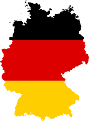
Germany
-
Greece
-
Hungary
-
Iceland
-
Ireland
-
Italy
-
Latvia
-
Liechtenstein
-
Lithuania
-
Luxembourg
-
Malta
-
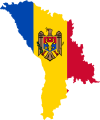
Moldova
-
Monaco
-
Montenegro
-
Netherlands
-
North Macedonia
-
Norway
-
Poland
-
Portugal
-
Romania
-
Russia
-
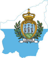
San Marino
-
Serbia
-
Slovakia
-
Slovenia
-
Spain
-
Sweden
-
Switzerland
-
Ukraine
-
United Kingdom
-
Vatican City


Unrecognized States
-
Donetsk People's Republic
-
Kosovo
-
Luhansk People's Republic
-
Republc of Srpska
-
Transnistria


Dependencies
-
Åland
-
Corsica
-
Crimea
-
Faroe Islands
-
Gagauzia
-
Gibraltar
-
Guernsey
-
Heligoland
-
Isle of Man
-
Jan Mayen
-
Jersey
-
Svalbard


Austria
-
Burgenland
-
Carinthia
-
Lower Austria
-
Salzburg
-
Styria
-
Tyrol
-
Upper Austria
-
Vienna
-
Voralberg


Belarus
-
Brest Region
-
Gomel Region
-
Grodno Region
-
Minsk Region
-
Minsk
-
Mogilev Region
-
Vitebsk Region


Belgium
-
Brussels Capital Region
-
Flanders Region
-
German-speaking Community of Belgium
-
Walloonia


Czechia
-
Central Bohemian Region
-
Hradec Králové Region
-
Karlovy Vary Region
-
Liberec Region
-
Moravian-Silesian Region
-
Olomouc Region
-
Pardubice Region
-
Plzeň Region
-
South Bohemian Region
-
South Moravian Region
-
Ústí nad Labem Region
-
Vysočina Region
-
Zlín Region


Estonia
-
Petseri

Finland
-
Kainuu
-
Lapland
-
North Karelia
-
Uusima


Cities
-
Helsinki
-
Rovaniemi


France
-
Brittany
-
Corsica
-
Normandy
-
Pays de la Loire
-
Provence-Alpes-Côte d'Azur


Overseas Territory
-
Clipperton Island
-
French Guiana
-
French Polynesia
-
French Southern and Antarctic Lands
-
Guadeloupe
-
Kerguelen Islands
-
Martinique
-
Mayotte
-
New Caledonia
-
Réunion
-
Saint Barthélemy
-
Saint Martin
-
Saint Pierre and Miquelon
-
Wallis and Futuna


Former Regions
-
Aquitaine
-
Auvergne
-
Limousin
-
Lorraine


Germany
-
Baden-Württemberg
-
Bavaria
-
Berlin
-
Brandenburg
-
Bremen
-
Hamburg
-
Hesse
-
Lower Saxony
-
Mecklenburg-Vorpommern
-
North Rhine-Westphalia
-
Rhineland-Palatinate
-
Saarland
-
Saxony
-
Saxony-Anhalt
-
Schleswig-Holstein
-
Thuringia


Hungary
-
Baranya County
-
Bács-Kiskun County
-
Békés County
-
Borsod-Abaúj-Zemplén County
-
Budapest
-
Csongrád-Csanád County
-
Fejér County
-
Győr-Moson-Sopron County
-
Hajdú-Bihar County
-
Heves County
-
Jász-Nagykun-Szolnok County
-
Komárom-Esztergom County
-
Nógrád County
-
Pest County
-
Somogy County
-
Szabolcs-Szatmár-Bereg County
-
Tolna County
-
Vas County
-
Veszprém County
-
Zala County


Italy
-
Abruzzo
-
Aosta Valley
-
Basilicata
-
Calabria
-
Campania
-
Lazio
-
Liguria
-
Lombardy
-
Marche
-
Molise
-
Piedmont
-
Sardinia
-
Sicily
-
Trentino-South Tyrol
-
Trieste
-
Tuscany
-
Umbria
-
Veneto


Spain
-
Andalucia
-
Aragon
-
Asturias
-
Balearic Islands
-
Basque Country
-
Canary Islands
-
Cantabria
-
Castile-La Mancha
-
Castile and León
-
Catalonia
-
Ceuta
-
Community of Madrid
-
Extremadura
-
Galicia
-
Huelva
-
La Rioja
-
Melilla
-
Murcia
-
Navarre
-
Valencia


Autonomous cities
-
Ceuta
-
Melilla
Netherlands
-
Aruba
-
Bonaire
-
Curaçao
-
Saba
-
Sint Eustatius
-
Sint Maarten
-
South Holland


Cities
-
Amsterdam

Poland
-
Kuyavian-Pomeranian Voivodeship
-
Łódzkie Voivodeship
-
Lublin Voivodeship
-
Lubusz Voivodeship
-
Warmian-Masurian Voivodeship


Russia
-
Adygea Republic
-
Altai Krai
-
Altai Republic
-
Amur Oblast
-
Arkhangelsk Oblast
-
Astrakhan Oblast
-
Bashkortostan Republic
-
Belgorod Oblast
-
Bryansk Oblast
-
Buryatia Republic
-
Chechnya Republic
-
Chelyabinsk Oblast
-
Chukotka Autonomous Okrug
-
Chuvashia Republic
-
Dagestan Republic
-
Ingushetia Republic
-
Irkutsk Oblast
-
Ivanovo Oblast
-
Jewish Autonomous Oblast
-
Kabardino-Balkaria Republic
-
Kaliningrad Oblast
-
Kalmykia Republic
-
Kaluga Oblast
-
Kamchatka Krai
-
Karachay-Cherkessia Republic
-
Karelia Republic
-
Kemerovo Oblast
-
Khabarovsk Krai
-
Khakassia Republic
-
Khanty–Mansi Autonomous Okrug – Yugra
-
Kirov Oblast
-
Komi Republic
-
Kostroma Oblast
-
Krasnodar Krai
-
Krasnoyarsk Krai
-
Kurgan Oblast
-
Kursk Oblast
-
Leningrad Oblast
-
Lipetsk Oblast
-
Magadan Oblast
-
Mari El Republic
-
Mordovia Republic
-
Moscow Federal City
-
Moscow Oblast
-
Murmansk Oblast
-
Nenets Autonomous Okrug
-
Nizhny Novgorod Oblast
-
North Ossetia–Alania Republic
-
Novgorod Oblast
-
Novosibirsk Oblast
-
Omsk Oblast
-
Oryol Oblast
-
Penza Oblast
-
Perm Krai
-
Primorsky Krai
-
Pskov Oblast
-
Rostov Oblast
-
Ryazan Oblast
-
Saint Petersburg Federal City
-
Sakha Republic (Yakutia)
-
Sakhalin Oblast
-
Samara Oblast
-
Saratov Oblast
-
Sevastopol Federal City
-
Smolensk Oblast
-
Stravopol Krai
-
Sverdlovsk Oblast
-
Tambov Oblast
-
Tatarstan Republic
-
Tula Oblast
-
Tuva Republic
-
Tver Oblast
-
Tyumen Oblast
-
Udmurtia Republic
-
Ulyanovsk Oblast
-
Vladimir Oblast
-
Volgograd Oblast
-
Vologda Oblast
-
Voronezh Oblast
-
Yamalo-Nenets Autonomous Okrug
-
Yaroslavl Oblast
-
Zabaykalsky Krai


Slovakia
-
Banská Bystrica
-
Bratislava
-
Žilina


Ukraine
-
Cherkasy Oblast
-
Chernihiv Oblast
-
Chernivtsi Oblast
-
Crimea Autonomous Region
-
Dnipropetrovsk Oblast
-
Donetsk Oblast
-
Ivano-Frankivsk Oblast
-
Kharkiv Oblast
-
Kherson Oblast
-
Khmelnytskyi Oblast
-
Kirovohrad Oblast
-
Kyiv City
-
Kyiv Oblast
-
Luhansk Oblast
-
Lviv Oblast
-
Mykolaiv Oblast
-
Odessa Oblast
-
Poltava Oblast
-
Rivne Oblast
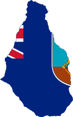
-
Sevastopol City
-
Sumy Oblast
-
Ternopil Oblast
-
Vinnytsia Oblast
-
Volyn Oblast
-
Zakarpattia Oblast
-
Zaporizhzhia Oblast
-
Zhytomyr Oblast


United Kingdom
-
England
-
Northern Ireland
(Ulster Banner) -
Scotland
-
Wales


Regions and cities
-
Cornwall
-
Cumbria and Lancashire
-
Belfast, Northern Ireland
-
Birmingham, England
-
Cardiff, Wales
-
Edinburgh, Scotland
-
Greater London, England


Crown Dependencies
-
Guernsey
-
Isle of Man
-
Jersey
Overseas Territories
-
Akrotiri and Dhekelia
-
Anguilla
-
Ascension Island
-
Bermuda
-
British Antarctic Territory
-
British Indian Ocean Territory
-
British Virgin Islands
-
Cayman Islands
-
Falkland Islands
-
Gibraltar
-
Montserrat
-
Pitcairn Islands
-
Saint Helena
-
South Georgia and the South Sandwich Islands
-
Tristan da Cunha
-
Turks and Caicos Islands


Africa
-
Algeria
-
Angola
-
Benin
-
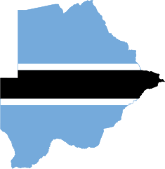
Botswana
-
Burkina Faso
-
Burundi
-
Cameroon
-
Cape Verde
-
Central African Republic
-
Chad
-
Comoros
-
Congo
-
Democratic Republic of Congo
-
Djibouti
-
Egypt
-
Equatorial Guinea
-
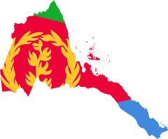
Eritrea
-
Eswatini
-
Ethiopia
-
Gabon
-
Gambia
-
Ghana
-
Guinea
-
Guinea-Bissau
-
Ivory Coast
-
Kenya
-
Lesotho
-
Liberia
-
Libya
-
Madagascar
-
Malawi
-
Mali
-
Mauritania
-
Mauritius
-
Morocco
-
Mozambique
-
Namibia
-
Niger
-
Nigeria
-
Rwanda
-
Sao Tome and Principe
-
Senegal
-
Seychelles
-
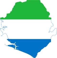
Sierra Leone
-
Somalia
-
South Africa
-
South Sudan
-
Sudan
-
Tanzania
-
Togo
-
Tunisia
-
Uganda
-
Zambia
-
Zimbabwe


Unrecognized States
-
Ambazonia
-
Azawad
-
Somaliland
-
Western Sahara


Dependencies
-
Ascension Island
-
Canary Islands
-
Ceuta
-
Madeira
-
Mayotte
-
Melilla
-
Reunion
-
Saint Helena
-
Tristan da Cunha


Angola
-
Barotseland
-
Cabinda


Democratic Republic of Congo
-
Sankuru

Egypt
-
Alexandria
-
North Sinai

Antarctica
-
Antarctica (True South Flag)
-
Antarctica (Graham Bartram Flag)
-
Bouvet Island
-
Chilean Antarctic Territory
-
French Southern And Antarctic Lands
-
Heard Island and McDonald Islands
-
Kerguelen Islands
-
Peter I Island
-
Ross Dependency
-
Tierra del Fuego, Antarctica and South Atlantic Islands


All
-
Afghanistan
-
Albania
-
Algeria
-
Andorra
-
Angola
-
Antigua and Barbuda
-
Argentina
-
Armenia
-
Aruba
-
Australia
-
Austria
-
Azerbaijan
-
Bahamas
-
Bahrain
-
Bangladesh
-
Barbados
-
Belarus
-
Belgium
-
Belize
-
Benin
-
Bermuda
-
Bhutan
-
Bolivia
-
Bosnia and Herzegovina
-
Botswana
-
Brazil
-
British Indian Ocean Territory
-
British Virgin Islands
-
Brunei
-
Bulgaria
-
Burkina Faso
-
Burundi
-
Cambodia
-
Cameroon
-
Canada
-
Cape Verde
-
Central African Republic
-
Chad
-
Chile
-
People's Republic of China
-
Christmas Island
-
Colombia
-
Comoros
-
Congo
-
Democratic Republic of Congo
-
Cook Islands
-
Costa Rica
-
Croatia
-
Cuba
-
Curacao
-
Cyprus
-
Czechia
-
Denmark
-
Dominica
-
Dominican Republic
-
Djibouti
-
Ecuador
-
Egypt
-
El Salvador
-
Equatorial Guinea
-
Eritrea
-
Estonia
-
Eswatini
-
Ethiopia
-
Falkland Islands
-
Faroe Islands
-
Fiji
-
Finland
-
France
-
Gabon
-
Gambia
-
Georgia
-
Germany
-
Ghana
-
Greece
-
Grenada
-
Guatemala
-
Guinea
-
Guinea-Bissau
-
Guyana
-
Haiti
-
Honduras
-
Hungary
-
Iceland
-
India
-
Indonesia
-
Iran
-
Iraq
-
Ireland
-
Israel
-
Italy
-
Ivory Coast
-
Jamaica
-
Japan
-
Jordan
-
Kazakhstan
-
Kenya
-
Kiribati
-
North Korea
-
South Korea
-
Kuwait
-
Kyrgyzstan
-
Laos
-
Latvia
-
Lebanon
-
Lesotho
-
Liberia
-
Libya
-
Liechtenstein
-
Lithuania
-
Luxembourg
-
Madagascar
-
Malaysia
-
Malawi
-
Maldives
-
Mali
-
Malta
-
Marshall Islands
-
Mauritania
-
Mauritius
-
Mexico
-
Moldova
-
Monaco
-
Mongolia
-
Montenegro
-
Morocco
-
Mozambique
-
Myanmar (Burma)
-
Namibia
-
Nauru
-
Nepal
-
Netherlands
-
New Zealand
-
Nicaragua
-
Niger
-
Nigeria
-
North Macedonia
-
Norway
-
Oman
-
Pakistan
-
Palau
-
Panama
-
Papua New Guinea
-
Paraguay
-
Peru
-
Philippines
-
Poland
-
Portugal
-
Qatar
-
Romania
-
Russia
-
Rwanda
-
Saint Kitts and Nevis
-
Saint Lucia
-
Saint Vincent and the Grenadines
-
Samoa
-
San Marino
-
Sao Tome and Principe
-
Saudi Arabia
-
Scotland
-
Senegal
-
Serbia
-
Seychelles
-
Sierra Leone
-
Singapore
-
Slovakia
-
Slovenia
-
Solomon Islands
-
Somalia
-
South Africa
-
South Sudan
-
Spain
-
Sri Lanka
-
Sudan
-
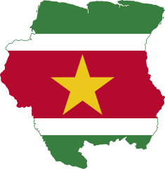
Suriname
-
Sweden
-
Switzerland
-
Syria
-
Tajikistan
-
Tanzania
-
Thailand
-
Timor-Leste
-
Togo
-
Tonga
-
Trinidad and Tobago
-
Tunisia
-
Turkey
-
Turkmenistan
-
Tuvalu
-
Uganda
-
Ukraine
-
United Arab Emirates
-
United Kingdom
-
United States
-
Uruguay
-
Uzbekistan
-
Vanuatu
-
Vatican City
-
Venezuela
-
Vietnam
-
Yemen
-
Zambia
-
Zimbabwe


Unrecognized States
-
Abkhazia
-
Adjara
-
Ambazonia
-
Artsakh
-
Donetsk
-
Kosovo
-
Luhansk
-
Northern Cyprus
-
Somaliland
-
South Ossetia
-
Republic of China (Taiwan)
-
Republic of Srpska
-
Transnistria
-
Western Sahara


Dependencies
-
Akrotiri and Dhekelia
-
Anguilla
-
Antartica
-
Åland
-
Ascension Island
-
Ashmore and Cartier Islands
-
Azores
-
Bajo Nuevo Bank
-
Baker Island
-
Barbuda
-
Bikini Atoll
-
Bonaire
-
Bouvet Island
-
Canary Islands
-
Cayman Islands
-
Ceuta
-
Chatham Islands
-
Chilean Antarctic Territory
-
Clipperton Island
-
Cocos (Keeling) Islands
-
Coral Sea Islands
-
Corsica
-
Easter Island
-
French Guiana
-
French Polynesia
-
French Southern And Antarctic Lands
-
Gagauzia
-
Galapagos
-
Gibraltar
-
Greenland
-
Guadeloupe
-
Guam
-
Guernsey
-
Hawaii
-
Heligoland
-
Hong Kong
-
Howland Island
-
Isle of Man
-
Jan Mayen
-
Jarvis Island
-
Jersey
-
Jervis Bay Territory
-
Johnston Atoll
-
Kerguelen Islands
-
Kingman Reef
-
Macau
-
Madeira
-
Martinique
-
Mayotte
-
Melilla
-
Midway Atoll
-
Montserrat
-
Navassa Island
-
New Caledonia
-
Niue
-
Norfolk Island
-
Northern Mariana Islands
-
Palmyra Atoll
-
Peter I Island
-
Pitcairn Islands
-
Puerto Rico
-
Reunion
-
Saba
-
Saint Barthélemy
-
Saint Helena
-
Saint Martin
-
Saint Pierre and Miquelon
-
San Andrés, Providencia and Santa Catalina
-
Sint Eustatius
-
Sint Maarten
-
South Georgia and the South Sandwich Islands
-
Svalbard
-
Tokelau
-
Tristan da Cunha
-
Turks and Caicos Islands
-
USNB Guantanamo Bay
-
Virgin Islands
-
Wake Island
-
Wallis and Futuna
-
Брэст