Category:Spokane, Washington
둘러보기로 이동
검색으로 이동
미국 워싱턴주에 위치한 도시  Vattenfall i Spokane   Spokane i Spokane County och Washington | |||||
| 미디어 올리기 | |||||
| 발음 (음성 파일) | |||||
|---|---|---|---|---|---|
| 다음 종류에 속함 | |||||
| 명칭의 유래 | |||||
| 위치 | 스포캔군, 워싱턴주, 태평양 북서부, 워싱턴주, Pacific States Region | ||||
| 다음 유역을 끼고 있음 | |||||
| 공용어 | |||||
| 행정부 수반 |
| ||||
| 설립자 |
| ||||
| 만들어진 날 |
| ||||
| 인구수 |
| ||||
| 면적 |
| ||||
| 해발고도 |
| ||||
| 다음과 다름 | |||||
| 공식 웹사이트 | |||||
 | |||||
하위 분류
다음은 이 분류에 속하는 하위 분류 20개 가운데 20개입니다.
A
B
- B. Schade Brewing Company (4 F)
C
- Central Steam Heat Plant (17 F)
G
I
M
P
R
S
- Spokane Public Library (4 F)
T
V
"Spokane, Washington" 분류에 속하는 미디어
다음은 이 분류에 속하는 파일 408개 가운데 200개입니다.
(이전 페이지) (다음 페이지)-
Flag of Spokane, Washington (1912–1958).svg 2,250 × 1,125; 5 KB
-
Flag of Spokane, Washington (2021–present).svg 512 × 288; 14 KB
-
-
02-05-16, spokane river - panoramio.jpg 2,048 × 1,409; 1.39 MB
-
20110319-SupermoonSpokaneWAUSA.JPG 409 × 402; 97 KB
-
500 Block Sumner.png 4,032 × 3,024; 16.78 MB
-
5MileSign.png 4,032 × 3,024; 18.43 MB
-
600 Block Sumner.png 3,809 × 2,105; 16.02 MB
-
8thAvenue&AshStreetSpokane.jpg 4,592 × 3,056; 6.56 MB
-
A panoram photograph of Spokane, Washington LCCN2007663012.tif 3,881 × 714; 7.93 MB
-
Abraham Lincoln - Statue in Downtown Spokane WA - USA.jpg 3,072 × 2,304; 3.13 MB
-
-
Alaska-Yukon-Pacific Exposition - Seattle, June 1-October 16, 1909 - Page 44.jpg 2,864 × 4,662; 3.03 MB
-
Arbor Crest Wine Cellars.jpg 800 × 533; 209 KB
-
Arrowleaf balsamroot.jpg 3,024 × 4,032; 2.44 MB
-
At Spokane Food Coop (36870778076).jpg 2,048 × 1,536; 916 KB
-
AvistaUtilities.jpg 4,592 × 3,056; 6.66 MB
-
Babys Clothes Never Worn.png 1,325 × 959; 236 KB
-
BabysClothesNeverWorn.jpg 574 × 403; 142 KB
-
Barnett House NRHP 03000809 Spokane County, WA.jpg 1,204 × 896; 549 KB
-
Below Spokane Falls (36870787416).jpg 2,048 × 1,536; 1.46 MB
-
BenBurrTrail.jpg 4,592 × 3,056; 6.88 MB
-
BenBurrTrailBend.jpg 4,592 × 3,056; 8.28 MB
-
BenBurrTrailBridge.jpg 4,592 × 3,056; 7.63 MB
-
Benny&JoonHouse.jpg 4,592 × 3,056; 5.25 MB
-
Better fruit (20341988176).jpg 2,485 × 3,375; 1.07 MB
-
Better fruit (Page 6) BHL5152799.jpg 2,423 × 3,421; 1.24 MB
-
Better fruit (Page 7) BHL5152800.jpg 2,423 × 3,421; 1.12 MB
-
Birchwood farm pics 113.jpg 2,625 × 2,447; 652 KB
-
Buena Vista Apartments Spokane.png 4,032 × 3,024; 19.8 MB
-
Burger Basket ice cream sign, E. Sprague Street, Spokane, Washington LCCN2017703728.tif 3,568 × 5,196; 106.13 MB
-
Burger Stop sign, Spokane, Washington LCCN2017709803.tif 5,325 × 3,655; 111.41 MB
-
Butcher Boy Meat Market, Spokane, Washington LCCN2017706733.tif 5,185 × 3,590; 106.55 MB
-
CalvaryBaptistChurchSpokane.jpg 4,592 × 3,056; 5.25 MB
-
Canada Flag Sculpture on Former World's Fair Site - Spokane WA - USA.jpg 2,304 × 3,072; 2.92 MB
-
Cannon Hill Pond.png 4,032 × 1,825; 12.77 MB
-
Carousel from across the lake - panoramio.jpg 2,931 × 734; 350 KB
-
-
Centennial Sculpture Harold Balazs 1978 Spokane.jpg 3,456 × 2,592; 7.75 MB
-
Central Steam Plant.JPG 1,944 × 2,592; 992 KB
-
-
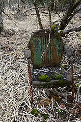
Chair by the River.jpg 4,000 × 6,016; 7.15 MB
-
Childhood Express Red Wagon Spokane.jpg 3,888 × 2,592; 10.2 MB
-
Clarke Ave PV.jpg 4,017 × 2,680; 7.97 MB
-
Cliff Park Grass Top.png 4,032 × 2,532; 11.97 MB
-
Cliff Park Sign.png 2,867 × 3,331; 20.57 MB
-
Cliff Park Stairs.png 3,024 × 4,032; 22.62 MB
-
CliffCannon Cliff Pano.png 9,683 × 2,388; 49.47 MB
-
CliffCannonSpokane.jpg 4,592 × 3,056; 5.75 MB
-
Cmglee Spokane Valley night aerial.jpg 1,024 × 1,536; 512 KB
-
CoastTradingCoGrainElevator.jpg 4,592 × 3,056; 4.59 MB
-
ComstockEntrance.png 4,032 × 3,024; 15.58 MB
-
-
Corbin Park Historical District, Spokane, WA.jpg 6,016 × 4,000; 12.04 MB
-
Corbin Park Sign.png 4,032 × 3,024; 25.89 MB
-
Covered Wagon Tavern, Spokane, Washington LCCN2017709387.tif 5,169 × 3,566; 105.52 MB
-
Cowley Park NRHP 73001891 Spokane County, WA.jpg 1,216 × 912; 1.17 MB
-
CW22KSKN.png 600 × 237; 31 KB
-
D. C. Corbin House 1900-1910.tif 6,566 × 10,150; 190.67 MB
-
-
DivisionStreetSpokane.jpg 4,592 × 3,056; 4.19 MB
-
DivisionStreetSpokane1.jpg 4,592 × 3,056; 5.72 MB
-
Downtown Spokane - panoramio.jpg 4,000 × 3,000; 4.35 MB
-
Driscoll Boulevard NW Spokane.png 4,032 × 3,024; 21.56 MB
-
DSC00786 (296943138).jpg 991 × 432; 120 KB
-
Dwight Merkel Sports Complex & Joe Albi Stadium.png 1,275 × 847; 1.74 MB
-
Dwight Merkel Sports Complex.png 4,032 × 3,024; 17.3 MB
-
East Valley HS Spokane 2011.jpg 635 × 419; 99 KB
-
ECAbdandonedHouse.jpg 4,592 × 3,056; 5.84 MB
-
Elevation of Hangman Creek - Spokane River Viaduct.png 1,381 × 230; 190 KB
-
En-us-Spokane.ogg 0.9 s; 19 KB
-
Exercise Group at Corbin Park, Spokane, WA.jpg 4,000 × 6,016; 9.68 MB
-
FerrisHighSchoolSpokane.jpg 4,592 × 3,056; 7.25 MB
-
Fishing in Spokane (27708889066).jpg 2,048 × 1,463; 2.9 MB
-
Flag of Spokane, Washington (1975–2021).svg 1,080 × 720; 17 KB
-
Flag of Spokane, Washington (2021).png 1,140 × 641; 111 KB
-
-
Fort George Wright, Washington, ca 1918 (WASTATE 1084).jpeg 768 × 586; 60 KB
-
Free coffee at Dutch Bros.jpg 1,879 × 1,213; 925 KB
-
Garden of Historic Fotheringham House - Spokane WA - USA.jpg 2,304 × 3,072; 3.08 MB
-
GarlandBusinessDistrictSpokane.jpg 4,592 × 3,056; 6.06 MB
-
GarlandDistrictSpokaneAtNight.jpg 4,592 × 3,056; 4.66 MB
-
GarlandTheaterAtDuskSpokane.jpg 4,592 × 3,056; 4.5 MB
-
Gibbs House Rockwood and Garfield.tif 1,508 × 1,066; 1.54 MB
-
Golden Age Beer 01.jpg 1,706 × 2,244; 1.55 MB
-
GrandBoulevardAtManito.jpg 4,592 × 3,056; 8.19 MB
-
Grandview Thorpe Road.png 4,032 × 3,024; 17.39 MB
-
Hays Park.png 4,032 × 3,024; 30.12 MB
-
Highland Boulevard Towers.png 4,032 × 3,024; 25.71 MB
-
Holiday Hills.png 2,913 × 225; 1.2 MB
-
Homes Under Maple PV.jpg 4,032 × 3,024; 14.28 MB
-
-
I-90SunsetHillSpokane.jpg 800 × 536; 398 KB
-
Indian Congress at Spokane Civic Center.tif 2,872 × 1,446; 11.88 MB
-
Indian Trail Park Spokane.png 4,032 × 3,024; 21.5 MB
-
IndianCanyonMysticFalls.jpg 4,592 × 3,056; 8.94 MB
-
Industrial Worker, Volume 1, Issue 01.png 632 × 901; 694 KB
-
Into the Earth (53009225661).jpg 6,000 × 4,000; 10.75 MB
-
ISS015-E-7200 - View of Washington.jpg 3,032 × 2,008; 1.91 MB
-
Jack and Dan's Wide.png 4,032 × 2,069; 9.99 MB
-
JeffersonStreetSpokane.jpg 4,592 × 3,056; 5.34 MB
-
Joe Albi Stadium.jpg 371 × 500; 261 KB
-
JoelEFerrisHighSchoolSpokane.jpg 4,592 × 3,056; 7.09 MB
-
Kardong Bridge.jpg 4,032 × 3,024; 3 MB
-
Kelly Plant Gardens materials BHL47321365.jpg 1,770 × 2,747; 451 KB
-
Kendall Yards and old West Central.png 4,031 × 1,866; 9 MB
-
Kendall Yards Homes.png 4,032 × 3,024; 19.08 MB
-
Kendall-Yards Summit-Parkway1.jpg 2,250 × 1,500; 2.53 MB
-
KHQ-TVBroadcastStudio.jpg 4,592 × 3,056; 4.41 MB
-
KQNT radio tower Spokane Valley (36888164792).jpg 1,536 × 2,048; 1.07 MB
-
KXLYBroadcastCenter.jpg 4,592 × 3,056; 5.31 MB
-
Latah Creek in Vinegar Flats.jpg 1,536 × 2,048; 597 KB
-
Latah Sediment.jpg 1,125 × 735; 747 KB
-
Latah Valley Eagle Ridge.png 4,030 × 1,869; 10.22 MB
-
Latah Valley, Spokane, WA, USA - panoramio (1).jpg 4,918 × 3,250; 6.7 MB
-
Latah Valley, Spokane, WA, USA - panoramio.jpg 4,928 × 3,264; 6.29 MB
-
Lawn and trees at Minnehaha Park, Spokane, Washington.jpg 2,592 × 1,936; 2.6 MB
-
-
Liberty Overview.png 4,032 × 3,024; 23.14 MB
-
Liberty Park Library.png 4,032 × 2,386; 12.23 MB
-
Liberty Park View.png 4,032 × 3,024; 23.68 MB
-
Littlebrook.jpg 6,016 × 3,230; 11.32 MB
-
Looff Carousel.JPG 3,072 × 2,304; 2.13 MB
-
Looking SW From Krell Hill, September 2012.jpg 960 × 720; 164 KB
-
LookingEastOnSpragueAvenue1890.jpg 840 × 648; 104 KB
-
Lower Dam from under the North Monroe St. Bridge. - panoramio.jpg 2,308 × 503; 145 KB
-
ManitoBoulevardParkway.jpg 4,592 × 3,056; 9.19 MB
-
ManitoBoulevardSpokane.jpg 4,592 × 3,056; 8.72 MB
-
Maple from Water Ave.jpg 3,024 × 4,032; 10.48 MB
-
Maple Playground PV.jpg 3,797 × 2,604; 12.16 MB
-
Maple PV.jpg 4,032 × 3,024; 13.29 MB
-
Marycliff Gatehouse.png 4,032 × 2,484; 20.69 MB
-
Metasequoias planted in 1950.jpg 3,024 × 4,032; 7.86 MB
-
Mine No 6 Va explosion.png 446 × 559; 315 KB
-
Minnehaha4.png 3,804 × 2,551; 18.17 MB
-
Monaghan Monument Spokane.png 2,584 × 3,211; 15.4 MB
-
MonroeStreetCorridorAtDuskSpokane.jpg 4,592 × 3,056; 4.31 MB
-
MonroeStreetSpokane.jpg 4,592 × 3,056; 4.88 MB
-
Moore-Turner Heritage Gardens downhill.png 4,032 × 3,024; 22.15 MB
-
Moore-Turner Heritage Gardens uphill.png 4,032 × 3,024; 23.83 MB
-
Moore-Turner House Spokane.tif 3,250 × 2,083; 19.38 MB
-
Morning Freeze.jpg 1,152 × 2,048; 701 KB
-
Nettleton's Summit Ave.jpg 4,032 × 3,024; 4.57 MB
-
-
Nighttime view of I-90 in Spokane, from Sunset Hill.jpg 1,152 × 600; 87 KB
-
NinthAvenueHistoricDistrictHousesSpokane.jpg 4,592 × 3,056; 8.47 MB
-
No-Li Brewhouse sign.jpg 2,688 × 1,520; 971 KB
-
North Indian Trail New Homes.png 4,032 × 2,074; 10.54 MB
-
NorthTownMallSpokane.jpg 4,592 × 3,056; 3.97 MB
-
Northwest Industrial Exposition 1890 Building.png 3,200 × 2,340; 9.67 MB
-
Northwest Spokane Street Scene.png 4,032 × 2,166; 11.52 MB
-
Official Spokane Flag - 1920 postcard.jpg 1,615 × 1,004; 166 KB
-
Old Hydroelectric turbine on display. (52188605726).jpg 4,032 × 3,024; 3.73 MB
-
Old Liberty Park View.png 4,032 × 3,024; 19.07 MB
-
Old National Bank & Paulsen Buildings, Spokane, Washington, ca1926.jpg 1,640 × 2,656; 3.08 MB
-
PapagorgioLookOutSpotSpokane.jpg 4,592 × 3,056; 5.03 MB
-
Park Scene with Street Person - Spokane, WA, USA (4007792980).jpg 3,072 × 2,304; 2.87 MB
-
Peerless-Sunpuft Inc. Office and Warehouse.png 3,270 × 3,023; 14.13 MB
-
Peking Garden sign, Spokane, Washington LCCN2017709793.tif 3,655 × 5,325; 111.42 MB
-
People's Gallery - Street Fresco - Spokane, WA, USA (4007816200).jpg 3,072 × 2,304; 3.09 MB
-
PerryStreetSpokane.jpg 4,592 × 3,056; 7.09 MB
-
Picking apples near Spokane Falls, Washington, ca 1885 (WASTATE 7).jpeg 768 × 598; 176 KB
-
Pine Lodge Motel, Spokane, Washington LCCN2017710431.tif 5,148 × 3,526; 103.9 MB
-
Plaque in Interior of Davenport Hotel - Spokane WA - USA.jpg 3,072 × 2,304; 3 MB
-
Post St from 1st Ave toward Sprague Ave, Spokane (CURTIS 795).jpeg 768 × 624; 88 KB
-
-
Post Street Substation Washington Water Power Sign.jpg 4,032 × 3,024; 3.13 MB
-
Qualchan hanging historical marker- 2014-04-12 18-49.jpg 3,264 × 2,448; 4.36 MB
-
-
-
RiverfrontParkSkateRibbonSkyRide.jpg 4,592 × 3,056; 5.94 MB
-
Riverpoint Observatory.JPG 2,592 × 1,944; 1.73 MB
-
Riverside Ave from Civic Building.tif 2,408 × 2,976; 6.85 MB
-
Riverside Ave looking east, Spokane, Washington, 1909 (WASTATE 582).jpeg 768 × 602; 103 KB
-
Riverside Ave, Spokane, Washington, ca 1923 (WASTATE 448).jpeg 768 × 609; 107 KB
-
Riverside Avenue looking east from W 400 block, Spokane, Washington, 1912.jpg 1,962 × 3,220; 2.14 MB
-
Riverside Parkway Spokane.png 3,686 × 2,975; 23.86 MB
-
Riverside Water Treatment Plant Spokane.jpg 4,032 × 3,024; 3.44 MB
-
Riverside, Spokane, WA, USA - panoramio (1).jpg 4,858 × 3,156; 4.68 MB
-
Riverside, Spokane, WA, USA - panoramio (11).jpg 4,732 × 2,936; 4.56 MB
-
Riverside, Spokane, WA, USA - panoramio (12).jpg 4,846 × 3,136; 3.02 MB
-
Riverside, Spokane, WA, USA - panoramio (13).jpg 3,264 × 4,928; 2.21 MB
-
Riverside, Spokane, WA, USA - panoramio (14).jpg 4,572 × 2,556; 2.8 MB
-
Riverside, Spokane, WA, USA - panoramio (15).jpg 4,750 × 2,970; 3.62 MB
-
Riverside, Spokane, WA, USA - panoramio (16).jpg 4,751 × 2,776; 3.45 MB
-
Riverside, Spokane, WA, USA - panoramio (17).jpg 4,538 × 2,624; 3.45 MB
-
Riverside, Spokane, WA, USA - panoramio (19).jpg 4,762 × 2,992; 5.8 MB
-
Riverside, Spokane, WA, USA - panoramio (2).jpg 4,876 × 3,182; 4.49 MB
-
Riverside, Spokane, WA, USA - panoramio (20).jpg 3,244 × 4,914; 5.06 MB
-
Riverside, Spokane, WA, USA - panoramio (21).jpg 2,942 × 4,736; 4.33 MB
-
Riverside, Spokane, WA, USA - panoramio (22).jpg 4,658 × 2,834; 4.01 MB
-
Riverside, Spokane, WA, USA - panoramio (27).jpg 4,768 × 3,002; 5.29 MB
-
Riverside, Spokane, WA, USA - panoramio (28).jpg 4,828 × 3,106; 5.39 MB
-
Riverside, Spokane, WA, USA - panoramio (29).jpg 4,918 × 3,248; 5.01 MB
-
Riverside, Spokane, WA, USA - panoramio (3).jpg 4,916 × 3,246; 5.74 MB
-
Riverside, Spokane, WA, USA - panoramio (30).jpg 4,918 × 3,248; 6.68 MB
-
Riverside, Spokane, WA, USA - panoramio (31).jpg 4,197 × 2,648; 3.66 MB
-
Riverside, Spokane, WA, USA - panoramio (32).jpg 4,800 × 3,060; 6.22 MB
-
Riverside, Spokane, WA, USA - panoramio (33).jpg 4,808 × 3,072; 5.67 MB
-
Riverside, Spokane, WA, USA - panoramio (34).jpg 4,856 × 3,152; 6.53 MB