Category:Balochistan
Vai alla navigazione
Vai alla ricerca

Definition
[modifica]العربية: بَلوشِستان هي منطقة جغرافية تقع في تقاطع جنوب و المرکز و الغرب الآسيا، ضمن حدود الأفغانستان و إيران و باکستان و يشكل البلوش غالبية سكان هذه المنطقة.
English: Balochistan is the name of a geographical and cultural region located at the
convergence of Central, South and West Asia, inhabited predominantly by the Baloches.
Türkçe: Belucistan, Güneybatı Asya'da Beluçların yaşadığı kurak ve dağlık bir bölgedir. Pakistan'ın Belucistan eyaleti, İran'ın Sistan ve Belucistan eyaleti ile Afganistan'ın Nimruz, Helmend ve Kandehar vilayetlerinin de bulunduğu güney bölgelerini içeriyor.
فارسی: بلوچستان نام تاریخی منطقهای است در محل تقاطع جنوب، مرکز و غرب آسیا که مردم بلوچ از زمان های دور در آن سکونت داشته اند و امروزه میان سه کشور افغانستان, ایران, پاکستان تقسیم شده است.
| Category Balochistan on sister projects: | |||||||||
|---|---|---|---|---|---|---|---|---|---|
Regione dell'Asia sud-occidentale   | |||||
| Carica un file multimediale | |||||
| Istanza di | |||||
|---|---|---|---|---|---|
| Prende il nome da | |||||
| Luogo | altopiano iranico, Iran | ||||
| Situato sul mare / lago / fiume | |||||
| Consiste di | |||||
| Evento significativo |
| ||||
 | |||||
Sottocategorie
Questa categoria contiene le 15 sottocategorie indicate di seguito, su un totale di 15.
File nella categoria "Balochistan"
Questa categoria contiene 43 file, indicati di seguito, su un totale di 43.
-
001220-Gurdim-IMG 1100-2.jpg 3 000 × 2 000; 691 KB
-
1855 Colton Map of Balochistan.jpg 1 068 × 743; 275 KB
-
2021 Balochistan earthquake.jpg 612 × 684; 123 KB
-
A General Sketch of Political History from the Earlist Times - India.jpg 2 467 × 1 926; 849 KB
-
Abulmalek molazadah.jpg 186 × 272; 24 KB
-
Abulmalek molazadah1.jpg 414 × 715; 70 KB
-
Abulmalek molazadah2.jpg 640 × 440; 68 KB
-
Aomar Karim.jpg 600 × 363; 50 KB
-
Aslam-Baloch-Dr-Allah-Nazar.jpg 827 × 400; 93 KB
-
Autonomous regions in the Middle East and Asia.jpg 720 × 694; 204 KB
-
Balochistan Map at its greatest extent - 18th century.jpg 1 280 × 670; 38 KB
-
Balochistan Map.jpg 1 800 × 1 440; 552 KB
-
Baluchistan and Sistan province.jpg 720 × 658; 62 KB
-
LL-Q809 (pol)-Olaf-Beludżystan.wav 1,4 s; 131 KB
-
British Raj-es.svg 1 201 × 1 007; 176 KB
-
BYAC logo.png 300 × 300; 8 KB
-
District Gazetteer Mastung 2020.jpg 951 × 1 280; 110 KB
-
Free Balochistan poster, London.jpg 736 × 325; 70 KB
-
Godrouch1.jpg 1 038 × 1 326; 1,14 MB
-
Hasya karim bux.jpg 1 280 × 720; 83 KB
-
Hosseinhaft.jpg 258 × 311; 102 KB
-
Independent Balochistan Map.jpg 2 880 × 2 160; 1,46 MB
-
Justiceforbalochwomen.jpg 400 × 400; 164 KB
-
Justiceforbalochwomenhasya.jpg 851 × 315; 209 KB
-
Luminescent beaches in Chabahar.jpg 1 497 × 1 200; 237 KB
-
Luminescent beaches in Chabahar2.jpg 600 × 400; 42 KB
-
Luminescent beaches in Chabahar3.jpg 2 376 × 1 584; 477 KB
-
Luminescent beaches in Chabahar4.jpg 3 000 × 2 000; 718 KB
-
Mahrang Baloch.jpg 1 825 × 2 951; 1,66 MB
-
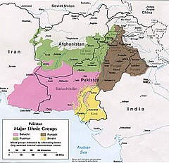
Major ethnic groups of Pakistan in 1980 borders removed.jpg 960 × 928; 182 KB
-
Map of Baluchistan States Union and British Baluchistan.png 700 × 600; 20 KB
-
Mir Muhammad Murad Mullazai (prime Minister Of Riyasat -E-Kalat).jpg 417 × 556; 42 KB
-
Mitchell Map 1850 country of Balochistan.jpg 1 235 × 737; 442 KB
-
Mohsen New Shoot.jpg 5 906 × 3 456; 4,7 MB
-
Mohsenbaloch2.jpg 1 000 × 750; 83 KB
-
Mohsenbaloch3.jpg 1 080 × 608; 58 KB
-
Pakistan Balochistan Provincial Assembly 08042022.svg 360 × 185; 6 KB
-
Pashtoon Culture.jpg 2 154 × 3 391; 3,45 MB
-
-
Shaheed Gul Bahar Bugti.jpg 479 × 479; 15 KB
-
-
The Jamali Tribe.png 270 × 148; 1 KB
-
میر احمد خان سوم احمدزایی بلوچ.jpg 986 × 1 040; 556 KB