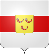
Category:Heuvelland
Jump to navigation
Jump to search
municipality in West Flanders, Belgium | |||||
| Upload media | |||||
| Instance of | |||||
|---|---|---|---|---|---|
| Part of |
| ||||
| Location | Arrondissement of Ypres, West-Vlaanderen, Vlaams Gewest, Belhika | ||||
| Capital | |||||
| Official language | |||||
| Head of government |
| ||||
| Legal form |
| ||||
| Inception |
| ||||
| Population |
| ||||
| Area |
| ||||
| Elevation above sea level |
| ||||
| official website | |||||
 | |||||
Mga ubos-nga-kaarangay
Ini nga kaarangay mayda han mga nasunod nga 17 nga mga ubos-nga-kaarangay, tikang hin 17 nga kabug-osan.
B
C
- Command Bunker Kemmel (2 F)
L
- Letter boxes in Heuvelland (18 F)
M
- Maps of Heuvelland (11 F)
O
R
S
Media ha kaarangay nga "Heuvelland"
An mga nasunod nga 28 ka mga fayl aada han hini nga kaarangay, tikang hin 28 nga kabug-osan.
-
Heuvelland vlag.gif 324 × 216; 2 nga KB
-
Aardappelgal, doormiddengesneden.jpg 5,312 × 2,988; 1.16 nga MB
-
Bronnen van het Heuvelland Natuurpunt.jpg 2,048 × 1,536; 667 nga KB
-
Entre-Deux-Monts Heuvelland.jpg 2,048 × 1,536; 641 nga KB
-
First Aid Bunker near Mount Kemmel - panoramio.jpg 1,702 × 1,327; 1.6 nga MB
-
Blason Heuvelland.svg 600 × 660; 12 nga KB
-
Blason ville be Heuvelland.svg 600 × 660; 85 nga KB
-
Flag of Heuvelland.svg 600 × 400; 697 nga B
-
Heuvelland vanaf de Rodeberg.jpg 640 × 480; 57 nga KB
-
Heuvelland Vlag - 22561 - onroerenderfgoed.jpg 1,000 × 1,500; 116 nga KB
-
Heuvelland Wapen - 22562 - onroerenderfgoed.jpg 1,000 × 1,500; 126 nga KB
-
Heuvelland wapen.gif 94 × 104; 4 nga KB
-
Heuvelland wapen.jpg 135 × 140; 4 nga KB
-
Heuvelland wapen.svg 554 × 638; 37 nga KB
-
Heuvellandpanorama09.jpg 4,596 × 468; 501 nga KB
-
Near Dranouter (9613997269).jpg 3,405 × 1,692; 3.75 nga MB
-
Near Rodeberg (9614021693).jpg 3,572 × 1,841; 3.62 nga MB
-
Near Rodeberg (9617252654).jpg 2,202 × 2,383; 3.38 nga MB
-
Near Rodeberg (9617266396).jpg 2,717 × 1,118; 1.83 nga MB
-
Near Rodeberg (9617277686).jpg 3,648 × 2,736; 6.01 nga MB
-
Photography Q27530.jpg 463 × 800; 97 nga KB
-
S. K Nieuwkerke (9186016813).jpg 3,648 × 2,736; 6.85 nga MB
-
S. K Nieuwkerke (9186029399).jpg 3,648 × 2,736; 6.86 nga MB
-
S. K Nieuwkerke (9186035601).jpg 3,544 × 2,592; 6.69 nga MB
-
S. K Nieuwkerke (9188820634).jpg 3,648 × 2,736; 7.3 nga MB
-
S. K Nieuwkerke (9188838686).jpg 3,640 × 2,726; 6.33 nga MB
-
S. K Nieuwkerke (9188844262).jpg 3,648 × 2,736; 6.57 nga MB
-
Tussen Dranouter en Nieuwkerke - panoramio.jpg 3,000 × 2,253; 3.37 nga MB


