Category:Maps by Nilfanion
Media in category "Maps by Nilfanion"
The following 200 files are in this category, out of 2,022 total.
(previous page) (next page)-
20200421163557!Christchurch UK locator map.svg 1,425 × 990; 997 KB
-
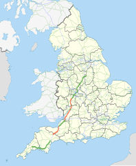
A38 UK road map.svg 1,108 × 1,345; 2.22 MB
-
Abbey River (Devon) map.png 1,518 × 880; 140 KB
-
Aberdeen new routes map.svg 1,425 × 1,189; 638 KB
-
Aberdeen UK blank map.svg 1,425 × 1,189; 671 KB
-
Aberdeen UK location map.svg 1,425 × 1,189; 630 KB
-
Aberdeen UK parish map (blank).svg 1,425 × 1,189; 720 KB
-
Aberdeen UK relief location map.jpg 2,003 × 1,670; 213 KB
-
Aberdeen UK ward map (blank).svg 1,425 × 1,189; 823 KB
-
Aberdeen UK ward map 2017 (blank).svg 1,425 × 1,189; 796 KB
-
Aberdeenshire UK blank map.svg 1,425 × 1,253; 1.12 MB
-
Aberdeenshire UK location map.svg 1,425 × 1,253; 1.84 MB
-
Aberdeenshire UK parish map (blank).svg 1,425 × 1,253; 1.68 MB
-
Aberdeenshire UK relief location map.jpg 2,000 × 1,758; 519 KB
-
Aberdeenshire UK ward map (blank).svg 1,425 × 1,253; 1.49 MB
-
Aberdeenshire UK ward map 2017 (blank).svg 1,425 × 1,253; 1.52 MB
-
Adur UK locator map.svg 1,425 × 995; 896 KB
-
Adur UK ward map 2010 (blank).svg 1,425 × 1,170; 190 KB
-
Allerdale UK ward map 2010 (blank).svg 1,015 × 1,345; 881 KB
-
Amber Valley UK locator map.svg 884 × 1,305; 1,000 KB
-
Amber Valley UK ward map 2010 (blank).svg 1,170 × 1,305; 500 KB
-
Angus UK blank map.svg 1,425 × 1,400; 834 KB
-
Angus UK location map.svg 1,425 × 1,400; 1.14 MB
-
Angus UK parish map (blank).svg 1,425 × 1,400; 1.07 MB
-
Angus UK relief location map.jpg 1,998 × 1,962; 471 KB
-
Angus UK ward map (blank).svg 1,425 × 1,400; 1.01 MB
-
Angus UK ward map 2017 (blank).svg 1,425 × 1,400; 1 MB
-
Anlaby with Anlaby Common UK parish locator map.svg 1,425 × 1,107; 1.68 MB
-
AONB within Cornwall map.svg 1,224 × 1,187; 1.36 MB
-
Argyll and Bute UK blank map.svg 1,336 × 1,384; 3.15 MB
-
Argyll and Bute UK location map.svg 1,336 × 1,384; 3.65 MB
-
Argyll and Bute UK parish map (blank).svg 1,336 × 1,384; 2.61 MB
-
Argyll and Bute UK relief location map.jpg 2,003 × 2,077; 655 KB
-
Argyll and Bute UK ward map (blank).svg 1,336 × 1,384; 3.26 MB
-
Arnold and Carlton unparished area UK locator map.svg 1,118 × 1,306; 207 KB
-
Arnside and Silverdale AONB locator map.svg 1,648 × 2,000; 1.04 MB
-
Arun District Council election 2011 map.svg 1,425 × 925; 384 KB
-
Arun UK locator map.svg 1,425 × 995; 896 KB
-
Arun UK ward map 2010 (blank).svg 1,425 × 925; 383 KB
-
Arun UK ward map 2015 (blank).svg 1,425 × 925; 451 KB
-
Ashfield UK locator map.svg 1,030 × 1,305; 906 KB
-
Ashfield UK ward map 2010 (blank).svg 1,011 × 1,305; 297 KB
-
Ashfield UK ward map 2015 (blank).svg 1,011 × 1,305; 383 KB
-
Ashford Borough Council election 2011 map.svg 1,199 × 1,266; 641 KB
-
Ashford UK locator map.svg 1,425 × 1,000; 1.18 MB
-
Ashford UK parish map 2011 (blank).svg 1,199 × 1,266; 669 KB
-
Ashford UK ward map 2010 (blank).svg 1,199 × 1,266; 640 KB
-
Ashford unparished area UK locator map.svg 1,199 × 1,266; 656 KB
-
Ashley Bristol UK ward map.svg 1,138 × 1,266; 709 KB
-
Avon UK constituency map (blank).svg 1,425 × 1,241; 1.13 MB
-
Avon UK district map (blank).svg 1,425 × 1,241; 1,003 KB
-
Avon UK parish map (blank).svg 1,425 × 1,241; 1.91 MB
-
Avon UK ward map (blank).svg 1,425 × 1,241; 1.85 MB
-
Avonmouth Bristol UK ward map.svg 1,138 × 1,266; 709 KB
-
Aylesbury Vale UK locator map.svg 1,070 × 1,266; 921 KB
-
Aylesbury Vale UK ward map 2010 (blank).svg 1,187 × 1,266; 889 KB
-
Aylesbury Vale UK ward map 2015 (blank).svg 1,187 × 1,266; 923 KB
-
Babergh District Council election 2011 map.svg 1,425 × 873; 768 KB
-
Babergh UK locator map.svg 1,425 × 927; 1,024 KB
-
Babergh UK ward map 2010 (blank).svg 1,425 × 873; 767 KB
-
Badenoch and Strathspey UK blank map.svg 1,385 × 1,424; 1.08 MB
-
Badenoch and Strathspey UK location map.svg 1,385 × 1,424; 1.49 MB
-
Badenoch and Strathspey UK relief location map.jpg 2,002 × 2,059; 703 KB
-
Bamber Bridge unparished area UK locator map.svg 1,425 × 1,038; 355 KB
-
Barking and Dagenham London UK blank ward map.svg 1,108 × 1,266; 471 KB
-
Barking and Dagenham London UK location map.svg 1,108 × 1,266; 3.16 MB
-
Barnet London UK blank ward map 2002 to 2022.svg 1,131 × 1,266; 651 KB
-
Barnet London UK location map.svg 1,131 × 1,266; 1.78 MB
-
Barnsley UK locator map.svg 1,425 × 974; 691 KB
-
Barnsley UK ward map 2010 (blank).svg 1,425 × 981; 419 KB
-
Barnsley unparished area UK locator map.svg 1,425 × 981; 456 KB
-
Barrow-in-Furness UK ward map 2010 (blank).svg 833 × 1,345; 365 KB
-
Barrow-in-Furness unparished area UK locator map.svg 833 × 1,345; 315 KB
-
Basildon UK locator map.svg 1,425 × 1,141; 1.41 MB
-
Basildon UK ward map 2010 (blank).svg 1,108 × 1,266; 362 KB
-
Basildon unparished area UK locator map.svg 1,108 × 1,266; 331 KB
-
Basingstoke and Deane UK locator map.svg 1,425 × 1,213; 1.23 MB
-
Basingstoke and Deane UK ward map 2010 (blank).svg 1,223 × 1,226; 491 KB
-
Basingstoke unparished area UK locator map.svg 1,223 × 1,226; 646 KB
-
Bassetlaw UK locator map.svg 1,030 × 1,305; 906 KB
-
Bassetlaw UK ward map 2010 (blank).svg 1,141 × 1,305; 542 KB
-
Bath and North East Somerset UK locator map.svg 1,425 × 901; 1.15 MB
-
Bath and North East Somerset UK ward map 2010 (blank).svg 1,425 × 982; 708 KB
-
Bath unparished area UK locator map.svg 1,425 × 982; 873 KB
-
Bedford UK locator map.svg 1,120 × 1,266; 675 KB
-
Bedford UK ward map 2010 (blank).svg 1,267 × 1,266; 458 KB
-
Bedford UK ward map 2011 (blank).svg 1,267 × 1,266; 453 KB
-
Bedford unparished area UK locator map.svg 1,267 × 1,266; 542 KB
-
Bedfordshire UK constituency map (blank).svg 1,120 × 1,266; 723 KB
-
Bedfordshire UK district map (blank).svg 1,120 × 1,266; 675 KB
-
Bedfordshire UK location map.svg 1,120 × 1,266; 1.34 MB
-
Bedfordshire UK locator map 2010.svg 1,108 × 1,345; 302 KB
-
Bedfordshire UK parish map (blank).svg 1,120 × 1,266; 1.33 MB
-
Bedfordshire UK relief location map.jpg 2,006 × 2,269; 381 KB
-
Bedfordshire UK ward map (blank).svg 1,120 × 1,266; 1.13 MB
-
Bedminster Bristol UK ward map.svg 1,138 × 1,266; 709 KB
-
Beeston unparished area UK locator map.svg 880 × 1,306; 249 KB
-
Berkshire UK constituency map (blank).svg 1,425 × 741; 759 KB
-
Berkshire UK district map (blank).svg 1,425 × 741; 735 KB
-
Berkshire UK location map.svg 1,425 × 741; 1.51 MB
-
Berkshire UK locator map 2010.svg 1,108 × 1,345; 302 KB
-
Berkshire UK parish map (blank).svg 1,425 × 741; 1.18 MB
-
Berkshire UK relief location map.jpg 1,999 × 1,040; 238 KB
-
Berkshire UK ward map (blank).svg 1,425 × 741; 1.17 MB
-
Bexhill-on-Sea unparished area UK locator map.svg 1,425 × 1,105; 682 KB
-
Bexley London UK blank ward map.svg 1,055 × 1,266; 682 KB
-
Bexley London UK location map.svg 1,055 × 1,266; 3.83 MB
-
Birmingham UK locator map.svg 1,425 × 974; 720 KB
-
Birmingham UK ward map 2010 (blank).svg 1,045 × 1,266; 448 KB
-
Birmingham unparished area UK locator map.svg 1,045 × 1,266; 207 KB
-
Birtley unparished area UK locator map.svg 1,425 × 943; 246 KB
-
Bishopston Bristol UK ward map.svg 1,138 × 1,266; 709 KB
-
Bishopsworth Bristol UK ward map.svg 1,138 × 1,266; 709 KB
-
Blaby UK locator map.svg 1,425 × 1,123; 1,021 KB
-
Blaby UK ward map 2010 (blank).svg 1,319 × 1,266; 335 KB
-
Blackbrook River map.png 1,471 × 1,508; 171 KB
-
Blackburn unparished area UK locator map.svg 1,099 × 1,305; 291 KB
-
Blackburn with Darwen UK locator map.svg 1,116 × 1,305; 1.25 MB
-
Blackburn with Darwen UK ward map 2010 (blank).svg 1,099 × 1,305; 345 KB
-
Blackdown Hills AONB locator map.svg 1,648 × 2,000; 1.05 MB
-
Blackpool Council election 2011 map.svg 1,079 × 1,305; 197 KB
-
Blackpool UK locator map.svg 1,116 × 1,305; 1.25 MB
-
Blackpool UK ward map 2010 (blank).svg 1,079 × 1,305; 196 KB
-
Blackwater River (River Axe) map.png 1,502 × 1,002; 143 KB
-
Blaenau Gwent UK community map (blank).svg 990 × 1,266; 271 KB
-
Blaenau Gwent UK location map.svg 990 × 1,266; 407 KB
-
Blaenau Gwent UK map.svg 990 × 1,266; 227 KB
-
Blaenau Gwent UK relief location map.jpg 2,006 × 2,566; 442 KB
-
Blaenau Gwent UK ward map (blank).svg 990 × 1,266; 305 KB
-
Bolham River map.png 1,513 × 914; 102 KB
-
Bolsover UK locator map.svg 884 × 1,305; 1,000 KB
-
Bolsover UK ward map 2010 (blank).svg 792 × 1,306; 419 KB
-
Bolton UK locator map.svg 1,425 × 993; 860 KB
-
Bolton UK ward map 2010 (blank).svg 1,425 × 1,102; 336 KB
-
Bolton unparished area UK locator map.svg 1,425 × 1,102; 225 KB
-
Bootle and Crosby unparished area UK locator map.svg 707 × 1,306; 286 KB
-
Boston Borough Council election 2011 map.svg 1,425 × 1,225; 414 KB
-
Boston UK locator map.svg 1,086 × 1,305; 1.27 MB
-
Boston UK ward map 2010 (blank).svg 1,425 × 1,225; 412 KB
-
Boston UK ward map 2015 (blank).svg 1,425 × 1,225; 438 KB
-
Boston unparished area UK locator map.svg 1,425 × 1,225; 479 KB
-
Bournemouth Borough Council election 2011 map.svg 1,425 × 904; 265 KB
-
Bournemouth UK locator map.svg 1,425 × 990; 909 KB
-
Bournemouth UK ward map 2010 (blank).svg 1,425 × 904; 263 KB
-
Bournemouth unparished area UK locator map.svg 1,425 × 904; 194 KB
-
Bracknell Forest UK locator map.svg 1,425 × 741; 735 KB
-
Bracknell Forest UK ward map 2010 (blank).svg 1,138 × 1,266; 217 KB
-
Bradford UK locator map.svg 1,425 × 1,039; 765 KB
-
Bradford UK ward map 2010 (blank).svg 1,348 × 1,345; 460 KB
-
Bradford UK ward map 2010 (Bowling & Barkerend).svg 1,685 × 1,681; 837 KB
-
Bradford unparished area UK locator map.svg 1,348 × 1,345; 413 KB
-
Braintree UK locator map.svg 1,425 × 1,141; 1.41 MB
-
Braintree UK ward map 2010 (blank).svg 990 × 1,266; 799 KB
-
Braintree UK ward map 2015 (blank).svg 990 × 1,266; 777 KB
-
Braintree unparished area UK locator map.svg 990 × 1,266; 969 KB
-
Breckland UK ward map 2010 (blank).svg 1,078 × 1,266; 679 KB
-
Breckland UK ward map 2015 (blank).svg 1,078 × 1,266; 680 KB
-
Brecon Beacons National Park UK location map.svg 1,425 × 912; 1.27 MB
-
Brecon Beacons National Park UK relief location map.png 2,002 × 1,281; 2.73 MB
-
Brent London UK blank ward map.svg 1,425 × 1,140; 375 KB
-
Brent London UK location map.svg 1,425 × 1,140; 3.61 MB
-
Brentwood UK locator map.svg 1,425 × 1,141; 1.41 MB
-
Brentwood UK ward map 2010 (blank).svg 1,144 × 1,266; 366 KB
-
Brentwood unparished area UK locator map.svg 1,144 × 1,266; 339 KB
-
Bridgend UK community map (blank).svg 1,273 × 1,266; 391 KB
-
Bridgend UK location map.svg 1,273 × 1,266; 541 KB
-
Bridgend UK map.svg 1,273 × 1,266; 267 KB
-
Bridgend UK relief location map.jpg 1,998 × 1,987; 324 KB
-
Bridgend UK ward map (blank).svg 1,273 × 1,266; 474 KB
-
Brighton and Hove City Council election 2011 map.svg 1,425 × 900; 545 KB
-
Brighton and Hove UK locator map.svg 1,425 × 928; 787 KB
-
Brighton and Hove UK ward map (blank).svg 1,425 × 900; 543 KB
-
Brighton and Hove unparished area UK locator map.svg 1,425 × 900; 481 KB
-
Brislington East Bristol UK ward map.svg 1,138 × 1,266; 709 KB
-
Brislington West Bristol UK ward map.svg 1,138 × 1,266; 709 KB
-
Bristol East, Bristol UK constituency map.svg 1,138 × 1,266; 597 KB
-
Bristol North West, Bristol UK constituency map.svg 1,138 × 1,266; 597 KB
-
Bristol South, Bristol UK constituency map.svg 1,138 × 1,266; 597 KB
-
Bristol UK constituency map (blank).svg 1,138 × 1,266; 597 KB
-
Bristol UK district map (blank).svg 1,138 × 1,266; 488 KB
-
Bristol UK general election 2010 map.svg 1,138 × 1,266; 597 KB
-
Bristol UK local election 2010 map.svg 1,138 × 1,266; 710 KB
-
Bristol UK location map.svg 1,138 × 1,266; 683 KB
-
Bristol UK locator map 2010.svg 1,108 × 1,345; 302 KB
-
Bristol UK relief location map.jpg 2,007 × 2,233; 252 KB
-
Bristol UK ward map (blank).svg 1,138 × 1,266; 709 KB
-
Bristol UK ward map 2016 (blank).svg 1,138 × 1,266; 827 KB
-
Bristol West, Bristol UK constituency map.svg 1,138 × 1,266; 597 KB
-
British Isles population density 2011 countries.svg 871 × 1,346; 1.89 MB
-
British Isles population density 2011 NUTS1.svg 871 × 1,346; 2.04 MB
-
British Isles population density 2011 NUTS2.svg 871 × 1,346; 2.04 MB
-
British Isles population density 2011 NUTS3.svg 871 × 1,346; 2.74 MB
-
Broadland UK ward map 2010 (blank).svg 1,425 × 968; 724 KB
-
Brockey River map.png 1,508 × 1,211; 174 KB
-
Bromley London UK blank ward map.svg 1,210 × 1,266; 604 KB
-
Bromley London UK location map.svg 1,210 × 1,266; 2.45 MB
-
Bromsgrove UK ward map 2010 (blank).svg 1,345 × 1,266; 418 KB
-
Bromsgrove UK ward map 2015 (blank).svg 1,345 × 1,266; 535 KB
-
Bromsgrove unparished area UK locator map.svg 1,345 × 1,266; 389 KB
-
Broxbourne UK locator map.svg 1,425 × 992; 846 KB