Ô-de-Selle
From Wikipedia, the free encyclopedia
The printable version is no longer supported and may have rendering errors. Please update your browser bookmarks and please use the default browser print function instead.
Commune in Hauts-de-France, France
Ô-de-Selle | |
|---|---|
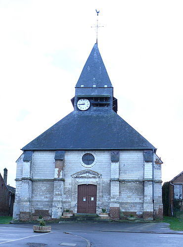 The church in Lœuilly | |
Location of Ô-de-Selle  | |
 Ô-de-Selle  Ô-de-Selle | |
| Coordinates: 49°46′36″N 2°10′34″E / 49.7767°N 2.1761°E / 49.7767; 2.1761 | |
| Country | France |
| Region | Hauts-de-France |
| Department | Somme |
| Arrondissement | Amiens |
| Canton | Ailly-sur-Noye |
| Intercommunality | CC Somme Sud-Ouest |
| Government | |
| • Mayor (2021–2026) | Valérie Mouton[1] |
| Area 1 | 26.72 km2 (10.32 sq mi) |
| Population (2021)[2] | 1,159 |
| • Density | 43/km2 (110/sq mi) |
| Time zone | UTC+01:00 (CET) |
| • Summer (DST) | UTC+02:00 (CEST) |
| INSEE/Postal code | 80485 /80160 |
| Elevation | 42–152 m (138–499 ft) |
| 1 French Land Register data, which excludes lakes, ponds, glaciers > 1 km2 (0.386 sq mi or 247 acres) and river estuaries. | |
Ô-de-Selle (French pronunciation: [o də sɛl]) is a commune in the Somme department in Hauts-de-France in northern France. It was established on 1 January 2019 by merger of the former communes of Lœuilly (the seat), Neuville-lès-Lœuilly and Tilloy-lès-Conty.[3]
See also
References
- ^ "Répertoire national des élus: les maires". data.gouv.fr, Plateforme ouverte des données publiques françaises (in French). 22 April 2021.
- ^ "Populations légales 2021" (in French). The National Institute of Statistics and Economic Studies. 28 December 2023.
- ^ Arrêté préfectoral 7 December 2018 (in French)
Wikimedia Commons has media related to Ô-de-Selle.
Communes nouvelles of the Somme department | |
|---|---|
| Arrondissement of Amiens | |
| Arrondissement of Montdidier | |
| Arrondissement of Péronne | |
This Arrondissement of Amiens geographical article is a stub. You can help Wikipedia by expanding it. |
Hidden categories:
- Pages using gadget WikiMiniAtlas
- CS1 French-language sources (fr)
- Articles with French-language sources (fr)
- Articles with short description
- Short description is different from Wikidata
- Coordinates on Wikidata
- Pages using infobox settlement with image map1 but not image map
- Pages with French IPA
- Commons category link from Wikidata
- All stub articles
- Pages using the Kartographer extension