2nd parallel north: Difference between revisions
Content deleted Content added
m adding orphan template; no mainspace non-redirect non-disambig links using AWB |
added a ref list |
||
| (38 intermediate revisions by 19 users not shown) | |||
| Line 1: | Line 1: | ||
{{ |
{{Unreferenced|date=January 2021}} |
||
{{Location map-line|lat=2}} |
|||
The '''2nd parallel north''' is a [[circle of latitude]] that is 2 [[degree (angle)|degrees]] [[true north|north]] of the [[Earth|Earth's]] [[equator|equatorial plane]]. |
|||
{{kml}} |
|||
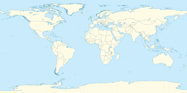
The '''2nd parallel north''' is a [[circle of latitude]] that is 2 [[degree (angle)|degrees]] [[true north|north]] of the [[Earth|Earth's]] [[equator|equatorial plane]]. It crosses the [[Atlantic Ocean]], [[Africa]], the [[Indian Ocean]], [[Southeast Asia]], the [[Pacific Ocean]] and [[South America]]. |
|||
==Around the world== |
|||
Starting at the [[Prime Meridian]] and heading eastwards, the parallel 2° north passes through: |
Starting at the [[Prime Meridian]] and heading eastwards, the parallel 2° north passes through: |
||
:{| class="wikitable" |
:{| class="wikitable plainrowheaders" |
||
! scope="col" | Co-ordinates |
|||
! Country, territory or sea |
|||
! scope="col" | Country, territory or sea |
|||
! Notes |
|||
! scope="col" | Notes |
|||
|- |
|- |
||
| style="background:#b0e0e6;" | |
| style="background:#b0e0e6;" | {{Coord|2|0|N|0|0|E|type:landmark|name=Prime Meridian}} |
||
! scope="row" style="background:#b0e0e6;" | [[Atlantic Ocean]] |
|||
| style="background:#b0e0e6;" | [[Gulf of Guinea]] |
| style="background:#b0e0e6;" | [[Gulf of Guinea]] |
||
|- |
|- |
||
| {{Coord|2|0|N|9|47|E|type:country|name=Equatorial Guinea}} |
|||
| {{GNQ}} |
|||
! scope="row" | {{GNQ}} |
|||
| |
| |
||
|- |
|- |
||
| {{Coord|2|0|N|11|20|E|type:country|name=Gabon}} |
|||
| {{GAB}} |
|||
! scope="row" | {{GAB}} |
|||
| |
| |
||
|- |
|- |
||
| {{Coord|2|0|N|13|14|E|type:country|name=Republic of the Congo}} |
|||
| {{COG}} |
|||
! scope="row" | {{COG}} |
|||
| |
| |
||
|- |
|- |
||
| {{Coord|2|0|N|15|2|E|type:country|name=Cameroon}} |
|||
| {{CMR}} |
|||
! scope="row" | {{CMR}} |
|||
| For about 9 km |
|||
|- |
|||
| {{Coord|2|0|N|15|7|E|type:country|name=Republic of the Congo}} |
|||
! scope="row" | {{COG}} |
|||
| For about 17 km |
|||
|- |
|||
| {{Coord|2|0|N|15|16|E|type:country|name=Cameroon}} |
|||
! scope="row" | {{CMR}} |
|||
| |
| |
||
|- |
|- |
||
| {{Coord|2|0|N|16|3|E|type:country|name=Republic of the Congo}} |
|||
| {{COG}} |
|||
! scope="row" | {{COG}} |
|||
| |
| |
||
|- |
|- |
||
| {{Coord|2|0|N|18|5|E|type:country|name=Democratic Republic of the Congo}} |
|||
| {{COD}} |
|||
! scope="row" | {{COD}} |
|||
| |
| |
||
|- |
|- |
||
| style="background:#b0e0e6;" | {{Coord|2|0|N|31|3|E|type:waterbody|name=Lake Albert}} |
|||
| {{UGA}} |
|||
! scope="row" style="background:#b0e0e6;" | [[Lake Albert (Africa)|Lake Albert]] |
|||
| style="background:#b0e0e6;" | The border with Uganda is in the lake at {{Coord|2|0|N|31|14|E|type:country|name=Uganda}} |
|||
|- |
|||
| {{Coord|2|0|N|31|24|E|type:country|name=Uganda}} |
|||
! scope="row" | {{UGA}} |
|||
| |
| |
||
|- |
|- |
||
| {{Coord|2|0|N|34|59|E|type:country|name=Kenya}} |
|||
| {{KEN}} |
|||
! scope="row" | {{KEN}} |
|||
| |
| |
||
|- |
|- |
||
| {{Coord|2|0|N|41|0|E|type:country|name=Somalia}} |
|||
| {{SOM}} |
|||
! scope="row" | {{SOM}} |
|||
| |
| |
||
|- |
|- |
||
| style="background:#b0e0e6;" | |
| style="background:#b0e0e6;" | {{Coord|2|0|N|45|17|E|type:waterbody|name=Indian Ocean}} |
||
! scope="row" style="background:#b0e0e6;" | [[Indian Ocean]] |
|||
| style="background:#b0e0e6;" | Passing just south of [[Mogadishu]], {{SOM}} |
|||
|- |
|- |
||
| {{Coord|2|0|N|73|21|E|type:country|name=Maldives}} |
|||
| {{MDV}} |
|||
! scope="row" | {{MDV}} |
|||
| [[Laamu Atoll]] |
| [[Laamu Atoll]] |
||
|- |
|- |
||
| style="background:#b0e0e6;" | |
| style="background:#b0e0e6;" | {{Coord|2|0|N|73|33|E|type:waterbody|name=Indian Ocean}} |
||
! scope="row" style="background:#b0e0e6;" | [[Indian Ocean]] |
|||
| style="background:#b0e0e6;" | Passing just south of the [[Banyak Islands]], {{IDN}} |
|||
|-valign="top" |
|||
|- |
|||
| {{IDN}} |
|||
| {{Coord|2|0|N|98|27|E|type:country|name=Indonesia}} |
|||
! scope="row" | {{IDN}} |
|||
| Islands of [[Sumatra]] and [[Rupat]] |
| Islands of [[Sumatra]] and [[Rupat]] |
||
|- |
|- |
||
| style="background:#b0e0e6;" | |
| style="background:#b0e0e6;" | {{Coord|2|0|N|101|46|E|type:waterbody|name=Strait of Malacca}} |
||
! scope="row" style="background:#b0e0e6;" | [[Strait of Malacca]] |
|||
| style="background:#b0e0e6;" | |
| style="background:#b0e0e6;" | |
||
|- |
|- |
||
| {{Coord|2|0|N|102|35|E|type:country|name=Malaysia}} |
|||
| {{MYS}} |
|||
! scope="row" | {{MYS}} |
|||
| [[Johor]] |
| [[Johor]] |
||
|- |
|- |
||
| style="background:#b0e0e6;" | |
| style="background:#b0e0e6;" | {{Coord|2|0|N|104|6|E|type:waterbody|name=South China Sea}} |
||
! scope="row" style="background:#b0e0e6;" | [[South China Sea]] |
|||
| style="background:#b0e0e6;" | |
| style="background:#b0e0e6;" | |
||
|- |
|- |
||
| {{Coord|2|0|N|109|35|E|type:country|name=Indonesia}} |
|||
| {{IDN}} |
|||
! scope="row" | {{IDN}} |
|||
| [[Borneo]] - for about 3km |
|||
| island of [[Borneo]]<br/>[[West Kalimantan]] - for about 3 km |
|||
|- |
|- |
||
| {{Coord|2|0|N|109|37|E|type:country|name=Malaysia}} |
|||
| {{MYS}} |
|||
! scope="row" | {{MYS}} |
|||
| [[Sarawak]], [[Borneo]] - for about 3km |
|||
| [[Sarawak]] - for about 3 km |
|||
|- |
|- |
||
| style="background:#b0e0e6;" | |
| style="background:#b0e0e6;" | {{Coord|2|0|N|109|39|E|type:waterbody|name=South China Sea}} |
||
! scope="row" style="background:#b0e0e6;" | [[South China Sea]] |
|||
| style="background:#b0e0e6;" | |
| style="background:#b0e0e6;" | |
||
|- |
|- |
||
| {{Coord|2|0|N|111|10|E|type:country|name=Malaysia}} |
|||
| {{MYS}} |
|||
! scope="row" | {{MYS}} |
|||
| [[Sarawak]], [[Borneo]] |
|||
| island of [[Borneo]]<br/>[[Sarawak]] |
|||
|- |
|- |
||
| {{Coord|2|0|N|114|52|E|type:country|name=Indonesia}} |
|||
| {{IDN}} |
|||
! scope="row" | {{IDN}} |
|||
| [[Borneo]] |
|||
| [[North Kalimantan]]<br/>[[East Kalimantan]] |
|||
|- |
|- |
||
| style="background:#b0e0e6;" | |
| style="background:#b0e0e6;" | {{Coord|2|0|N|117|50|E|type:waterbody|name=Celebes Sea}} |
||
! scope="row" style="background:#b0e0e6;" | [[Celebes Sea]] |
|||
| style="background:#b0e0e6;" | |
| style="background:#b0e0e6;" | |
||
|- |
|- |
||
| style="background:#b0e0e6;" | |
| style="background:#b0e0e6;" | {{Coord|2|0|N|125|17|E|type:waterbody|name=Molucca Sea}} |
||
! scope="row" style="background:#b0e0e6;" | [[Molucca Sea]] |
|||
| style="background:#b0e0e6;" | Passing just south of the island of [[Biaro]], {{IDN}} |
|||
|- |
|- |
||
| {{Coord|2|0|N|127|46|E|type:country|name=Indonesia}} |
|||
| {{IDN}} |
|||
! scope="row" | {{IDN}} |
|||
| Islands of [[Halmahera]] and [[Morotai]] |
|||
| Island of [[Halmahera]] |
|||
|- |
|- |
||
| style="background:#b0e0e6;" | |
| style="background:#b0e0e6;" | {{Coord|2|0|N|127|57|E|type:waterbody|name=Pacific Ocean}} |
||
! scope="row" style="background:#b0e0e6;" | [[Pacific Ocean]] |
|||
| style="background:#b0e0e6;" | |
| style="background:#b0e0e6;" | |
||
|- |
|- |
||
| {{Coord|2|0|N|128|16|E|type:country|name=Indonesia}} |
|||
| {{KIR}} |
|||
! scope="row" | {{IDN}} |
|||
| Island of [[Morotai]] - for about 1 km |
|||
|- |
|||
| style="background:#b0e0e6;" | {{Coord|2|0|N|128|17|E|type:waterbody|name=Pacific Ocean}} |
|||
! scope="row" style="background:#b0e0e6;" | [[Pacific Ocean]] |
|||
| style="background:#b0e0e6;" | Passing just north of [[Abaiang]] atoll, {{KIR}} |
|||
|- |
|||
| {{Coord|2|0|N|173|15|E|type:country|name=Kiribati}} |
|||
! scope="row" | {{KIR}} |
|||
| [[Marakei]] atoll |
| [[Marakei]] atoll |
||
|- |
|- |
||
| style="background:#b0e0e6;" | |
| style="background:#b0e0e6;" | {{Coord|2|0|N|173|18|E|type:waterbody|name=Pacific Ocean}} |
||
! scope="row" style="background:#b0e0e6;" | [[Pacific Ocean]] |
|||
| style="background:#b0e0e6;" | |
| style="background:#b0e0e6;" | |
||
|- |
|- |
||
| {{Coord|2|0|N|157|47|W|type:country|name=Kiribati}} |
|||
| {{KIR}} |
|||
! scope="row" | {{KIR}} |
|||
| [[Kiritimati]] atoll |
| [[Kiritimati]] atoll |
||
|- |
|- |
||
| style="background:#b0e0e6;" | |
| style="background:#b0e0e6;" | {{Coord|2|0|N|157|40|W|type:waterbody|name=Pacific Ocean}} |
||
! scope="row" style="background:#b0e0e6;" | [[Pacific Ocean]] |
|||
| style="background:#b0e0e6;" | |
| style="background:#b0e0e6;" | |
||
|- |
|- |
||
| {{Coord|2|0|N|78|39|W|type:country|name=Colombia}} |
|||
| {{COL}} |
|||
! scope="row" | {{COL}} |
|||
| |
| |
||
|- |
|- |
||
| {{Coord|2|0|N|68|13|W|type:country|name=Brazil}} |
|||
| {{BRA}} |
|||
! scope="row" | {{BRA}} |
|||
| For about 3km |
|||
| [[Amazonas (Brazilian state)|Amazonas]] - for about 3 km |
|||
|- |
|- |
||
| {{Coord|2|0|N|68|11|W|type:country|name=Colombia}} |
|||
| {{COL}} |
|||
! scope="row" | {{COL}} |
|||
| |
| |
||
|- |
|- |
||
| {{Coord|2|0|N|67|39|W|type:country|name=Brazil}} |
|||
| {{BRA}} |
|||
! scope="row" | {{BRA}} |
|||
| For about 3km |
|||
| Amazonas |
|||
|- |
|- |
||
| {{Coord|2|0|N|67|18|W|type:country|name=Colombia}} |
|||
| {{COL}} |
|||
! scope="row" | {{COL}} |
|||
| |
| |
||
|- |
|- |
||
| {{Coord|2|0|N|67|7|W|type:country|name=Venezuela}} |
|||
| {{VEN}} |
|||
! scope="row" | {{VEN}} |
|||
| |
| |
||
|-valign="top" |
|||
| {{Coord|2|0|N|63|46|W|type:country|name=Brazil}} |
|||
! scope="row" | {{BRA}} |
|||
| Amazonas<br/> [[Roraima]] |
|||
|- |
|||
| {{Coord|2|0|N|59|44|W|type:country|name=Area disputed between Guyana and Venezuela}} |
|||
! scope="row" | Disputed area |
|||
| Controlled by {{GUY}}, claimed by {{VEN}} |
|||
|- |
|- |
||
| {{Coord|2|0|N|58|28|W|type:country|name=Guyana}} |
|||
| {{BRA}} |
|||
! scope="row" | {{GUY}} |
|||
| |
| |
||
|- |
|- |
||
| {{Coord|2|0|N|57|55|W|type:country|name=Area disputed between Guyana and Suriname}} |
|||
| {{GUY}} |
|||
! scope="row" | Disputed area |
|||
| Including territory claimed by {{VEN}} |
|||
| Controlled by {{GUY}}, claimed by {{SUR}} |
|||
|- |
|- |
||
| {{Coord|2|0|N|57|9|W|type:country|name=Brazil}} |
|||
| {{BRA}} |
|||
! scope="row" | {{BRA}} |
|||
| For about 8km |
|||
| [[Pará]] - for about 8 km |
|||
|- |
|- |
||
| {{Coord|2|0|N|57|4|W|type:country|name=Area disputed between Guyana and Suriname}} |
|||
| {{GUY}} |
|||
! scope="row" | Disputed area |
|||
| |
|||
| Controlled by {{GUY}}, claimed by {{SUR}} |
|||
|- |
|- |
||
| {{Coord|2|0|N|56|38|W|type:country|name=Suriname}} |
|||
| {{SUR}} |
|||
! scope="row" | {{SUR}} |
|||
| |
| |
||
|-valign="top" |
|||
| {{Coord|2|0|N|55|55|W|type:country|name=Brazil}} |
|||
! scope="row" | {{BRA}} |
|||
| Pará<br/> [[Amapá]] - mainland and the island of [[Maracá]] |
|||
|- |
|- |
||
| style="background:#b0e0e6;" | {{Coord|2|0|N|50|17|W|type:waterbody|name=Atlantic Ocean}} |
|||
| {{BRA}} |
|||
! scope="row" style="background:#b0e0e6;" | [[Atlantic Ocean]] |
|||
| Mainland and the island of [[Maracá]] |
|||
|- |
|||
| style="background:#b0e0e6;" | [[Atlantic Ocean]] |
|||
| style="background:#b0e0e6;" | |
| style="background:#b0e0e6;" | |
||
|- |
|- |
||
|} |
|} |
||
== References == |
|||
{{geographical coordinates}} |
|||
<references /> |
|||
==See also== |
|||
*[[1st parallel north]] |
|||
*[[3rd parallel north]] |
|||
{{-}} |
|||
{{geographical coordinates|state=collapsed}} |
|||
[[Category: |
[[Category:Circles of latitude|n02]] |
||
[[Category:Democratic Republic of the Congo–Uganda border]] |
|||
Latest revision as of 21:56, 14 February 2024
2°
2nd parallel north
The 2nd parallel north is a circle of latitude that is 2 degrees north of the Earth's equatorial plane. It crosses the Atlantic Ocean, Africa, the Indian Ocean, Southeast Asia, the Pacific Ocean and South America.
Around the world[edit]
Starting at the Prime Meridian and heading eastwards, the parallel 2° north passes through:
References[edit]