Charleroi, Pennsylvania: Difference between revisions
Modified historical population, infobox (via CenPop script) |
m adjust photos |
||
| (47 intermediate revisions by 39 users not shown) | |||
| Line 11: | Line 11: | ||
| image_shield = |
| image_shield = |
||
| shield_alt = |
| shield_alt = |
||
| etymology = [[Charleroi]], [[Belgium]] Charles the King |
| etymology = [[Charleroi]], [[Belgium]]; Charles the King{{which?|date=January 2023}} |
||
| nickname = Magic City |
| nickname = Magic City |
||
| motto = Business Friendly |
| motto = Business Friendly |
||
| Line 42: | Line 42: | ||
| leader_name = Paul Pervonick |
| leader_name = Paul Pervonick |
||
| unit_pref = Imperial |
| unit_pref = Imperial |
||
| area_footnotes = <ref name=" |
| area_footnotes = <ref name="TigerWebMapServer">{{cite web|title=ArcGIS REST Services Directory|url=https://tigerweb.geo.census.gov/arcgis/rest/services/TIGERweb/Places_CouSub_ConCity_SubMCD/MapServer/5/query?where=STATE='42'&outFields=NAME,STATE,PLACE,AREALAND,AREAWATER,LSADC,CENTLAT,CENTLON&orderByFields=PLACE&returnGeometry=false&returnTrueCurves=false&f=json|publisher=United States Census Bureau|accessdate=October 12, 2022}}</ref> |
||
| area_total_sq_mi = 0.86 |
| area_total_sq_mi = 0.86 |
||
| area_land_sq_mi = 0.76 |
| area_land_sq_mi = 0.76 |
||
| Line 53: | Line 53: | ||
| elevation_footnotes = |
| elevation_footnotes = |
||
| elevation_ft = |
| elevation_ft = |
||
| population_footnotes = |
| population_footnotes = <ref name="USCensusDecennial2020CenPopScriptOnly"/> |
||
| population_total = |
| population_total = 4234 |
||
| population_as_of = [[ |
| population_as_of = [[2020 United States Census|2020]] |
||
| population_density_sq_mi = |
| population_density_sq_mi = 5556.43 |
||
| population_demonym = |
| population_demonym = |
||
| population_note = <ref name="USCensusEst2020-2021">{{cite web |last1=Bureau |first1=US Census |title=City and Town Population Totals: 2020-2021 |url=https://www.census.gov/data/tables/time-series/demo/popest/2020s-total-cities-and-towns.html |website=Census.gov |publisher=US Census Bureau |access-date=21 July 2022}}</ref> |
|||
| population_note = |
|||
| timezone1 = [[Eastern Time Zone|EST]] |
| timezone1 = [[Eastern Time Zone|EST]] |
||
| utc_offset1 = -5 |
| utc_offset1 = -5 |
||
| Line 70: | Line 70: | ||
| blank_info_sec1 = |
| blank_info_sec1 = |
||
| website = {{URL|http://www.charleroiboro.org}} |
| website = {{URL|http://www.charleroiboro.org}} |
||
| pop_est_as_of = |
| pop_est_as_of = |
||
| pop_est_footnotes = |
| pop_est_footnotes = |
||
| population_est = |
| population_est = |
||
| blank_name = [[Federal Information Processing Standards|FIPS code]] |
| blank_name = [[Federal Information Processing Standards|FIPS code]] |
||
| blank_info = 42-12704 |
| blank_info = 42-12704 |
||
| Line 78: | Line 78: | ||
| area_land_km2 = 1.97 |
| area_land_km2 = 1.97 |
||
| area_water_km2 = 0.26 |
| area_water_km2 = 0.26 |
||
| population_density_km2 = |
| population_density_km2 = 2144.98 |
||
| official_name = |
| official_name = |
||
}} |
}} |
||
'''Charleroi''' ({{IPAc-en|ˈ|ʃ|ɑːr|l|ə|r|ɔɪ}} {{respell|SHAR|lə|roy}}) is a [[Borough (Pennsylvania)|borough]] in [[Washington County, Pennsylvania |
'''Charleroi''' ({{IPAc-en|ˈ|ʃ|ɑːr|l|ə|r|ɔɪ}} {{respell|SHAR|lə|roy}}) is a [[Borough (Pennsylvania)|borough]] in [[Washington County, Pennsylvania]], United States, along the [[Monongahela River]], 21 miles south of [[Pittsburgh]].<ref>{{Cite web |url=http://www.geobytes.com/CityDistanceTool.htm?d&pt_1=uspapitt&pt_2=uspachar |title=City Distance Calculator |access-date=2012-09-30 |archive-date=2018-07-28 |archive-url=https://web.archive.org/web/20180728002858/http://www.geobytes.com/CityDistanceTool.htm?d&pt_1=uspapitt&pt_2=uspachar |url-status=dead }}</ref> |
||
Charleroi was settled by [[Walloons]] in 1890 and incorporated in 1891.<ref>{{cite EB1911|wstitle=Charleroi (Pennsylvania)|volume=5|page=897}}</ref> |
|||
| ⚫ | |||
The 2020 census recorded a population of 4,210.<ref name="USCensusEst2020-2021"/> There has been a large-scale cessation of industrial activities in the region. The decrease in the population is associated with the decline of regional heavy and medium industries, especially the steel-making industry, all once fed by the cheap transportation on the [[Monongahela River]], which extends from upstream of Charleroi well into northern [[West Virginia]] and north and downstream past McKeesport to the mouth of the Monongahela in Pittsburgh. |
|||
| ⚫ | Colloquially, the stretch from Charleroi north to McKeesport (historically because of press coverage of High School sports leagues), is known as the "Mon Valley," and has been extended by some to mean from the river mouth to northern West Virginia. Once dubbed "Magic City," Charleroi has in recent years seen a gradual revitalization of its business district.<ref>{{Cite web|title=After tough times, Charleroi looks to recapture its magic|url=https://www.post-gazette.com/local/region/2018/11/04/Charleroi-pennsylvania-our-towns-mon-valley-shopping-economic-revival/stories/201808100141|website=Pittsburgh Post-Gazette|language=en|access-date=2020-05-21}}</ref> |
||
== History == |
== History == |
||
[[ |
[[File:First National Bank Charleroi Pennsylvania.jpg|thumb|upright|left|First National Bank (1922)]] |
||
Charleroi got its name from the Belgian city of [[Charleroi]]. |
Charleroi got its name from the Belgian city of [[Charleroi]]. Many [[Belgian Americans|Belgian immigrants]] lived in the Monongahela area at the end of the 19th century, some of whom were glass makers.<ref>Pennsylvania Heritage, Volumes 34-36 - Pennsylvania Historical and Museum Commission, 2008. Pg. 5</ref><ref>{{Cite web|url=https://books.google.com/books?id=CoRNpoT7XSMC&q=Belgian+|title = Pennsylvania Heritage|year = 2008}}</ref> |
||
[[Image:First National Bank Charleroi Pennsylvania.jpg|thumb|right|250px|First National Bank (1922)<br />National Register of Historic Places]] |
|||
| ⚫ | The Pittsburgh Plate Glass Company, today [[PPG Industries]], had one of its major factories located at the current chamber plaza, at one point employing up to a thousand employees, making it one of the largest glass factories in the world at the time. For years it was the home to one of [[Corning Glass]] Companies leading employers. Today it is home to [[Corelle Brands]], which makes [[Pyrex]]. In celebration of the 100th anniversary of Pyrex products, Charleroi renamed itself "Pyrex, PA" for 100 days in 2015.<ref name="pyrex100">[http://triblive.com/lifestyles/history/8223960-74/pyrex-glass-says "Pyrex, Pa.: Charleroi celebrating the centennial of its famed product"] |
||
| ⚫ | The Pittsburgh Plate Glass Company, today [[PPG Industries]], had one of its major factories located at the current chamber plaza, at one point employing up to a thousand employees, making it one of the largest glass factories in the world at the time. For years it was the home to one of [[Corning Glass]] Companies leading employers. Today it is home to [[Corelle Brands]], which makes [[Pyrex]]. In celebration of the 100th anniversary of Pyrex products, Charleroi renamed itself "Pyrex, PA" for 100 days in 2015.<ref name="pyrex100">[http://triblive.com/lifestyles/history/8223960-74/pyrex-glass-says "Pyrex, Pa.: Charleroi celebrating the centennial of its famed product"], TribLive.com, May 11, 2015.</ref> |
||
| ⚫ | Charleroi was home to one of the first movie theatres in the nation, the |
||
| ⚫ | Charleroi was home to one of the first movie theatres in the nation, the Electric Theatre at 520 McKean Avenue, which opened in October 1905 and has since been demolished. The [[Charleroi Historic District]], [[First National Bank of Charleroi]] and [[United States Post Office (Charleroi, Pennsylvania)|United States Post Office]] are listed on the [[National Register of Historic Places]].<ref name="nris">{{NRISref|2010a}}</ref><ref>For more about the designation as a historic district and about the Charleroi history: David Templeton, [http://www.post-gazette.com/local/washington/2004/02/08/Charleroi-s-story-is-history/stories/200402080195 "Charleroi's story is history. Town built for glass factory could be large historic district"], ''Pittsburgh Post-Gazette'', February 8, 2004.</ref> |
||
| ⚫ | |||
| ⚫ | Charleroi is located at {{coord|40|8|17|N|79|54|5|W|type:city}} (40.138088, -79.901333).<ref name="GR1">{{cite web|url=https://www.census.gov/geographies/reference-files/time-series/geo/gazetteer-files.html|publisher=[[United States Census Bureau]]| |
||
In 2020, [[Paul Magnette]], mayor of [[Charleroi]] ([[Belgium]]) visited the town that was founded by migrants from his city.<ref>[https://www.demorgen.be/politiek/greetings-from-charleroi-usa-paul-magnette-ontdekt-charleroi-pennsylvania~b9656e11/ Greetings from Charleroi, USA] De Morgen, October 17, 2020.</ref> |
|||
According to the [[United States Census Bureau]], the borough has a total area of {{convert|0.9|sqmi|km2}}, of which, {{convert|0.8|sqmi|km2}} of it is land and {{convert|0.1|sqmi|km2}} of it is [[water]]. The total area is 10.47% water. |
|||
| ⚫ | |||
[[File:Downtown Charleroi Pennsylvania.jpg|thumb|McKean Avenue in Charleroi]] |
|||
| ⚫ | Charleroi is located at {{coord|40|8|17|N|79|54|5|W|type:city}} (40.138088, -79.901333).<ref name="GR1">{{cite web|url=https://www.census.gov/geographies/reference-files/time-series/geo/gazetteer-files.html|publisher=[[United States Census Bureau]]|access-date=2011-04-23|date=2011-02-12|title=US Gazetteer files: 2010, 2000, and 1990}}</ref> According to the [[United States Census Bureau|U.S. Census Bureau]], the borough has a total area of {{convert|0.9|sqmi|km2}}, of which {{convert|0.8|sqmi|km2}} is land and {{convert|0.1|sqmi|km2}} is water. The total area is 10.47% water. |
||
==Surrounding and adjacent neighborhoods== |
==Surrounding and adjacent neighborhoods== |
||
Charleroi has four land borders, including [[North Charleroi, Pennsylvania|North Charleroi]] to the north, [[Speers, Pennsylvania|Speers]] to the southwest, [[Twilight, Pennsylvania|Twilight]] to the south, and [[ |
Charleroi has four land borders, including [[North Charleroi, Pennsylvania|North Charleroi]] to the north, [[Speers, Pennsylvania|Speers]] to the southwest, [[Twilight, Pennsylvania|Twilight]] to the south, and [[Fallowfield Township, Washington County, Pennsylvania|Fallowfield Township]] to the west. Across the Monongahela River to the east, Charleroi runs adjacent with [[Rostraver Township, Pennsylvania|Rostraver Township]] in Westmoreland County. |
||
==Demographics== |
==Demographics== |
||
| Line 115: | Line 120: | ||
|2000= 4871 |
|2000= 4871 |
||
|2010= 4120 |
|2010= 4120 |
||
|2020= 4240 |
|||
|estyear= |
|estyear=2021 |
||
|estimate= |
|estimate=4210 |
||
|estref=<ref name="USCensusEst2019CenPopScriptOnlyDirtyFixDoNotUse">{{cite web|url=https://www.census.gov/programs-surveys/popest/data/tables.2019.html|date=May 24, 2020|title=Population and Housing Unit Estimates|publisher=United States Census Bureau|accessdate=May 27, 2020}}</ref> |
|||
|estref=<ref name="USCensusEst2020-2021"/> |
|||
|footnote=Sources:<ref name="USDecennialCensus">{{cite web|title=Census of Population and Housing|url=https://www.census.gov/programs-surveys/decennial-census.html|publisher=U.S. Census Bureau| |
|footnote=Sources:<ref name="USDecennialCensus">{{cite web|title=Census of Population and Housing|url=https://www.census.gov/programs-surveys/decennial-census.html|publisher=U.S. Census Bureau|access-date=11 December 2013}}</ref><ref name="GR2" /><ref name=CensusPopEst>{{cite web|title=Incorporated Places and Minor Civil Divisions Datasets: Subcounty Resident Population Estimates: April 1, 2010 to July 1, 2012|url=https://www.census.gov/popest/data/cities/totals/2012/SUB-EST2012.html|work=Population Estimates|publisher=U.S. Census Bureau|access-date=11 December 2013|url-status=dead|archive-url=https://web.archive.org/web/20130611010502/http://www.census.gov/popest/data/cities/totals/2012/SUB-EST2012.html|archive-date=11 June 2013}}</ref><ref name="DecennialCensus">{{cite web|url=http://www.census.gov/prod/www/decennial.html|title=Census of Population and Housing|publisher=Census.gov|accessdate=June 4, 2016}}</ref><ref name="USCensusDecennial2020CenPopScriptOnly">{{cite web|url=https://api.census.gov/data/2020/dec/pl?get=P1_001N,NAME&for=place:*&in=state:42&key=5ccd0821c15d9f4520e2dcc0f8d92b2ec9336108|title=Census Population API|publisher=United States Census Bureau|accessdate=Oct 12, 2022}}</ref> |
||
}} |
}} |
||
As of the [[census]]<ref name="GR2" /> of 2000, there were 4,871 people, 2,258 households, and 1,208 families residing in the borough. The |
As of the [[census]]<ref name="GR2">{{cite web|url=https://www.census.gov|publisher=[[United States Census Bureau]]|access-date=2008-01-31|title=U.S. Census website}}</ref> of 2000, there were 4,871 people, 2,258 households, and 1,208 families residing in the borough. The population density was {{convert|6,308.6|PD/sqmi|PD/km2|sp=us|adj=off}}. There were 2,656 housing units at an average density of {{convert|3,439.9|/sqmi|/km2|sp=us|adj=off}}. The racial makeup of the borough was 95.3% [[White (U.S. Census)|White]], 3.2% [[African American (U.S. Census)|African American]], 0.1% [[Native American (U.S. Census)|Native American]], 0.3% [[Asian (U.S. Census)|Asian]], 0.2% from [[Race (United States Census)|other races]], and 0.8% from two or more races. [[Hispanic (U.S. Census)|Hispanic]] or [[Latino (U.S. Census)|Latino]] of any race were 0.7% of the population. |
||
There were 2,258 households out of which 22.3% had children under the age of 18 living with them, 35.5% were [[Marriage|married couples]] living together, 13.37% had a female householder with no husband present, and 46.5% were non-families. 41.8% of all households were made up of individuals and 21.9% had someone living alone who was 65 years of age or older. The average household size was 2.11 and the average family size was 2.88. |
There were 2,258 households, out of which 22.3% had children under the age of 18 living with them, 35.5% were [[Marriage|married couples]] living together, 13.37% had a female householder with no husband present, and 46.5% were non-families. 41.8% of all households were made up of individuals, and 21.9% had someone living alone who was 65 years of age or older. The average household size was 2.11 and the average family size was 2.88. |
||
In the borough the population was spread out with 20.5% under the age of 18, 7.1% from 18 to 24, 27.1% from 25 to 44, 20.2% from 45 to 64, and 25.0% who were 65 years of age or older. The median age was 41 years. For every 100 females, there were 81.4 males. For every 100 females age 18 and over, there were 77.1 males. |
In the borough the population was spread out, with 20.5% under the age of 18, 7.1% from 18 to 24, 27.1% from 25 to 44, 20.2% from 45 to 64, and 25.0% who were 65 years of age or older. The median age was 41 years. For every 100 females, there were 81.4 males. For every 100 females age 18 and over, there were 77.1 males. |
||
The median income for a household in the borough was $23,593, and the median income for a family was $31,699. Males had a median income of $30,093 versus $23,873 for females. The [[per capita income]] for the borough was $13,752. About 16.1% of families and 21.3% of the population were below the [[poverty line]], including 36.2% of those under age 18 and 13.7% of those age 65 or over. |
The median income for a household in the borough was $23,593, and the median income for a family was $31,699. Males had a median income of $30,093 versus $23,873 for females. The [[per capita income]] for the borough was $13,752. About 16.1% of families and 21.3% of the population were below the [[poverty line]], including 36.2% of those under age 18 and 13.7% of those age 65 or over. |
||
| Line 130: | Line 136: | ||
==In popular culture == |
==In popular culture == |
||
* A large part of the plot of the [[alternate history (fiction)|alternate history]] novel ''[[The Two Georges]]'', by [[Harry Turtledove]] and [[Richard Dreyfuss]], takes place in Charleroi, Pennsylvania. In the alternate history of this book, North America remains part of the [[British Empire]]. Charleroi is described as a large coal-mining town filled with embittered [[coal miners]] of mainly [[Irish people|Irish]] descent living under conditions of poverty, exploitation and pollution, who end up supporting radical underground political movements. |
* A large part of the plot of the [[alternate history (fiction)|alternate history]] novel ''[[The Two Georges]]'', by [[Harry Turtledove]] and [[Richard Dreyfuss]], takes place in Charleroi, Pennsylvania. In the alternate history of this book, North America remains part of the [[British Empire]]. Charleroi is described as a large coal-mining town filled with embittered [[coal miners]] of mainly [[Irish people|Irish]] descent living under conditions of poverty, exploitation and pollution, who end up supporting radical underground political movements. |
||
* Charleroi and the surrounding area are the setting for ''American Rust |
* Charleroi and the surrounding area are the setting for ''[[American Rust]]'', a 2009 novel by [[Philipp Meyer]]. |
||
==Notable people== |
==Notable people== |
||
| ⚫ | |||
| ⚫ | |||
| ⚫ | |||
* [[Shirley Jones]] (1934- ), singer, actress on [[Broadway theatre|Broadway]], movies, and television |
* [[Shirley Jones]] (1934- ), singer, actress on [[Broadway theatre|Broadway]], movies, and television |
||
* [[Robert Karvelas]] (1921-1991), American actor born in [[New York City]], but raised in Charleroi |
|||
| ⚫ | |||
* [[Lisa Kirk]] (1925-1990), singer and actress |
|||
| ⚫ | |||
* [[Demi Moore]] (1962- ), actress; lived in Charleroi for less than a year<ref>Templeton, David (November 12, 1995). [https://www.newspapers.com/newspage/89028520 "Demi Now and Then"]. ''Pittsburgh Post-Gazette''.</ref> |
|||
* [[Mitchell Paige]] (Serbian: Mihajlo Pejic) (1918-2003), WW2 [[Medal of Honor]] recipient |
* [[Mitchell Paige]] (Serbian: Mihajlo Pejic) (1918-2003), WW2 [[Medal of Honor]] recipient |
||
| ⚫ | |||
* [[Myron Pottios]] (1939- ), professional football player, All American at Notre Dame 1959 |
* [[Myron Pottios]] (1939- ), professional football player, All American at Notre Dame 1959 |
||
* [[Olive Thomas]] (1894-1920), Ziegfeld |
* [[Olive Thomas]] (1894-1920), Ziegfeld girl, actress; wife of [[Jack Pickford]] |
||
* [[Barbara Bosson]] (1939- ), actress, movies, and television, Multiple Emmy Award Nominations |
|||
| ⚫ | |||
| ⚫ | |||
==See also== |
==See also== |
||
| Line 152: | Line 160: | ||
* [http://www.charleroiboro.org Official '''Borough of Charleroi''' website] |
* [http://www.charleroiboro.org Official '''Borough of Charleroi''' website] |
||
* [http://www.charleroisd.org/ Official Charleroi Area High School website] |
* [http://www.charleroisd.org/ Official Charleroi Area High School website] |
||
{{Commons category|Charleroi Historic District|position=left}} |
|||
{{Washington County, Pennsylvania}} |
{{Washington County, Pennsylvania}} |
||
| Line 160: | Line 167: | ||
[[Category:Boroughs in Washington County, Pennsylvania]] |
[[Category:Boroughs in Washington County, Pennsylvania]] |
||
[[Category: |
[[Category:Pennsylvania populated places on the Monongahela River]] |
||
[[Category:Pittsburgh metropolitan area]] |
[[Category:Pittsburgh metropolitan area]] |
||
[[Category:Place names of French origin in the Pittsburgh metropolitan area]] |
|||
[[Category:Populated places established in 1890]] |
[[Category:Populated places established in 1890]] |
||
[[Category:1890 establishments in Pennsylvania]] |
[[Category:1890 establishments in Pennsylvania]] |
||
Revision as of 20:49, 25 April 2024
Charleroi, Pennsylvania | |
|---|---|
 Overview of Charleroi from across the Monongahela River | |
| Etymology: Charleroi, Belgium; Charles the King[which?] | |
| Nickname: Magic City | |
| Motto: Business Friendly | |
 Location of Charleroi in Washington County, Pennsylvania. | |
 Charleroi, Pennsylvania Location of Charleroi in Pennsylvania | |
| Coordinates: 40°8′17″N 79°54′5″W / 40.13806°N 79.90139°W | |
| Country | United States |
| State | Pennsylvania |
| County | Washington |
| Established | 1890 |
| Government | |
| • Council President | Paul Pervonick (D) |
| Area | |
| • Total | 0.86 sq mi (2.23 km2) |
| • Land | 0.76 sq mi (1.97 km2) |
| • Water | 0.10 sq mi (0.26 km2) |
| Population | |
| • Total | 4,234 |
| • Density | 5,556.43/sq mi (2,144.98/km2) |
| [3] | |
| Time zone | UTC-5 (EST) |
| • Summer (DST) | UTC-4 (EDT) |
| Zip code | 15022 |
| Area code(s) | 724, 878 |
| Website | www |
Charleroi (/ˈʃɑːrlərɔɪ/ SHAR-lə-roy) is a borough in Washington County, Pennsylvania, United States, along the Monongahela River, 21 miles south of Pittsburgh.[4]
Charleroi was settled by Walloons in 1890 and incorporated in 1891.[5]
The 2020 census recorded a population of 4,210.[3] There has been a large-scale cessation of industrial activities in the region. The decrease in the population is associated with the decline of regional heavy and medium industries, especially the steel-making industry, all once fed by the cheap transportation on the Monongahela River, which extends from upstream of Charleroi well into northern West Virginia and north and downstream past McKeesport to the mouth of the Monongahela in Pittsburgh.
Colloquially, the stretch from Charleroi north to McKeesport (historically because of press coverage of High School sports leagues), is known as the "Mon Valley," and has been extended by some to mean from the river mouth to northern West Virginia. Once dubbed "Magic City," Charleroi has in recent years seen a gradual revitalization of its business district.[6]
History

Charleroi got its name from the Belgian city of Charleroi. Many Belgian immigrants lived in the Monongahela area at the end of the 19th century, some of whom were glass makers.[7][8]
The Pittsburgh Plate Glass Company, today PPG Industries, had one of its major factories located at the current chamber plaza, at one point employing up to a thousand employees, making it one of the largest glass factories in the world at the time. For years it was the home to one of Corning Glass Companies leading employers. Today it is home to Corelle Brands, which makes Pyrex. In celebration of the 100th anniversary of Pyrex products, Charleroi renamed itself "Pyrex, PA" for 100 days in 2015.[9]
Charleroi was home to one of the first movie theatres in the nation, the Electric Theatre at 520 McKean Avenue, which opened in October 1905 and has since been demolished. The Charleroi Historic District, First National Bank of Charleroi and United States Post Office are listed on the National Register of Historic Places.[10][11]
In 2020, Paul Magnette, mayor of Charleroi (Belgium) visited the town that was founded by migrants from his city.[12]
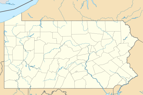
Geography

Charleroi is located at 40°8′17″N 79°54′5″W / 40.13806°N 79.90139°W (40.138088, -79.901333).[13] According to the U.S. Census Bureau, the borough has a total area of 0.9 square miles (2.3 km2), of which 0.8 square miles (2.1 km2) is land and 0.1 square miles (0.26 km2) is water. The total area is 10.47% water.
Surrounding and adjacent neighborhoods
Charleroi has four land borders, including North Charleroi to the north, Speers to the southwest, Twilight to the south, and Fallowfield Township to the west. Across the Monongahela River to the east, Charleroi runs adjacent with Rostraver Township in Westmoreland County.
Demographics
| Census | Pop. | Note | %± |
|---|---|---|---|
| 1900 | 5,930 | — | |
| 1910 | 9,615 | 62.1% | |
| 1920 | 11,516 | 19.8% | |
| 1930 | 11,260 | −2.2% | |
| 1940 | 10,784 | −4.2% | |
| 1950 | 9,872 | −8.5% | |
| 1960 | 8,148 | −17.5% | |
| 1970 | 6,723 | −17.5% | |
| 1980 | 5,717 | −15.0% | |
| 1990 | 5,014 | −12.3% | |
| 2000 | 4,871 | −2.9% | |
| 2010 | 4,120 | −15.4% | |
| 2020 | 4,240 | 2.9% | |
| 2021 (est.) | 4,210 | [3] | −0.7% |
| Sources:[14][15][16][17][2] | |||
As of the census[15] of 2000, there were 4,871 people, 2,258 households, and 1,208 families residing in the borough. The population density was 6,308.6 inhabitants per square mile (2,435.8/km2). There were 2,656 housing units at an average density of 3,439.9 per square mile (1,328.2/km2). The racial makeup of the borough was 95.3% White, 3.2% African American, 0.1% Native American, 0.3% Asian, 0.2% from other races, and 0.8% from two or more races. Hispanic or Latino of any race were 0.7% of the population.
There were 2,258 households, out of which 22.3% had children under the age of 18 living with them, 35.5% were married couples living together, 13.37% had a female householder with no husband present, and 46.5% were non-families. 41.8% of all households were made up of individuals, and 21.9% had someone living alone who was 65 years of age or older. The average household size was 2.11 and the average family size was 2.88.
In the borough the population was spread out, with 20.5% under the age of 18, 7.1% from 18 to 24, 27.1% from 25 to 44, 20.2% from 45 to 64, and 25.0% who were 65 years of age or older. The median age was 41 years. For every 100 females, there were 81.4 males. For every 100 females age 18 and over, there were 77.1 males.
The median income for a household in the borough was $23,593, and the median income for a family was $31,699. Males had a median income of $30,093 versus $23,873 for females. The per capita income for the borough was $13,752. About 16.1% of families and 21.3% of the population were below the poverty line, including 36.2% of those under age 18 and 13.7% of those age 65 or over.
In popular culture
- A large part of the plot of the alternate history novel The Two Georges, by Harry Turtledove and Richard Dreyfuss, takes place in Charleroi, Pennsylvania. In the alternate history of this book, North America remains part of the British Empire. Charleroi is described as a large coal-mining town filled with embittered coal miners of mainly Irish descent living under conditions of poverty, exploitation and pollution, who end up supporting radical underground political movements.
- Charleroi and the surrounding area are the setting for American Rust, a 2009 novel by Philipp Meyer.
Notable people
- Keith Ackerman (1946- ), a bishop and former rector of St. Mary's Church
- Barbara Bosson (1939-2023), actress
- Anne Feeney (1951-2021), a political activist, folk musician and singer-songwriter.
- Shirley Jones (1934- ), singer, actress on Broadway, movies, and television
- Robert Karvelas (1921-1991), American actor born in New York City, but raised in Charleroi
- Lisa Kirk (1925-1990), singer and actress
- Craig McCracken (1971- ), animator, director, producer
- Demi Moore (1962- ), actress; lived in Charleroi for less than a year[18]
- Mitchell Paige (Serbian: Mihajlo Pejic) (1918-2003), WW2 Medal of Honor recipient
- Myron Pottios (1939- ), professional football player, All American at Notre Dame 1959
- Olive Thomas (1894-1920), Ziegfeld girl, actress; wife of Jack Pickford
See also
References
- ^ "ArcGIS REST Services Directory". United States Census Bureau. Retrieved October 12, 2022.
- ^ a b "Census Population API". United States Census Bureau. Retrieved Oct 12, 2022.
- ^ a b c Bureau, US Census. "City and Town Population Totals: 2020-2021". Census.gov. US Census Bureau. Retrieved 21 July 2022.
- ^ "City Distance Calculator". Archived from the original on 2018-07-28. Retrieved 2012-09-30.
- ^ Chisholm, Hugh, ed. (1911). . Encyclopædia Britannica. Vol. 5 (11th ed.). Cambridge University Press. p. 897.
- ^ "After tough times, Charleroi looks to recapture its magic". Pittsburgh Post-Gazette. Retrieved 2020-05-21.
- ^ Pennsylvania Heritage, Volumes 34-36 - Pennsylvania Historical and Museum Commission, 2008. Pg. 5
- ^ "Pennsylvania Heritage". 2008.
- ^ "Pyrex, Pa.: Charleroi celebrating the centennial of its famed product", TribLive.com, May 11, 2015.
- ^ "National Register Information System". National Register of Historic Places. National Park Service. July 9, 2010.
- ^ For more about the designation as a historic district and about the Charleroi history: David Templeton, "Charleroi's story is history. Town built for glass factory could be large historic district", Pittsburgh Post-Gazette, February 8, 2004.
- ^ Greetings from Charleroi, USA De Morgen, October 17, 2020.
- ^ "US Gazetteer files: 2010, 2000, and 1990". United States Census Bureau. 2011-02-12. Retrieved 2011-04-23.
- ^ "Census of Population and Housing". U.S. Census Bureau. Retrieved 11 December 2013.
- ^ a b "U.S. Census website". United States Census Bureau. Retrieved 2008-01-31.
- ^ "Incorporated Places and Minor Civil Divisions Datasets: Subcounty Resident Population Estimates: April 1, 2010 to July 1, 2012". Population Estimates. U.S. Census Bureau. Archived from the original on 11 June 2013. Retrieved 11 December 2013.
- ^ "Census of Population and Housing". Census.gov. Retrieved June 4, 2016.
- ^ Templeton, David (November 12, 1995). "Demi Now and Then". Pittsburgh Post-Gazette.
External links

| Counties |
|  | ||||||||
|---|---|---|---|---|---|---|---|---|---|---|
| Major cities | ||||||||||
| Cities and towns 15k–50k (in 2010) | ||||||||||
| Airports | ||||||||||
| Topics | ||||||||||
| International | |
|---|---|
| National | |