Cléguérec: Difference between revisions
Luckas-bot (talk | contribs) m r2.7.1) (Robot: Adding sv:Cléguérec |
|||
| (36 intermediate revisions by 17 users not shown) | |||
| Line 1: | Line 1: | ||
{{Use dmy dates|date=August 2023}} |
|||
{{short description|Commune in Brittany, France}} |
|||
{{Infobox French commune |
{{Infobox French commune |
||
|name = Cléguérec |
|name = Cléguérec |
||
|native name = Klegereg |
|native name = Klegereg |
||
|commune status = [[Communes of France|Commune]] |
|||
|longitude=-3.0694 |
|||
|image = Eglise Saint Guérec Cléguérec.JPG |
|||
|latitude=48.125 |
|||
|caption = The parish church Saint Guérec. |
|||
|image coat of arms = Blason ville fr Cléguérec (Morbihan).svg |
|||
|coordinates = {{coord|48.125|-3.0694|format=dms|display=inline,title}} |
|||
|INSEE = 56041 |
|INSEE = 56041 |
||
|postal code = 56480 |
|postal code = 56480 |
||
|arrondissement = Pontivy |
|arrondissement = Pontivy |
||
|canton = |
|canton = Gourin |
||
|mayor = Marc Ropers<ref>{{cite web|url=https://www.morbihan.gouv.fr/content/download/45068/325032/file/Maires%20du%20Morbihan%202020%20-%20250.pdf|title=Maires du Morbihan|date=7 July 2020|publisher=Préfecture du Morbihan}}</ref> |
|||
|mayor = Marc Ropers |
|||
|term = |
|term = 2020–2026 |
||
|intercommunality = Pontivy Communauté |
|intercommunality = Pontivy Communauté |
||
|elevation min m = 55 |
|elevation min m = 55 |
||
|elevation max m = 281 |
|elevation max m = 281 |
||
|area km2 = 62.99 |
|area km2 = 62.99 |
||
|population = |
|population = {{France metadata Wikidata|population_total}} |
||
|population date = |
|population date = {{France metadata Wikidata|population_as_of}} |
||
|population footnotes = {{France metadata Wikidata|population_footnotes}} |
|||
}} |
}} |
||
'''Cléguérec''' ( |
'''Cléguérec''' ({{IPA-fr|kleɡeʁɛk}}; {{lang-br|Klegereg}}) is a [[Communes of France|commune]] in the [[Morbihan]] [[Departments of France|department]] of [[Brittany (administrative region)|Brittany]] in north-western [[France]].<ref>[https://www.insee.fr/fr/metadonnees/cog/commune/COM56041-cleguerec INSEE commune file]</ref> |
||
==Geography== |
|||
The town is located {{convert|12|km|mi|abbr=on}} northwest of [[Pontivy]]. Cléguérec is border by [[Séglien]] and [[Silfiac]] to the west, by [[Sainte-Brigitte]] and [[Saint-Aignan, Morbihan|Saint-Aignan]] to the north, by [[Neulliac]] to the east and by [[Malguénac]] to the south. Historically, the town belongs to [[Bro Gwened|Vanetais]]. The forest of Quénécan extends to the north of the commune. The Breuil du Chêne is the highest hill in the town. The summit is {{convert|948|ft|m|0|adj=ri0}} above sea level. |
|||
==Map== |
|||
{{wide image|Cléguérec_opentopomap 1.png|400px|Topographic map}} |
|||
==Demographics== |
==Demographics== |
||
Inhabitants of Cléguérec are called in [[French language|French]] ''Cléguérecois''. |
Inhabitants of Cléguérec are called in [[French language|French]] ''Cléguérecois''. |
||
{{Historical populations |
|||
| align = none |
|||
| cols = 2 |
|||
| percentages = pagr |
|||
| source = EHESS<ref name=ehess>{{Cassini-Ehess|9656|Cléguérec}}</ref> and INSEE (1968-2020)<ref name=pophist>[https://www.insee.fr/fr/statistiques/7633058?geo=COM-56041#ancre-POP_T1 Population en historique depuis 1968], INSEE</ref> |
|||
|graph-pos = bottom |
|||
|1793 |3595 |
|||
|1800 |3793 |
|||
|1806 |3303 |
|||
|1821 |3210 |
|||
|1831 |3700 |
|||
|1836 |3659 |
|||
|1841 |3434 |
|||
|1846 |3699 |
|||
|1851 |3850 |
|||
|1856 |3579 |
|||
|1861 |3442 |
|||
|1866 |3470 |
|||
|1872 |3335 |
|||
|1876 |3465 |
|||
|1881 |3360 |
|||
|1886 |3586 |
|||
|1891 |3617 |
|||
|1896 |3560 |
|||
|1901 |3608 |
|||
|1906 |3633 |
|||
|1911 |3670 |
|||
|1921 |3491 |
|||
|1926 |3504 |
|||
|1931 |3423 |
|||
|1936 |3405 |
|||
|1946 |3477 |
|||
|1954 |3111 |
|||
|1962 |3013 |
|||
|1968 |2812 |
|||
|1975 |2679 |
|||
|1982 |2717 |
|||
|1990 |2716 |
|||
|1999 |2749 |
|||
|2009 |2880 |
|||
|2014 |2909 |
|||
|2020 |2835 |
|||
}} |
|||
==Breton language== |
==Breton language== |
||
In 2008, |
In 2008, 13,85% of children in the commune attended bilingual primary schools.<ref>{{in lang|fr}} ''Ofis ar Brezhoneg'': [http://www.ofis-bzh.org/fr/services/observatoire/travaux.php?travail_id=83 ''Enseignement bilingue'']</ref> |
||
==Gallery== |
|||
<gallery widths="200px"> |
|||
File:Saint-Aignan 56 - Ferme du Corboulo 02.jpg|Manor of Corbello |
|||
File:Chapelle de la Trinité (Cléguérec) 7844.JPG|Chapel of Trinity |
|||
File:Saint-André Langlo 01.jpg|Chapel Saint-André de Langlo |
|||
File:Allée couverte de Bot-er-Mohed.jpg|Gallery grave of Bot-er-Mohed |
|||
File:Calvaire Saut du Chevrueil.jpg|Calvary on the top of Breuil du Chêne |
|||
</gallery> |
|||
==See also== |
==See also== |
||
*[[Communes of the Morbihan department]] |
*[[Communes of the Morbihan department]] |
||
*[[Gaston-Auguste Schweitzer]] Sculptor of Cléguérec war memorial |
|||
== |
==References== |
||
<references/> |
<references/> |
||
==References== |
|||
* [http://www.maires56.asso.fr Mayors of Morbihan Association] {{Fr icon}} |
|||
* [http://www.insee.fr/fr/methodes/nomenclatures/cog/fichecommunale.asp?codedep=56&codecom=041 INSEE commune file] |
|||
==External links== |
==External links== |
||
{{commons category}} |
|||
*[http://www.cleguerec.fr Official site] {{Fr icon}} |
|||
*[http://www.cleguerec.fr Official site] {{in lang|fr}} |
|||
*[http://www.culture.gouv.fr/public/mistral/merimee_fr?ACTION=CHERCHER&FIELD_98=INSEE&VALUE_98=56041 French Ministry of Culture list for Cléguérec] {{Fr icon}} |
|||
*{{Search Mérimée|56041}} |
|||
*[http://www.viamichelin.co.uk/viamichelin/gbr/dyn/controller/mapPerformPage?strAddress=&strCP=56480&strLocation=Cléguérec&strCountry=1424&image2.x=28&image2.y=7 Map of Cléguérec on Michelin] {{en icon}} |
|||
*[http://www.maires56.asso.fr Mayors of Morbihan Association] {{in lang|fr}} |
|||
{{Morbihan communes}} |
{{Morbihan communes}} |
||
{{authority control}} |
|||
{{DEFAULTSORT:Cleguerec}} |
{{DEFAULTSORT:Cleguerec}} |
||
| Line 48: | Line 117: | ||
{{Morbihan-geo-stub}} |
{{Morbihan-geo-stub}} |
||
[[als:Cléguérec]] |
|||
[[br:Klegereg]] |
|||
[[ca:Cléguérec]] |
|||
[[ceb:Cléguérec]] |
|||
[[es:Cléguérec]] |
|||
[[eu:Cléguérec]] |
|||
[[fr:Cléguérec]] |
|||
[[it:Cléguérec]] |
|||
[[la:Cléguérec]] |
|||
[[ms:Cléguérec]] |
|||
[[nl:Cléguérec]] |
|||
[[oc:Klegereg]] |
|||
[[pl:Cléguérec]] |
|||
[[pt:Cléguérec]] |
|||
[[sk:Cléguérec]] |
|||
[[sr:Клегерек]] |
|||
[[sv:Cléguérec]] |
|||
[[uk:Клегерек]] |
|||
[[vi:Cléguérec]] |
|||
[[vo:Cléguérec]] |
|||
[[war:Cléguérec]] |
|||
Latest revision as of 08:40, 10 January 2024
Cléguérec
Klegereg | |
|---|---|
 The parish church Saint Guérec. | |
 Coat of arms | |
Location of Cléguérec  | |
 Cléguérec 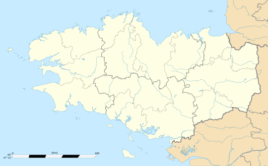 Cléguérec | |
| Coordinates: 48°07′30″N 3°04′10″W / 48.125°N 3.0694°W | |
| Country | France |
| Region | Brittany |
| Department | Morbihan |
| Arrondissement | Pontivy |
| Canton | Gourin |
| Intercommunality | Pontivy Communauté |
| Government | |
| • Mayor (2020–2026) | Marc Ropers[1] |
| Area 1 | 62.99 km2 (24.32 sq mi) |
| Population (2021)[2] | 2,839 |
| • Density | 45/km2 (120/sq mi) |
| Time zone | UTC+01:00 (CET) |
| • Summer (DST) | UTC+02:00 (CEST) |
| INSEE/Postal code | 56041 /56480 |
| Elevation | 55–281 m (180–922 ft) |
| 1 French Land Register data, which excludes lakes, ponds, glaciers > 1 km2 (0.386 sq mi or 247 acres) and river estuaries. | |
Cléguérec (French pronunciation: [kleɡeʁɛk]; Breton: Klegereg) is a commune in the Morbihan department of Brittany in north-western France.[3]
Geography
[edit]The town is located 12 km (7.5 mi) northwest of Pontivy. Cléguérec is border by Séglien and Silfiac to the west, by Sainte-Brigitte and Saint-Aignan to the north, by Neulliac to the east and by Malguénac to the south. Historically, the town belongs to Vanetais. The forest of Quénécan extends to the north of the commune. The Breuil du Chêne is the highest hill in the town. The summit is 948 feet (289 m) above sea level.
Map
[edit]
Demographics
[edit]Inhabitants of Cléguérec are called in French Cléguérecois.
|
| ||||||||||||||||||||||||||||||||||||||||||||||||||||||||||||||||||||||||||||||||||||||||||||||||||||||||||||||||||
| |||||||||||||||||||||||||||||||||||||||||||||||||||||||||||||||||||||||||||||||||||||||||||||||||||||||||||||||||||
| Source: EHESS[4] and INSEE (1968-2020)[5] | |||||||||||||||||||||||||||||||||||||||||||||||||||||||||||||||||||||||||||||||||||||||||||||||||||||||||||||||||||
Breton language
[edit]In 2008, 13,85% of children in the commune attended bilingual primary schools.[6]
Gallery
[edit]-
Manor of Corbello
-
Chapel of Trinity
-
Chapel Saint-André de Langlo
-
Gallery grave of Bot-er-Mohed
-
Calvary on the top of Breuil du Chêne


See also
[edit]- Communes of the Morbihan department
- Gaston-Auguste Schweitzer Sculptor of Cléguérec war memorial
References
[edit]- ^ "Maires du Morbihan" (PDF). Préfecture du Morbihan. 7 July 2020.
- ^ "Populations légales 2021" (in French). The National Institute of Statistics and Economic Studies. 28 December 2023.
- ^ INSEE commune file
- ^ Des villages de Cassini aux communes d'aujourd'hui: Commune data sheet Cléguérec, EHESS (in French).
- ^ Population en historique depuis 1968, INSEE
- ^ (in French) Ofis ar Brezhoneg: Enseignement bilingue
External links
[edit]- Official site (in French)
- Base Mérimée: Search for heritage in the commune, Ministère français de la Culture. (in French)
- Mayors of Morbihan Association (in French)
| National | |
|---|---|
| Geographic | |
This Morbihan geographical article is a stub. You can help Wikipedia by expanding it. |