Cléguérec: Difference between revisions
Content deleted Content added
Rescuing 0 sources and tagging 1 as dead.) #IABot (v2.0 |
m Task 15: language icon template(s) replaced (5×); |
||
| Line 29: | Line 29: | ||
==Breton language== |
==Breton language== |
||
In 2008, 13,85% of children in the commune attended bilingual primary schools.<ref>{{ |
In 2008, 13,85% of children in the commune attended bilingual primary schools.<ref>{{in lang|fr}} ''Ofis ar Brezhoneg'': [http://www.ofis-bzh.org/fr/services/observatoire/travaux.php?travail_id=83 ''Enseignement bilingue'']</ref> |
||
==See also== |
==See also== |
||
| Line 39: | Line 39: | ||
==References== |
==References== |
||
* [http://www.maires56.asso.fr Mayors of Morbihan Association] {{ |
* [http://www.maires56.asso.fr Mayors of Morbihan Association] {{in lang|fr}} |
||
* [http://www.insee.fr/fr/methodes/nomenclatures/cog/fichecommunale.asp?codedep=56&codecom=041 INSEE commune file] |
* [http://www.insee.fr/fr/methodes/nomenclatures/cog/fichecommunale.asp?codedep=56&codecom=041 INSEE commune file] |
||
==External links== |
==External links== |
||
{{commonscat}} |
{{commonscat}} |
||
*[http://www.cleguerec.fr Official site] {{ |
*[http://www.cleguerec.fr Official site] {{in lang|fr}} |
||
*[http://www.culture.gouv.fr/public/mistral/merimee_fr?ACTION=CHERCHER&FIELD_98=INSEE&VALUE_98=56041 French Ministry of Culture list for Cléguérec] {{ |
*[http://www.culture.gouv.fr/public/mistral/merimee_fr?ACTION=CHERCHER&FIELD_98=INSEE&VALUE_98=56041 French Ministry of Culture list for Cléguérec] {{in lang|fr}} |
||
*[http://www.viamichelin.co.uk/viamichelin/gbr/dyn/controller/mapPerformPage?strAddress=&strCP=56480&strLocation=Cléguérec&strCountry=1424&image2.x=28&image2.y=7 Map of Cléguérec on Michelin]{{Dead link|date=November 2019 |bot=InternetArchiveBot |fix-attempted=yes }} {{ |
*[http://www.viamichelin.co.uk/viamichelin/gbr/dyn/controller/mapPerformPage?strAddress=&strCP=56480&strLocation=Cléguérec&strCountry=1424&image2.x=28&image2.y=7 Map of Cléguérec on Michelin]{{Dead link|date=November 2019 |bot=InternetArchiveBot |fix-attempted=yes }} {{in lang|en}} |
||
{{Morbihan communes}} |
{{Morbihan communes}} |
||
Revision as of 02:19, 2 January 2020
Cléguérec
Klegereg | |
|---|---|
 The town hall in Cléguérec | |
 Coat of arms | |
Location of Cléguérec  | |
 Cléguérec 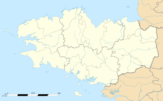 Cléguérec | |
| Coordinates: 48°07′30″N 3°04′10″W / 48.125°N 3.0694°W | |
| Country | France |
| Region | Brittany |
| Department | Morbihan |
| Arrondissement | Pontivy |
| Canton | Gourin |
| Intercommunality | Pontivy Communauté |
| Government | |
| • Mayor (2008—to date) | Marc Ropers |
| Area 1 | 62.99 km2 (24.32 sq mi) |
| Population (2021)[1] | 2,839 |
| • Density | 45/km2 (120/sq mi) |
| Time zone | UTC+01:00 (CET) |
| • Summer (DST) | UTC+02:00 (CEST) |
| INSEE/Postal code | 56041 /56480 |
| Elevation | 55–281 m (180–922 ft) |
| 1 French Land Register data, which excludes lakes, ponds, glaciers > 1 km2 (0.386 sq mi or 247 acres) and river estuaries. | |
Cléguérec (Klegereg in Breton) is a commune in the Morbihan department of Brittany in north-western France.
Demographics
Inhabitants of Cléguérec are called in French Cléguérecois.
Breton language
In 2008, 13,85% of children in the commune attended bilingual primary schools.[2]
See also
- Communes of the Morbihan department
- Gaston-Auguste Schweitzer Sculptor of Cléguérec war memorial
Notes
- ^ "Populations légales 2021" (in French). The National Institute of Statistics and Economic Studies. 28 December 2023.
- ^ (in French) Ofis ar Brezhoneg: Enseignement bilingue
References
- Mayors of Morbihan Association (in French)
- INSEE commune file
External links
Wikimedia Commons has media related to Cléguérec.
- Official site (in French)
- French Ministry of Culture list for Cléguérec (in French)
- Map of Cléguérec on Michelin[permanent dead link] (in English)
This Morbihan geographical article is a stub. You can help Wikipedia by expanding it. |