Condobolin: Difference between revisions
Tag: Reverted |
|||
| Line 96: | Line 96: | ||
{{Weather box |
{{Weather box |
||
|location = Condobolin Retirement Village |
|location = Condobolin Retirement Village, New South Wales, Australia (1879-present normals and extremes); 220 m AMSL |
||
|metric first = Yes |
|metric first = Yes |
||
|single line = Yes |
|single line = Yes |
||
|collapsed = Yes |
|||
| ⚫ | |||
|Jan record high C = 45.6 |
|Jan record high C = 45.6 |
||
|Feb record high C = 44.0 |
|Feb record high C = 44.0 |
||
| Line 112: | Line 112: | ||
|Nov record high C = 42.6 |
|Nov record high C = 42.6 |
||
|Dec record high C = 43.8 |
|Dec record high C = 43.8 |
||
| |
| Jan avg record high C = 38.9 |
||
| ⚫ | |||
| Mar avg record high C = 34.2 |
|||
| Apr avg record high C = 29.3 |
|||
| May avg record high C = 24.0 |
|||
| Jun avg record high C = 19.0 |
|||
| Jul avg record high C = 18.4 |
|||
| Aug avg record high C = 21.1 |
|||
| Sep avg record high C = 26.1 |
|||
| Oct avg record high C = 31.1 |
|||
| Nov avg record high C = 34.6 |
|||
| Dec avg record high C = 38.1 |
|||
|Jan high C = 33.7 |
|Jan high C = 33.7 |
||
|Feb high C = 33.0 |
|Feb high C = 33.0 |
||
| Line 125: | Line 136: | ||
|Nov high C = 29.1 |
|Nov high C = 29.1 |
||
|Dec high C = 32.3 |
|Dec high C = 32.3 |
||
| |
|Jan mean C = 26.2 |
||
|Feb mean C = 25.7 |
|||
|Mar mean C = 22.6 |
|||
|Apr mean C = 17.8 |
|||
|May mean C = 13.6 |
|||
|Jun mean C = 10.2 |
|||
|Jul mean C = 9.5 |
|||
|Aug mean C = 11.2 |
|||
|Sep mean C = 14.3 |
|||
|Oct mean C = 18.1 |
|||
|Nov mean C = 21.7 |
|||
|Dec mean C = 24.6 |
|||
|Jan low C = 18.6 |
|Jan low C = 18.6 |
||
|Feb low C = 18.4 |
|Feb low C = 18.4 |
||
| Line 138: | Line 160: | ||
|Nov low C = 14.2 |
|Nov low C = 14.2 |
||
|Dec low C = 16.9 |
|Dec low C = 16.9 |
||
| |
| Jan avg record low C = 14.0 |
||
| Feb avg record low C = 14.4 |
|||
| Mar avg record low C = 10.9 |
|||
| Apr avg record low C = 6.5 |
|||
| May avg record low C = 3.6 |
|||
| Jun avg record low C = 0.6 |
|||
| Jul avg record low C = 0.0 |
|||
| Aug avg record low C = 1.0 |
|||
| Sep avg record low C = 3.0 |
|||
| Oct avg record low C = 6.4 |
|||
| Nov avg record low C = 9.4 |
|||
| Dec avg record low C = 12.2 |
|||
|Jan record low C = 9.4 |
|Jan record low C = 9.4 |
||
|Feb record low C = 9.2 |
|Feb record low C = 9.2 |
||
| Line 151: | Line 184: | ||
|Nov record low C = 4.7 |
|Nov record low C = 4.7 |
||
|Dec record low C = 8.3 |
|Dec record low C = 8.3 |
||
| ⚫ | |||
| ⚫ | |||
|Jan precipitation mm = 43. |
|Jan precipitation mm = 43.0 |
||
|Feb precipitation mm = |
|Feb precipitation mm = 37.9 |
||
|Mar precipitation mm = |
|Mar precipitation mm = 39.6 |
||
|Apr precipitation mm = 33. |
|Apr precipitation mm = 33.6 |
||
|May precipitation mm = |
|May precipitation mm = 34.7 |
||
|Jun precipitation mm = |
|Jun precipitation mm = 37.4 |
||
|Jul precipitation mm = 33. |
|Jul precipitation mm = 33.7 |
||
|Aug precipitation mm = 35. |
|Aug precipitation mm = 35.0 |
||
|Sep precipitation mm = 31. |
|Sep precipitation mm = 31.4 |
||
|Oct precipitation mm = 41. |
|Oct precipitation mm = 41.1 |
||
|Nov precipitation mm = |
|Nov precipitation mm = 37.0 |
||
|Dec precipitation mm = 39. |
|Dec precipitation mm = 39.8 |
||
| |
|unit precipitation days = 1.0 mm |
||
|Jan precipitation days = |
|Jan precipitation days = 3.7 |
||
|Feb precipitation days = |
|Feb precipitation days = 3.4 |
||
|Mar precipitation days = |
|Mar precipitation days = 3.6 |
||
|Apr precipitation days = |
|Apr precipitation days = 3.6 |
||
|May precipitation days = |
|May precipitation days = 4.4 |
||
|Jun precipitation days = |
|Jun precipitation days = 5.5 |
||
|Jul precipitation days = |
|Jul precipitation days = 5.4 |
||
|Aug precipitation days = |
|Aug precipitation days = 5.2 |
||
|Sep precipitation days = |
|Sep precipitation days = 4.6 |
||
|Oct precipitation days = |
|Oct precipitation days = 4.7 |
||
|Nov precipitation days = 4. |
|Nov precipitation days = 4.0 |
||
|Dec precipitation days = |
|Dec precipitation days = 3.9 |
||
|Jan humidity = 46.5 |
|||
|year precipitation days = 65.8 |
|||
|Feb humidity = 50.5 |
|||
|source 1 = <ref>{{cite web |
|||
|Mar humidity = 52.0 |
|||
| url = http://www.bom.gov.au/climate/averages/tables/cw_050014_All.shtml| title = BOM }}</ref> |
|||
|Apr humidity = 57.5 |
|||
|date=January 2014 |
|||
|May humidity = 69.0 |
|||
|Jun humidity = 75.0 |
|||
|Jul humidity = 73.0 |
|||
|Aug humidity = 66.0 |
|||
|Sep humidity = 59.0 |
|||
|Oct humidity = 52.0 |
|||
|Nov humidity = 48.0 |
|||
|Dec humidity = 44.0 |
|||
|Jan dew point C = 13.1 |
|||
|Feb dew point C = 14.0 |
|||
|Mar dew point C = 12.4 |
|||
|Apr dew point C = 10.2 |
|||
|May dew point C = 8.6 |
|||
|Jun dew point C = 6.6 |
|||
|Jul dew point C = 5.5 |
|||
|Aug dew point C = 5.7 |
|||
|Sep dew point C = 6.9 |
|||
|Oct dew point C = 8.5 |
|||
|Nov dew point C = 9.8 |
|||
|Dec dew point C = 11.3 |
|||
|source 1 = [[Australian Bureau of Meteorology]] (1879-present normals and extremes)<ref>{{cite web |url=http://www.bom.gov.au/climate/averages/tables/cw_050014_All.shtml |title=Condobolin Retirement Village, NSW Climate (1879-present normals and extremes) |publisher= [[Australian Bureau of Meteorology]] |access-date=13 May 2022 }}</ref> |
|||
}} |
}} |
||
Revision as of 05:32, 13 May 2022
| Condobolin New South Wales | |||||||||
|---|---|---|---|---|---|---|---|---|---|
 Main street of Condobolin | |||||||||
 Condobolin | |||||||||
| Coordinates | 33°05′19″S 147°08′58″E / 33.08861°S 147.14944°E | ||||||||
| Population | 3,486 (2016 census)[1] | ||||||||
| Established | 1859 | ||||||||
| Postcode(s) | 2877 | ||||||||
| Elevation | 220 m (722 ft) | ||||||||
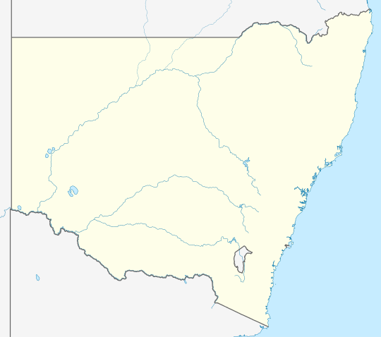
| Location | |||||||||
| LGA(s) | Lachlan Shire | ||||||||
| State electorate(s) | Barwon | ||||||||
| Federal division(s) | Parkes | ||||||||
| |||||||||
Condobolin /kənˈdoʊbɑːlən/[2] is a town in the west of the Central West region of New South Wales, Australia, on the Lachlan River. At the 2016 census, Condobolin had a population of 3,486.[1]
History

Prior to European settlement, the area was inhabited by the Wiradjuri people.
The name Condobolin is suggested by some[by whom?] to have evolved from the Aboriginal word Cundabullen — shallow crossing. The crossing was located a short distance below the junction of the Lachlan River and the Goobang Creek.[3] Others suggest that the town's name from the Wiradjuri word for 'hop bush', or 'hop brush'.[4][5]
The area was explored by John Oxley in 1817 and Thomas Mitchell in 1836. The 'Condoublin' run was established by 1844.[3] There had been squatters in the district since Mitchell's 1836 exploration. Closer settlement of the area began in 1880 when the large runs were broken up into smaller holdings.
The town of Condobolin was proclaimed in 1859. The railway arrived in 1898, and the town's population boomed, assisted by finds in 1885 of copper north of the town and in 1896 of gold in the district, north-west of the town. A major copper and gold mine was in operation at Condobolin from 1898 until around 1910. Agriculture is still a major influence on the town, production having expanded with the damming of the Lachlan River in 1935 by the Wyangala Dam.[4] Wheat, barley, canola, wool, sheep and cattle are produced in the district. In more recent years irrigation has brought horticulture and cotton to the Lachlan River area.[6] The Lachlan River saw paddle steamer traffic from the 1860's up until the 1920's.
The video clip for Shannon Noll's first single What About Me? was filmed in Condobolin.[citation needed]
Heritage listings
Condobolin has a number of heritage-listed sites, including:
- McDonnell Street: All Saints' Anglican Church, Condobolin[7]
- Various monuments and war memorials.
Geography
Condobolin is very close to Mount Tilga, which is said by some to be the geographical centre of New South Wales. Geosciences Australia's Bicentennial project however suggests near the Five Ways, 33 km west north west of Tottenham as one possible centre and makes no reference to Mount Tilga.[8]
Condobolin is located at the junction of Lachlan River and Goobang Creek. It is 463 kilometres (288 mi) west of Australia's largest city, Sydney.
Close to Condobolin is the Overflow Station, the setting of the poem Clancy of the Overflow by Banjo Paterson. The poem is about a Queensland drover and a sheep shearer responsible for herding large mobs of sheep long distances to market.
Climate
The area features a hot semi-arid climate (BSk) with long, sweltering summers and short, cool winters.
| Climate data for Condobolin Retirement Village, New South Wales, Australia (1879-present normals and extremes); 220 m AMSL | |||||||||||||
|---|---|---|---|---|---|---|---|---|---|---|---|---|---|
| Month | Jan | Feb | Mar | Apr | May | Jun | Jul | Aug | Sep | Oct | Nov | Dec | Year |
| Record high °C (°F) | 45.6 (114.1) |
44.0 (111.2) |
40.9 (105.6) |
37.0 (98.6) |
28.5 (83.3) |
25.5 (77.9) |
24.8 (76.6) |
28.7 (83.7) |
37.1 (98.8) |
38.1 (100.6) |
42.6 (108.7) |
43.8 (110.8) |
45.6 (114.1) |
| Mean maximum °C (°F) | 38.9 (102.0) |
37.8 (100.0) |
34.2 (93.6) |
29.3 (84.7) |
24.0 (75.2) |
19.0 (66.2) |
18.4 (65.1) |
21.1 (70.0) |
26.1 (79.0) |
31.1 (88.0) |
34.6 (94.3) |
38.1 (100.6) |
38.9 (102.0) |
| Mean daily maximum °C (°F) | 33.7 (92.7) |
33.0 (91.4) |
29.8 (85.6) |
24.7 (76.5) |
19.8 (67.6) |
15.8 (60.4) |
15.2 (59.4) |
17.4 (63.3) |
21.2 (70.2) |
25.4 (77.7) |
29.1 (84.4) |
32.3 (90.1) |
24.8 (76.6) |
| Daily mean °C (°F) | 26.2 (79.2) |
25.7 (78.3) |
22.6 (72.7) |
17.8 (64.0) |
13.6 (56.5) |
10.2 (50.4) |
9.5 (49.1) |
11.2 (52.2) |
14.3 (57.7) |
18.1 (64.6) |
21.7 (71.1) |
24.6 (76.3) |
18.0 (64.3) |
| Mean daily minimum °C (°F) | 18.6 (65.5) |
18.4 (65.1) |
15.4 (59.7) |
10.8 (51.4) |
7.3 (45.1) |
4.6 (40.3) |
3.7 (38.7) |
4.9 (40.8) |
7.3 (45.1) |
10.8 (51.4) |
14.2 (57.6) |
16.9 (62.4) |
11.1 (51.9) |
| Mean minimum °C (°F) | 14.0 (57.2) |
14.4 (57.9) |
10.9 (51.6) |
6.5 (43.7) |
3.6 (38.5) |
0.6 (33.1) |
0.0 (32.0) |
1.0 (33.8) |
3.0 (37.4) |
6.4 (43.5) |
9.4 (48.9) |
12.2 (54.0) |
0.0 (32.0) |
| Record low °C (°F) | 9.4 (48.9) |
9.2 (48.6) |
5.6 (42.1) |
0.5 (32.9) |
−0.2 (31.6) |
−5.0 (23.0) |
−5.0 (23.0) |
−2.6 (27.3) |
−0.6 (30.9) |
3.0 (37.4) |
4.7 (40.5) |
8.3 (46.9) |
−5.0 (23.0) |
| Average precipitation mm (inches) | 43.0 (1.69) |
37.9 (1.49) |
39.6 (1.56) |
33.6 (1.32) |
34.7 (1.37) |
37.4 (1.47) |
33.7 (1.33) |
35.0 (1.38) |
31.4 (1.24) |
41.1 (1.62) |
37.0 (1.46) |
39.8 (1.57) |
444.2 (17.5) |
| Average precipitation days (≥ 1.0 mm) | 3.7 | 3.4 | 3.6 | 3.6 | 4.4 | 5.5 | 5.4 | 5.2 | 4.6 | 4.7 | 4.0 | 3.9 | 52 |
| Average relative humidity (%) | 46.5 | 50.5 | 52.0 | 57.5 | 69.0 | 75.0 | 73.0 | 66.0 | 59.0 | 52.0 | 48.0 | 44.0 | 57.7 |
| Average dew point °C (°F) | 13.1 (55.6) |
14.0 (57.2) |
12.4 (54.3) |
10.2 (50.4) |
8.6 (47.5) |
6.6 (43.9) |
5.5 (41.9) |
5.7 (42.3) |
6.9 (44.4) |
8.5 (47.3) |
9.8 (49.6) |
11.3 (52.3) |
9.4 (48.9) |
| Source: Australian Bureau of Meteorology (1879-present normals and extremes)[9] | |||||||||||||
Demographics
At the 2016 census, Condobolin recorded a population of 3,486; a fall from the 3,743 recorded in 2011.[10] The median age was 38. 22.1% of residents reported being Aboriginal and/or Torres Strait Islander; the median age among this group was 21.
85.0% of respondents reported being born in Australia; substantially higher than the national average of 66.7%. 79.8% of residents reported having both parents born in Australia, compared to the national average of 47.3%. 88.8% of respondents spoke only English at home.
Christianity was the largest religious group in Condobolin at 78.6% of stated responses on religion. This included the denominations of Catholic (27.0%), Anglican (23.6%) and Presbyterian and Reformed (6.4%). 17.8% reported having no religion, lower than the national average of 29.6%. 10.8% of residents did not state a response to the optional question on religion.[1]
Events
Condobolin is home to a two-day cross country navigational rally, known as the "Condo 750". The Condo 750 runs over a variety of private and public roads and tracks and attracts competitors from all over Australia. It is a CAMS and MA sanctioned event. The course is made up of competitive sections known as selective sections which are timed over private tracks around the various sheep and cattle stations, these range in length from 20 to 70 kilometres (12 to 43 mi). Non-competitive road sections on public roads join the sections, these range from 0.2 to 30 kilometres (0.12 to 18.64 mi). The total length of the course is over 750 kilometres (470 mi).
Transport
Condobolin railway station opened in 1898[11] and lies on the Broken Hill railway line. The station is served by the twice-weekly Indian Pacific train, as well as NSW TrainLink's Broken Hill Outback Xplorer train. This train heads to Broken Hill on Mondays (Stopping at 2:01pm) and to Sydney on Tuesdays (Stopping at 1:41pm).
Notable residents
- Don Athaldo (born in Condobolin), strongman[12]
- William Beech, inventor periscope rifle holder WW1.
- Kevin Gilbert, poet, author, playwright, activist[13]
- Percy Knight, Former NSWRL Player for Balmain Tigers and Canberra Raiders
- Bill Leak, cartoonist
- Eris O'Brien, archbishop
- Shannon Noll, singer
- Darren Wighton, top bloke
References
- ^ a b c Australian Bureau of Statistics (27 June 2017). "Condobolin". 2016 Census QuickStats. Retrieved 17 August 2018.
- ^ Macquarie Dictionary, Fourth Edition (2005). Melbourne, The Macquarie Library Pty Ltd. ISBN 1-876429-14-3
- ^ a b "Condobolin". Historical Towns Directory. Hallmark Editions: Australian Heritage Magazine. Archived from the original on 31 August 2006. Retrieved 3 May 2006.
- ^ a b "Condobolin". The Sydney Morning Herald. 2005. Retrieved 3 May 2006.
- ^ "Condobolin". Geographical Names Register (GNR) of NSW. Geographical Names Board of New South Wales. Retrieved 3 August 2013.
- ^ "About our area: History". CTC@Condobolin. Western Plains Regional Development Inc.: Community Technology Centre. Archived from the original on 19 August 2006. Retrieved 3 May 2006.
- ^ "All Saints Anglican Church". New South Wales State Heritage Register. Department of Planning & Environment. H01787. Retrieved 18 May 2018.
Text is licensed by State of New South Wales (Department of Planning and Environment) under CC-BY 4.0 licence.
- ^ "Archived copy". Archived from the original on 12 February 2010. Retrieved 20 January 2010.
{{cite web}}: CS1 maint: archived copy as title (link) - ^ "Condobolin Retirement Village, NSW Climate (1879-present normals and extremes)". Australian Bureau of Meteorology. Retrieved 13 May 2022.
- ^ Australian Bureau of Statistics (31 October 2012). "Condobolin (State Suburb)". 2011 Census QuickStats. Retrieved 7 April 2015.
- ^ "Condoblin railway station". www.nswrail.net. Retrieved 7 April 2008.
- ^ Richard White. "Athaldo, Don (1894–1965)". adb.anu.edu.au. National Centre of Biography. Retrieved 23 February 2021.
- ^ McMillan, Pauline (June 1995). "Kevin Gilbert and Living Black [Truncated version of a longer essay based on the Kevin Gilbert Manuscript Collection held at the National Library of Australia.]" (PDF). Journal of Australian Studies. The Koori History website. pp. 1–14. ISSN 1444-3058. Retrieved 28 December 2014.
External links
Media related to Condobolin at Wikimedia Commons
| Authority control databases: Geographic |
|---|