Crisnée: Difference between revisions
Content deleted Content added
m robot Adding: war:Crisnée |
Tom.Reding (talk | contribs) m +{{Authority control}} (4 IDs from Wikidata); WP:GenFixes & cleanup on |
||
| (29 intermediate revisions by 23 users not shown) | |||
| Line 1: | Line 1: | ||
{{Infobox Belgium |
{{Infobox Belgium municipality |
||
|name=Crisnée |
|name = Crisnée |
||
|native_name = {{native_name|wa|Crusnêye}} |
|||
|picture=Crisnée JPG01.jpg |
|||
|picture |
|picture = Crisnée JPG01.jpg |
||
|picture-legend = |
|||
|map=Crisnée Liège Belgium Map. |
|map = Crisnée Liège Belgium Map.svg |
||
|map-legend=Location of Crisnée in the province of Liège |
|map-legend = Location of Crisnée in the province of Liège |
||
|arms=Blason Crisnée.svg |
|||
| |
|arms = Blason Crisnée.svg |
||
|flag = Flag of Crisnée.svg |
|||
|region={{BE-REG-WAL}} |
|||
| |
|region = {{BE-REG-WAL}} |
||
| |
|community = {{BE-FR}} |
||
|province = {{BE-PROV-LG}} |
|||
|arrondissement=[[Arrondissement of Waremme|Waremme]] |
|arrondissement = [[Arrondissement of Waremme|Waremme]] |
||
|nis=64021 |
|nis = 64021 |
||
|pyramid-date |
|pyramid-date |
||
|0-19= |
|0-19= |
||
| Line 18: | Line 19: | ||
|foreigners= |
|foreigners= |
||
|foreigners-date |
|foreigners-date |
||
|mayor=Philippe Goffin (MR) |
|mayor = Philippe Goffin (MR) |
||
|majority |
|majority = Maïeur |
||
|postal-codes=4367 |
|postal-codes = 4367 |
||
|telephone-area=04 |
|telephone-area = 04 |
||
|web=[http://www.crisnee.be/ www.crisnee.be] |
|web = [http://www.crisnee.be/ www.crisnee.be] |
||
|coordinates = {{coord|50|43|N|05|24|E|region:BE|display=inline,title}} |
|||
|lat_deg=50 |
|||
|lat_min=43 |
|||
|lon_deg=05 |
|||
|lon_min=24 |
|||
}} |
}} |
||
'''Crisnée''' is a [[ |
'''Crisnée''' ({{IPA-fr|kʁisne}}; {{lang-wa|Crusnêye}}) is a [[Municipalities of Belgium|municipality]] of [[Wallonia]] located in the [[Liège Province|province of Liège]], [[Belgium]]. |
||
It covers an area of 16.83 km<sup>2</sup> and on 1 January 2013 had a total population of 3,094, giving a [[population density]] on that date of 184 inhabitants per km<sup>2</sup>. |
|||
{| |
|||
| ⚫ | |||
The municipality consists of the following [[deelgemeente|districts]]: Crisnée, [[Fize-le-Marsal]], [[Kemexhe]], [[Odeur]], and [[Thys, Wallonia|Thys]]. |
|||
| ⚫ | |||
{{Liege municipalities}} |
|||
Crisnée is [[Twin towns and sister cities|twinned]] with the commune of [[Sansais]], [[Nouvelle-Aquitaine]], in western [[France]]. |
|||
| ⚫ | |||
==See also== |
|||
* [[List of protected heritage sites in Crisnée]] |
|||
==References== |
|||
{{reflist}} |
|||
==External links== |
|||
* {{Commons category-inline}} |
|||
{{Geographic location |
|||
|Centre = Crisnée |
|||
|N = [[Tongeren]] ([[Limburg (Belgium)|VLI]]) |
|||
|NE = [[Herstappe]] ([[Limburg (Belgium)|VLI]]) |
|||
|E = [[Awans]] |
|||
|S = [[Fexhe-le-Haut-Clocher]] |
|||
|SW = [[Remicourt, Belgium|Remicourt]] |
|||
|W = [[Oreye]] |
|||
| ⚫ | |||
{{Municipalities in Liège}} |
|||
{{Authority control}} |
|||
{{DEFAULTSORT:Crisnee}} |
{{DEFAULTSORT:Crisnee}} |
||
[[Category:Municipalities of Liège]] |
[[Category:Municipalities of Liège Province]] |
||
{{Liege-geo-stub}} |
{{Liege-geo-stub}} |
||
[[br:Crisnée]] |
|||
[[bg:Крине]] |
|||
[[ca:Crisnée]] |
|||
[[de:Crisnée]] |
|||
[[eo:Crisnée]] |
|||
[[fr:Crisnée]] |
|||
[[it:Crisnée]] |
|||
[[nl:Crisnée]] |
|||
[[pt:Crisnée]] |
|||
[[ro:Crisnée]] |
|||
[[simple:Crisnée]] |
|||
[[vi:Crisnée]] |
|||
[[vo:Crisnée]] |
|||
[[war:Crisnée]] |
|||
[[zh:克利斯内]] |
|||
Latest revision as of 15:29, 19 October 2023
Crisnée
Crusnêye (Walloon) | |
|---|---|
 | |
 Flag  Coat of arms | |
Location of Crisnée  | |
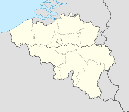 Crisnée Location in Belgium
Location of Crisnée in the province of Liège  | |
| Coordinates: 50°43′N 05°24′E / 50.717°N 5.400°E | |
| Country | |
| Community | French Community |
| Region | Wallonia |
| Province | Liège |
| Arrondissement | Waremme |
| Government | |
| • Mayor | Philippe Goffin (MR) |
| • Governing party/ies | Maïeur |
| Area | |
| • Total | 16.97 km2 (6.55 sq mi) |
| Population (2018-01-01)[1] | |
| • Total | 3,352 |
| • Density | 200/km2 (510/sq mi) |
| Postal codes | 4367 |
| NIS code | 64021 |
| Area codes | 04 |
| Website | www.crisnee.be |
Crisnée (French pronunciation: [kʁisne]; Walloon: Crusnêye) is a municipality of Wallonia located in the province of Liège, Belgium.
It covers an area of 16.83 km2 and on 1 January 2013 had a total population of 3,094, giving a population density on that date of 184 inhabitants per km2.
The municipality consists of the following districts: Crisnée, Fize-le-Marsal, Kemexhe, Odeur, and Thys.
Crisnée is twinned with the commune of Sansais, Nouvelle-Aquitaine, in western France.

See also
[edit]References
[edit]- ^ "Wettelijke Bevolking per gemeente op 1 januari 2018". Statbel. Retrieved 9 March 2019.
External links
[edit]Media related to Crisnée at Wikimedia Commons
Places adjacent to Crisnée | |
|---|---|
Municipalities in the province of Liège, Wallonia | ||
|---|---|---|
| Huy |  | |
| Liège | ||
| Verviers | ||
| Waremme | ||
| ||
| International | |
|---|---|
| National | |
This Liège Province location article is a stub. You can help Wikipedia by expanding it. |