Cam Ranh
Cam Ranh
Thành phố Cam Ranh | |
|---|---|
| Cam Ranh City | |
 A resort in Cam Ranh | |
 Cam Ranh Location of in Vietnam | |
| Coordinates: 11°54′49″N 109°8′13″E / 11.91361°N 109.13694°E | |
| Country | |
| Province | Khánh Hòa |
| Capital | Cam Ranh |
| Area | |
| • Total | 316 km2 (122 sq mi) |
| Population (2003) | |
| • Total | 121,050 |
| Time zone | UTC+7 (Indochina Time) |
| Climate | Aw |
| Website | http://saobiencamranh.net |
Cam Ranh () is a city in southern Khánh Hòa Province, in the South Central Coast region of Vietnam.
Geography
It is the second-largest city in the province, after Nha Trang. It is located on Cam Ranh Bay. As of 2009 the city had a population of 121,050[1] and covered an area of 316 km².[2]
-
Street in Cam Ranh
-
Post office


Infrastructures
Climate
Cam Ranh has a tropical savanna climate (Köppen climate classification: As).[3][4]
| Climate data for Cam Ranh | |||||||||||||
|---|---|---|---|---|---|---|---|---|---|---|---|---|---|
| Month | Jan | Feb | Mar | Apr | May | Jun | Jul | Aug | Sep | Oct | Nov | Dec | Year |
| Record high °C (°F) | 31.5 (88.7) |
33.0 (91.4) |
33.9 (93.0) |
37.1 (98.8) |
38.1 (100.6) |
37.7 (99.9) |
37.4 (99.3) |
39.0 (102.2) |
37.3 (99.1) |
33.4 (92.1) |
32.4 (90.3) |
32.0 (89.6) |
39.0 (102.2) |
| Mean daily maximum °C (°F) | 28.1 (82.6) |
29.4 (84.9) |
30.9 (87.6) |
32.2 (90.0) |
33.1 (91.6) |
33.2 (91.8) |
33.1 (91.6) |
33.3 (91.9) |
31.9 (89.4) |
30.1 (86.2) |
28.6 (83.5) |
27.5 (81.5) |
31.0 (87.8) |
| Daily mean °C (°F) | 24.3 (75.7) |
24.9 (76.8) |
26.4 (79.5) |
27.9 (82.2) |
28.8 (83.8) |
28.9 (84.0) |
28.7 (83.7) |
28.6 (83.5) |
27.7 (81.9) |
26.6 (79.9) |
25.7 (78.3) |
24.5 (76.1) |
26.9 (80.4) |
| Mean daily minimum °C (°F) | 21.7 (71.1) |
22.0 (71.6) |
23.1 (73.6) |
24.7 (76.5) |
25.5 (77.9) |
25.6 (78.1) |
25.3 (77.5) |
25.4 (77.7) |
24.6 (76.3) |
23.9 (75.0) |
23.3 (73.9) |
22.3 (72.1) |
24.0 (75.2) |
| Record low °C (°F) | 14.4 (57.9) |
16.4 (61.5) |
17.1 (62.8) |
19.9 (67.8) |
21.5 (70.7) |
21.1 (70.0) |
21.3 (70.3) |
21.0 (69.8) |
21.6 (70.9) |
19.3 (66.7) |
18.7 (65.7) |
15.7 (60.3) |
14.4 (57.9) |
| Average precipitation mm (inches) | 23 (0.9) |
6 (0.2) |
32 (1.3) |
29 (1.1) |
81 (3.2) |
62 (2.4) |
49 (1.9) |
50 (2.0) |
152 (6.0) |
305 (12.0) |
315 (12.4) |
140 (5.5) |
1,243 (48.9) |
| Average precipitation days | 4.7 | 2.5 | 1.9 | 3.4 | 8.2 | 8.0 | 7.7 | 8.7 | 13.7 | 15.4 | 14.2 | 10.8 | 99.2 |
| Average relative humidity (%) | 75.5 | 76.0 | 76.3 | 76.9 | 76.3 | 74.4 | 74.0 | 74.3 | 79.7 | 81.6 | 79.5 | 76.3 | 76.7 |
| Mean monthly sunshine hours | 227 | 238 | 286 | 266 | 255 | 217 | 234 | 224 | 200 | 182 | 167 | 175 | 2,672 |
| Source: Vietnam Institute for Building Science and Technology[5] | |||||||||||||
References
- ^ "Archived copy" (PDF). Archived from the original (PDF) on 2011-07-22. Retrieved 2011-05-21.
{{cite web}}: CS1 maint: archived copy as title (link) - ^ "Districts of Vietnam". Statoids. Retrieved March 20, 2009.
- ^ Kottek, Markus; Grieser, Jürgen; Beck, Christoph; Rudolf, Bruno; Rubel, Franz (2006). "World Map of the Köppen-Geiger climate classification updated" (PDF). Meteorologische Zeitschrift. 15 (3): 259–263. Bibcode:2006MetZe..15..259K. doi:10.1127/0941-2948/2006/0130.
- ^ Peel, M. C.; Finlayson B. L.; McMahon, T. A. (2007). "Updated world map of the Köppen–Geiger climate classification" (PDF). Hydrol. Earth Syst. Sci. 11 (5): 1633–1644. doi:10.5194/hess-11-1633-2007. ISSN 1027-5606.
{{cite journal}}: Unknown parameter|last-author-amp=ignored (|name-list-style=suggested) (help)CS1 maint: unflagged free DOI (link) - ^ "Vietnam Building Code Natural Physical & Climatic Data for Construction" (PDF). Vietnam Institute for Building Science and Technology. Archived from the original (PDF) on 22 July 2018. Retrieved 20 July 2018.
External links
Wikimedia Commons has media related to Cam Ranh.
| Da Nang city | 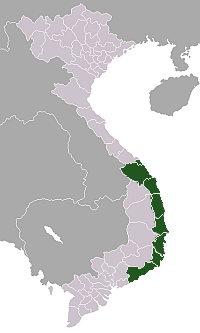 | |
|---|---|---|
| Bình Định province | ||
| Bình Thuận province | ||
| Khánh Hòa province |
| |
| Ninh Thuận province | ||
| Phú Yên province | ||
| Quảng Nam province | ||
| Quảng Ngãi province | ||
※ denotes provincial seat. / § Sovereignty over the Hoàng Sa and Trường Sa archipelagoes is disputed as of 5 August 2024. | ||
This article about a location in Khánh Hòa Province, Vietnam is a stub. You can help Wikipedia by expanding it. |