Cass Township, Boone County, Iowa
Cass Township, Boone County | |
|---|---|
 | |
| Coordinates: 41°54′22″N 93°54′00″W / 41.90611°N 93.90000°W | |
| Country | |
| State | |
| County | Boone |
| Area | |
| • Total | 18.36 sq mi (47.55 km2) |
| • Land | 18.05 sq mi (46.74 km2) |
| • Water | 0.31 sq mi (0.81 km2) |
| Elevation | 997 ft (304 m) |
| Population (2000) | |
| • Total | 668 |
| • Density | 37/sq mi (14.3/km2) |
| FIPS code | 19-90489[2] |
| GNIS feature ID | 0467537 |
Cass Township is one of seventeen townships in Boone County, Iowa, United States. As of the 2000 census, its population was 668.
History
Cass Township was established in 1858. It is named for Lewis Cass.[3]
Geography
Cass Township covers an area of 18.36 square miles (47.6 km2) and contains no incorporated settlements. According to the USGS, it contains two cemeteries: Liberty and State Hospital.
References
- ^ "US Board on Geographic Names". United States Geological Survey. October 25, 2007. Retrieved January 31, 2008.
- ^ "U.S. Census website". United States Census Bureau. Retrieved January 31, 2008.
- ^ Goldthwait, Nathan Edward (1914). History of Boone County, Iowa, Volume 1. Pioneer Publishing Company. p. 251.
External links
Municipalities and communities of Boone County, Iowa, United States | ||
|---|---|---|
| Cities | 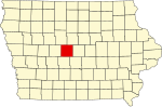 | |
| Townships | ||
| Unincorporated communities | ||
| Ghost town | ||
| Footnotes | ‡This populated place also has portions in an adjacent county or counties | |
This article about the geography of Boone County, Iowa is a stub. You can help Wikipedia by expanding it. |