Draft:Coulee Creek: Difference between revisions
No edit summary |
|||
| Line 40: | Line 40: | ||
<!---------------------- BASIN FEATURES --> |
<!---------------------- BASIN FEATURES --> |
||
| source1 = |
| source1 = |
||
| source1_location = East of [[Reardan, Washington]] |
| source1_location = East of [[Reardan, Washington]] |
||
| source1_coordinates= {{coord|47|0|58.59|N|117|48|52.82|W|}} |
| source1_coordinates= {{coord|47|0|58.59|N|117|48|52.82|W|}} |
||
| source1_elevation = {{convert|2500|ft|abbr=on}} |
| source1_elevation = {{convert|2500|ft|abbr=on}} |
||
| Line 46: | Line 46: | ||
| mouth_location = [[Deep Creek (Washington)]], [[Spokane, Washington|Spokane]], Washington |
| mouth_location = [[Deep Creek (Washington)]], [[Spokane, Washington|Spokane]], Washington |
||
| mouth_coordinates = {{coord|47|45|7.6|N|117|32|57.8|W}} |
| mouth_coordinates = {{coord|47|45|7.6|N|117|32|57.8|W}} |
||
| mouth_elevation = {{convert|1716|ft|abbr=on}} <ref>{{Cite web |title=Geographic Names Information System |url=https://edits.nationalmap.gov/apps/gaz-domestic/public/search/names/1504195 |access-date=2024-06-22 |website=edits.nationalmap.gov}}</ref> |
|||
| mouth_elevation = {{convert|1716|ft|abbr=on}} |
|||
| progression = [[Deep Creek (Washington)]] → [[Spokane River]] → [[Columbia River]] → Pacific Ocean |
| progression = [[Deep Creek (Washington)]] → [[Spokane River]] → [[Columbia River]] → Pacific Ocean |
||
| river_system = [[Columbia River]] |
| river_system = [[Columbia River]] |
||
Latest revision as of 18:06, 22 June 2024
| Draft article not currently submitted for review.
This is a draft Articles for creation (AfC) submission. It is not currently pending review. While there are no deadlines, abandoned drafts may be deleted after six months. To edit the draft click on the "Edit" tab at the top of the window. To be accepted, a draft should:
It is strongly discouraged to write about yourself, your business or employer. If you do so, you must declare it. Where to get help
How to improve a draft
You can also browse Wikipedia:Featured articles and Wikipedia:Good articles to find examples of Wikipedia's best writing on topics similar to your proposed article. Improving your odds of a speedy review To improve your odds of a faster review, tag your draft with relevant WikiProject tags using the button below. This will let reviewers know a new draft has been submitted in their area of interest. For instance, if you wrote about a female astronomer, you would want to add the Biography, Astronomy, and Women scientists tags. Editor resources
Last edited by CycloneFootball71 (talk | contribs) 49 days ago. (Update) |
| Coulee Creek | |
|---|---|
 Coulee Creek. Note the steep canyon wall in the background. | |
 Location of the mouth of Coulee Creek 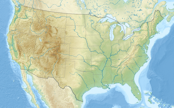 Coulee Creek (the United States) | |
| Location | |
| Country | United States |
| State | Washington |
| County | Spokane |
| City | Spokane |
| Physical characteristics | |
| Source | |
| • location | East of Reardan, Washington |
| • coordinates | 47°0′58.59″N 117°48′52.82″W / 47.0162750°N 117.8146722°W |
| • elevation | 2,500 ft (760 m) |
| Mouth | Deep Creek (Washington) |
• location | Deep Creek (Washington), Spokane, Washington |
• coordinates | 47°45′7.6″N 117°32′57.8″W / 47.752111°N 117.549389°W |
• elevation | 1,716 ft (523 m) [1] |
| Length | 13 mi (21 km) |
| Basin features | |
| Progression | Deep Creek (Washington) → Spokane River → Columbia River → Pacific Ocean |
| River system | Columbia River |
Coulee Creek a stream of approximately 13 mi (21 km) that originates in the far western edge of Spokane County, and has its mouth at a confluence with Deep Creek (Washington), approximately 0.75 miles (1.21 km)before both creeks enter into the Spokane River. The creek flows through mostly rural agricultural areas west of the Spokane urban area, though the mouth is located within state-owned conservation land. [2] [3]
Geography
[edit]
References
[edit]- ^ "Geographic Names Information System". edits.nationalmap.gov. Retrieved 2024-06-22.
- ^ http://spokanewatersheds.org/files/documents/Deep-Creek-and-Coulee-Creek-Groundwater-Surface-Water-Interaction.pdf
- ^ Spokane County Water Resources, Washington Department of Ecology (June 30, 2013). "Hydrogeologic Framework and Conceptual Groundwater Flow Model" (PDF). spokanewatersheds.org. Archived from the original (PDF) on 5 May 2017.