File:Europe EU laea location map.svg

Size of this PNG preview of this SVG file: 701 × 599 pixels. Other resolutions: 281 × 240 pixels | 561 × 480 pixels | 898 × 768 pixels | 1,198 × 1,024 pixels | 2,395 × 2,048 pixels | 1,401 × 1,198 pixels.
Original file (SVG file, nominally 1,401 × 1,198 pixels, file size: 1.43 MB)
| This is a file from the Wikimedia Commons. Information from its description page there is shown below. Commons is a freely licensed media file repository. You can help. |
Summary
| Description |
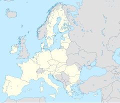
Deutsch: Positionskarte Europa, Europäische Union; Politisch mit Staatsgrenzen; Flächentreue Azimutalprojektion
English: Location map Europe, European Union; Political with state boundaries; Lambert azimuthal equal-area projection
Français : Carte de localisationEurope, Union européenne; Politique avec frontières d'Etats; Projection azimuthale de Lambert
|
| Date | |
| Source |
Own work
|
| Author | Alexrk2 |
| Other versions |
[]
|


|
This map has been made or improved in the German Kartenwerkstatt (Map Lab). You can propose maps to improve as well.
|
Licensing
I, the copyright holder of this work, hereby publish it under the following license:
This file is licensed under the Creative Commons Attribution-Share Alike 3.0 Unported license.
- You are free:
- to share – to copy, distribute and transmit the work
- to remix – to adapt the work
- Under the following conditions:
- attribution – You must give appropriate credit, provide a link to the license, and indicate if changes were made. You may do so in any reasonable manner, but not in any way that suggests the licensor endorses you or your use.
- share alike – If you remix, transform, or build upon the material, you must distribute your contributions under the same or compatible license as the original.
File history
Click on a date/time to view the file as it appeared at that time.
| Date/Time | Thumbnail | Dimensions | User | Comment | |
|---|---|---|---|---|---|
| 17:57, 8 September 2014 | 1,401 × 1,198 (1.48 MB) | Alexrk2 | + disputed crimea, golan heights | ||
| 17:42, 8 September 2014 | 1,401 × 1,198 (1.48 MB) | Alexrk2 | Reverted to version as of 17:19, 30 June 2013, converted back to straight SVG | ||
| 13:37, 24 April 2014 | 701 × 599 (178 KB) | NoviSadGrad | Crimea disputed | ||
| 17:19, 30 June 2013 | 1,401 × 1,198 (1.48 MB) | Alexrk2 | + Croatia | ||
| 17:06, 21 March 2010 | 1,401 × 1,198 (1.49 MB) | Alexrk2 | == Summary == {{Information |Description= {{de|Positionskarte Europa, Europäische Union; Politisch mit Staatsgrenzen; Flächentreue Azimutalprojektion}} {{en|Location map Europe, [[:en:European Uni |
File usage
More than 100 pages use this file. The following list shows the first 100 pages that use this file only. A full list is available.
- Bammarboda
- Bergkvara
- Bergshamra, Norrtälje
- Bjärnum
- Brevik, Sweden
- Bro, Stockholm
- Broby, Sweden
- Brunna
- Båstad
- Dalarö
- Djurö, Värmdö Municipality
- Douzelage
- Drottningholm
- Edsbro
- Ekeby, Södertälje
- Ekerö
- Eurojust
- European Agency for Safety and Health at Work
- European Capital of Culture
- European Centre for the Development of Vocational Training
- European Chemicals Agency
- European Defence Agency
- European Environment Agency
- European Fisheries Control Agency
- European Food Safety Authority
- European Maritime Safety Agency
- European Medicines Agency
- European Research Council
- European Union Agency for Law Enforcement Training
- European Union Aviation Safety Agency
- European Union Institute for Security Studies
- Europol
- Fisksätra
- Frontex
- Grisslehamn
- Grödby
- Gustavsberg, Värmdö Municipality
- Hallstavik
- Herräng
- Hok, Sweden
- Hässleholm
- Hästhagen, Nacka Municipality
- Höganäs
- Jordbro
- Järna, Södertälje Municipality
- Kil, Nacka Municipality
- Killeberg
- Kiruna
- Kristianstad
- Kungsberga
- Kungsängen
- Kårsta
- Lidingö
- List of urban areas in the European Union
- Lund
- Löddeköpinge
- Lönsboda
- Mellansel
- Märsta
- Mölnbo
- Nicosia
- Norrtälje
- Nykøbing Falster
- Nynäshamn
- Osby
- Rosersberg
- Rydbo
- Saltsjöbaden
- Sandhem
- Schengen, Luxembourg
- Sibbhult
- Sibble
- Sigtuna
- Skillingaryd
- Slottsskogen, Håbo Municipality
- Solberga, Österåker
- Sorunda
- Stavsnäs
- Sticklinge udde
- Stoby
- Stockholm
- Svanberga
- Södertälje
- Torsås
- Tranholmen
- Tumba, Sweden
- Tuna, Södertälje
- Tynningö
- Tyringe
- Upplands Väsby
- Vaggeryd
- Valletta
- Vankiva
- Vaxholm
- Vidja
- Västerhaninge
- Vårsta
- Ystad
- Åkersberga
- Åstorp
View more links to this file.
Global file usage
The following other wikis use this file:
- Usage on als.wikipedia.org
- Usage on ar.wikipedia.org
- Usage on azb.wikipedia.org
- Usage on az.wikipedia.org
- Usage on ba.wikipedia.org
- Usage on bn.wikipedia.org
- Usage on ceb.wikipedia.org
- Usage on da.wikipedia.org
- Usage on de.wikipedia.org
- Usage on es.wikipedia.org
- Usage on fa.wikipedia.org
- Usage on frr.wikipedia.org
- Usage on fr.wikipedia.org
- Usage on hi.wikipedia.org
- Usage on hr.wikipedia.org
View more global usage of this file.