Al-Hadher, Syria: Difference between revisions
Content deleted Content added
Citation bot (talk | contribs) Alter: url. URLs might have been internationalized/anonymized. | You can use this bot yourself. Report bugs here. | Suggested by AManWithNoPlan | All pages linked from cached copy of User:AManWithNoPlan/sandbox2 | via #UCB_webform_linked 430/1577 |
m Task 18 (cosmetic): eval 2 templates: del empty params (3×); hyphenate params (1×); |
||
| Line 48: | Line 48: | ||
| footnotes = |
| footnotes = |
||
}} |
}} |
||
'''Al-Hadher''' ({{lang-ar|الحاضر}}; transliteration: ''al-Ḥāḍir'') is a village in northern [[Syria]], administratively part of the [[Mount Simeon District]] of the [[Aleppo Governorate]]. According to the [[Central Bureau of Statistics (Syria)|Syria Central Bureau of Statistics]] (CBS), al-Hadher had a population of 8,550 in the 2004 census.<ref>{{cite web|title=General Census of Population 2004.|url=https://view.officeapps.live.com/op/view.aspx?src=https://www.humanitarianresponse.info/sites/www.humanitarianresponse.info/files/syr_pop_2004_sycensus_0.xls | |
'''Al-Hadher''' ({{lang-ar|الحاضر}}; transliteration: ''al-Ḥāḍir'') is a village in northern [[Syria]], administratively part of the [[Mount Simeon District]] of the [[Aleppo Governorate]]. According to the [[Central Bureau of Statistics (Syria)|Syria Central Bureau of Statistics]] (CBS), al-Hadher had a population of 8,550 in the 2004 census.<ref>{{cite web|title=General Census of Population 2004.|url=https://view.officeapps.live.com/op/view.aspx?src=https://www.humanitarianresponse.info/sites/www.humanitarianresponse.info/files/syr_pop_2004_sycensus_0.xls |access-date= 2017-10-20}}</ref> |
||
It is 4 kilometers east of the ancient town of [[Qinnasrin]] (Chalcis ad Belum).<ref name="Burns257">Burns 1992, p. 257.</ref> It was founded by the Arab tribe of [[Tanukh]] as a ''ḥāḍir'' (a settlement of sedentarized [[Bedouin]]) in the 4th century under [[Byzantine Empire|Byzantine]] rule.<ref>Sauvaget 1971, p. 85.</ref> Al-Hadher served as the headquarters of [[Jund Qinnasrin]], (military district of Qinnasrin).<ref name="Burns257"/> |
It is 4 kilometers east of the ancient town of [[Qinnasrin]] (Chalcis ad Belum).<ref name="Burns257">Burns 1992, p. 257.</ref> It was founded by the Arab tribe of [[Tanukh]] as a ''ḥāḍir'' (a settlement of sedentarized [[Bedouin]]) in the 4th century under [[Byzantine Empire|Byzantine]] rule.<ref>Sauvaget 1971, p. 85.</ref> Al-Hadher served as the headquarters of [[Jund Qinnasrin]], (military district of Qinnasrin).<ref name="Burns257"/> |
||
Revision as of 14:26, 21 December 2020
Al-Hadher
الحاضر | |
|---|---|
Town | |
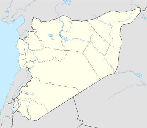 Al-Hadher Location in Syria | |
| Coordinates: 35°59′45″N 37°3′27″E / 35.99583°N 37.05750°E | |
| Country | |
| Governorate | Aleppo |
| District | Mount Simeon |
| Subdistrict | al-Hadher |
| Population (2004) | |
| • Total | 8,550 |
| Time zone | UTC+2 (EET) |
| • Summer (DST) | UTC+3 (EEST) |
| City Qrya Pcode | C1182 |
Al-Hadher (Arabic: الحاضر; transliteration: al-Ḥāḍir) is a village in northern Syria, administratively part of the Mount Simeon District of the Aleppo Governorate. According to the Syria Central Bureau of Statistics (CBS), al-Hadher had a population of 8,550 in the 2004 census.[1]
It is 4 kilometers east of the ancient town of Qinnasrin (Chalcis ad Belum).[2] It was founded by the Arab tribe of Tanukh as a ḥāḍir (a settlement of sedentarized Bedouin) in the 4th century under Byzantine rule.[3] Al-Hadher served as the headquarters of Jund Qinnasrin, (military district of Qinnasrin).[2]
References
- ^ "General Census of Population 2004". Retrieved 2017-10-20.
- ^ a b Burns 1992, p. 257.
- ^ Sauvaget 1971, p. 85.
Bibliography
- Burns, Ross (1992). Monuments of Syria: A Guide. I. B. Tauris. ISBN 9781845119478.
- Sauvaget, J. (1971). "Halab". In Lewis, B.; Ménage, V. L.; Pellat, Ch. & Schacht, J. (eds.). The Encyclopaedia of Islam, Second Edition. Volume III: H–Iram. Leiden: E. J. Brill. pp. 85–90. OCLC 495469525.


This article about a location in Aleppo Governorate, Syria is a stub. You can help Wikipedia by expanding it. |